NOAA Holds Its Below-Normal Hurricane Forecast as Florida Reaches Peak Season Without a Hurricane
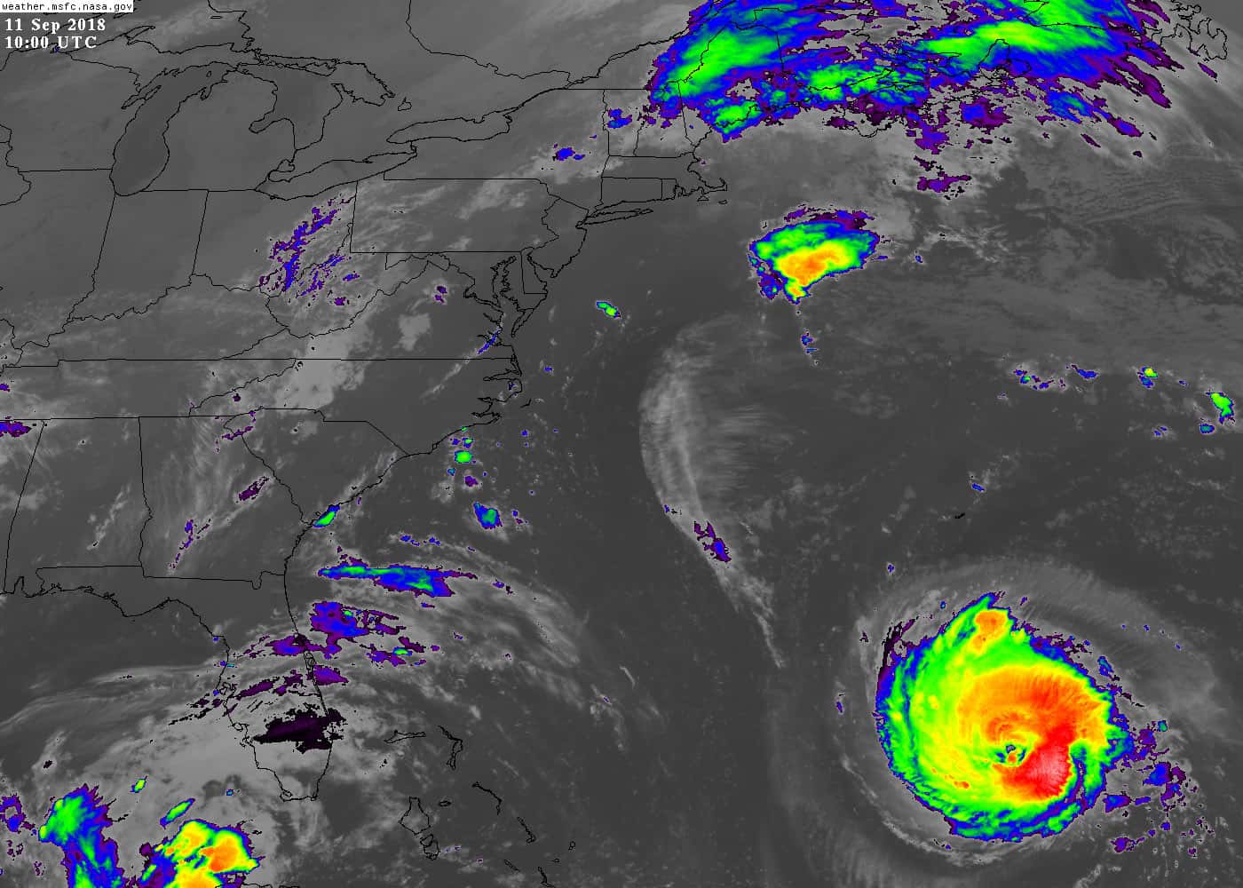
The Atlantic hurricane season has reached the doorstep of its most dangerous weeks with a record that would have seemed improbable in most recent years: two named storms, no hurricanes and no Florida landfall.
NOAA has maintained its prediction of below-normal activity for the 2026 season, forecasting 7 to 13 named storms, of which 2 to 6 could become hurricanes and 0 to 2 could reach major hurricane strength. Forecasters put the probability of a below-normal season at 75 percent, with a 20 percent chance of near-normal activity and a 5 percent chance of an above-normal season.
The season to date has produced Arthur and Bertha and nothing stronger. The National Hurricane Center has been monitoring a small number of tropical disturbances in the basin, with development probabilities revised downward as Saharan dust and hostile upper-level winds have interfered with organization.
What is suppressing the season
Several factors have combined. Saharan dust, the dry, dusty air mass that periodically moves off Africa across the tropical Atlantic, has been a persistent presence and has significantly inhibited developing systems. Dry air starves the thunderstorm activity that tropical cyclones need to organize.
Upper-level winds have been the other suppressant. Tropical cyclones require a relatively low-shear environment to build a vertically stacked circulation, and disturbances moving into regions of increasing upper-level winds tend to shear apart rather than intensify. Systems this season have repeatedly run into that pattern approaching the Caribbean.
The same broad atmospheric configuration that has kept the tropics quiet has contributed to the extreme heat currently baking Florida and the Southeast. A strong upper-level ridge suppresses both convection and tropical development, which is why an exceptionally hot, dry August in Florida and a quiet Atlantic frequently accompany each other.
None of this is a guarantee about the weeks ahead. Atmospheric patterns that suppress development can break down quickly, and the historical record contains seasons that produced almost nothing through mid-August and then generated damaging late-season storms.
What peak season means
The Atlantic season's climatological peak falls around September 10, and the period from late August through early October accounts for the substantial majority of Atlantic hurricane activity and an even larger share of Florida landfalls.
The reasons are physical. Sea surface temperatures reach their annual maximum in late summer, the atmospheric conditions that support development are typically most favorable in that window, and the tropical waves moving off Africa are at their most vigorous. Those factors align in September more reliably than in any other month.
Florida's landfall history reflects that concentration. The state's most consequential storms, including those of the past decade, have overwhelmingly arrived between mid-August and mid-October. A quiet July says little; a quiet September would be genuinely unusual.
What a quiet season would mean for Florida
The most immediate effect would be on the property insurance market. Florida's insurance situation has been improving since the litigation and claims reforms of 2022 and 2023, with new carriers entering the market, Citizens Property Insurance depopulating policies back to private insurers and rate filings turning downward for the first time in years.
Citizens reduced rates for its homeowners multiperil policyholders by an average of 8.8 percent in 2026 under rates approved by state regulators, with cuts of at least 2 percent for all Citizens personal lines policyholders and an average 5.5 percent reduction for wind-only policyholders. Those rates took effect July 1 for new policies and apply to existing policies at renewal.
A season without a major Florida landfall would allow that stabilization to continue and would strengthen the reinsurance position that underlies the whole market. Reinsurance pricing for Florida risk is set globally and responds to catastrophe experience, and consecutive loss-free years compound in the state's favor.
A single major landfall would reverse the direction quickly. Florida's insurance market improvements are recent and thin, and the state's history includes carrier insolvencies triggered by individual events. That fragility is why state officials and industry participants watch the season with an attention that the seasonal forecast numbers alone do not convey.
Why preparation still matters
Emergency managers make the same point every year and it holds in 2026: seasonal forecasts predict activity in the basin, not risk at any particular location. A below-normal season that produces one storm hitting Tampa Bay is worse for Tampa Bay than an above-normal season in which every storm recurves into the open Atlantic.
Hurricane Andrew arrived in 1992, a season that produced only seven named storms. That comparison is the standard illustration in Florida emergency management briefings, and it is accurate: seasonal counts and individual outcomes are only loosely related.
The practical preparation steps do not change. Households should know their evacuation zone, which is assigned by county and is based on storm surge modeling rather than on flood insurance zones. Supply kits, prescription medication reserves, fuel and cash, and a plan for pets and for anyone with medical needs all have to be arranged before a watch is issued.
Insurance documentation is the step most often deferred. Photographing the interior and exterior of a home, keeping policy numbers accessible and understanding the deductible structure, particularly Florida's separate hurricane deductible, makes the claims process substantially easier after an event.
Understanding the alerts
The distinction between a watch and a warning determines what action is appropriate. A hurricane watch means hurricane conditions are possible within the specified area, generally issued 48 hours ahead of the anticipated onset of tropical storm force winds. A hurricane warning means those conditions are expected, generally issued 36 hours ahead.
Evacuation orders are issued by county emergency management, not by the National Hurricane Center, and they are zone specific. An evacuation order covering Zone A in a coastal county does not apply to residents in Zone C, and residents who do not know their zone often cannot act on an order correctly.
Storm surge warnings are issued separately from wind warnings because surge is the deadliest hazard in most U.S. hurricanes and because the surge threat area does not always match the wind threat area. Florida's shallow continental shelf on the Gulf side makes the state particularly surge-prone.
How seasonal forecasts are made
NOAA's Climate Prediction Center builds its seasonal outlook from a set of large-scale climate signals rather than from any attempt to predict individual storms. The dominant inputs are sea surface temperatures across the tropical Atlantic, the state of the El Nino Southern Oscillation in the Pacific, and expected wind shear patterns.
El Nino conditions in the Pacific tend to suppress Atlantic hurricane activity by increasing wind shear over the basin, while La Nina conditions tend to enhance it. That teleconnection is among the most reliable signals available and does substantial work in seasonal forecasts.
Atlantic sea surface temperatures matter because tropical cyclones draw energy from warm water. Warmer than average water in the main development region between Africa and the Caribbean supports more and stronger storms, all else equal.
The forecasts are probabilistic by design. A prediction of 7 to 13 named storms with a 75 percent chance of below-normal activity is a statement about the distribution of likely outcomes, not a prediction that any particular number will occur, and it says nothing about where storms will go.
Why landfall cannot be forecast seasonally
Whether a storm hits Florida depends on the steering pattern in place during the days that storm exists, which is a weather question rather than a climate question. The Bermuda High's position and strength, the presence of troughs digging into the eastern United States and the timing of frontal passages all determine tracks, and none is predictable weeks in advance.
That is why emergency managers treat seasonal forecasts as background information rather than as planning input. Preparation requirements do not change based on whether NOAA expects 9 storms or 19, because the preparation is for the storm that reaches your county.
Florida's geography makes it the most exposed state regardless of seasonal activity. The peninsula extends into the tropical Atlantic and the Gulf, with more than 1,300 miles of coastline, which means storms approaching from multiple directions can affect it.
The state's population distribution compounds the exposure. Florida's growth over the past several decades has concentrated in coastal counties, placing more people and more property in the areas most vulnerable to surge and wind than existed during earlier active hurricane periods.
The insurance market's stake in the season
Florida's property insurance market has been recovering from a period of severe distress that saw multiple carrier insolvencies, rapid premium increases and a swelling of Citizens Property Insurance to a size that state officials described as financially precarious.
Legislative reforms in 2022 and 2023 targeted litigation costs, which industry analyses had identified as a driver of Florida's claims expenses well out of proportion to the state's share of national claims. Those reforms altered attorney fee provisions and claims procedures.
The market response has included new carrier entries, resumed writing by existing carriers and the depopulation of Citizens policies back into the private market. Rate filings turning downward, including Citizens' 2026 reductions, are the clearest indicator that the reforms changed underwriting economics.
All of that improvement rests on a foundation of recent loss experience. A major landfall in a densely populated Florida county would test whether the current carrier base is adequately capitalized and reinsured, and the answer to that question determines whether the improvement holds or reverses.
What's next
The National Hurricane Center issues tropical weather outlooks every six hours and updates them more frequently when systems are active. Those outlooks, available through the center's website, are the authoritative source for basin conditions.
The peak weeks run from late August through early October, and the pattern currently suppressing development would need to persist through that window for the season to finish as quietly as it has started. Forecasters have flagged signs of increased tropical activity as possible later in the month.
The season officially ends November 30. Florida residents can find their evacuation zone through their county emergency management office and can track statewide conditions through the Florida Division of Emergency Management.
Spotted an issue with this article?
Have something to say about this story?
Write a letter to the editorComments
No comments yet. Be the first to weigh in.
Related Coverage

Supreme Court Opens New Term Oct. 5 With Florida's Six-Person Felony Juries on the Docket
8h ago

Rubio Calls Cuba a Failed State, Warns Havana Cannot Wait Out Trump as South Florida Watches
8h ago
No Shutdown at Fiscal Year's End: What the Dec. 11 Funding and Flood Insurance Deadline Means for Florida
9h ago

The Fed's First Rate Hike Since 2023 Pushes Mortgages Past 7% and Freezes Florida's Housing Market
1d ago