Red Tide Organism Detected Along Florida East Coast as Bloom Patterns Shift
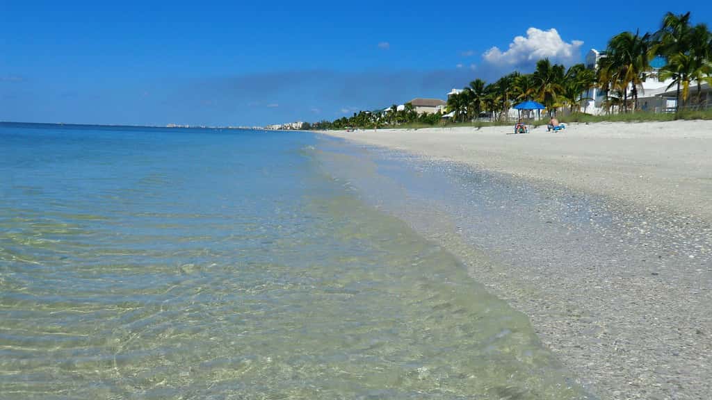
State water quality sampling has detected Karenia brevis, the organism responsible for Florida red tide, in dozens of samples collected along Florida's East Coast during August, an unusual distribution for a phenomenon most commonly associated with the Gulf coast. Recent status updates from the Florida Fish and Wildlife Conservation Commission documented the organism in roughly two dozen East Coast samples, with bloom concentrations recorded in Duval County earlier in the month and in a Nassau County sample more recently.
Concentrations offshore of Southwest Florida, the region historically most affected, have been recorded at background levels in a small number of samples during the same period. Respiratory irritation attributable to red tide was not reported statewide during at least one week of August, according to the commission's status updates.
The distribution matters for Florida because red tide drives measurable economic and public health consequences. Blooms kill fish and marine mammals, close shellfish harvesting areas, produce airborne toxins that cause respiratory irritation along beaches, and depress tourism revenue in affected coastal counties.
What the sampling shows
The Fish and Wildlife Conservation Commission maintains a statewide sampling program that reports concentrations in categories ranging from not present through background, very low, low, medium and bloom. Those categories correspond to cell counts per liter of water, and the effects observed at a beach vary sharply across them.
Background concentrations indicate the organism is present but at levels that generally produce no visible or respiratory effect. Karenia brevis is native to the Gulf of Mexico and is present in the water at low concentrations much of the time, so a background detection is not by itself an event.
Bloom concentrations are a different matter. At those levels the organism can discolor water, kill fish and release brevetoxins that become airborne in sea spray, producing coughing and throat irritation for people on or near the beach. The detections in Duval and Nassau counties reached that category in individual samples.
Sampling is not continuous coverage. Samples are collected at specific points on specific days, and a bloom can move substantially between collections. A single bloom-level sample indicates a patch at that location on that date rather than a condition affecting an entire coastline.
Why the East Coast distribution is notable
Florida red tide is fundamentally a Gulf phenomenon. Blooms typically initiate offshore in the Gulf of Mexico, often 20 to 40 miles out, and are carried toward the Southwest Florida coast by currents and winds. The severe blooms of recent decades have concentrated along Sarasota, Manatee, Lee and Collier counties.
East Coast occurrences happen when Gulf blooms are transported around the southern tip of the peninsula and carried north by the Gulf Stream and the Florida Current. That pathway is documented but less common, and it produces detections along the Atlantic beaches from Miami-Dade northward, sometimes reaching Northeast Florida.
Satellite imagery this season has shown a substantial mass of algae extending from the Nature Coast toward the northern Everglades, which observers have characterized as likely a mixture of red tide and other algal species. Satellite detection identifies chlorophyll concentrations and cannot distinguish species, which is why water sampling remains the authoritative method.
Blooms are also distinct from the blue-green algae that affect Lake Okeechobee and the connected river systems. Those are cyanobacteria, a freshwater organism producing different toxins and requiring different management responses. The two are frequently conflated in public discussion but are separate problems.
The Florida context
Red tide is not new. Spanish accounts describe fish kills along the Gulf coast centuries ago, and the phenomenon predates modern development. What has changed is the interaction between naturally occurring blooms and nutrient loading from land, which research indicates can intensify and prolong a bloom once it reaches nearshore waters.
Nutrient sources include agricultural runoff, stormwater discharge, wastewater and septic systems. Florida has invested in wastewater upgrades and septic-to-sewer conversions in coastal counties partly for this reason, and the state maintains a public water quality dashboard tracking red tide and blue-green algae conditions.
Forecasting has advanced. A collaboration between the University of South Florida and the wildlife commission produces short-term forecasts of bloom movement, projecting the direction of surface and subsurface water transport. Recent forecasts have indicated net southern movement in most areas from Pinellas through northern Monroe counties.
What it means for Floridians
For beachgoers, the practical guidance is to check conditions before traveling. The wildlife commission publishes a statewide status map, and county health departments issue advisories when conditions warrant. Respiratory irritation from brevetoxins is generally temporary for healthy people and resolves after leaving the beach, but people with asthma or chronic lung conditions can experience more significant effects and are advised to avoid affected areas.
For anglers and shellfish harvesters, the restrictions are regulatory rather than advisory. Shellfish harvesting areas close when concentrations exceed thresholds because filter feeders such as clams and oysters concentrate brevetoxins, and consuming them can cause neurotoxic shellfish poisoning. Finfish caught in bloom areas are generally considered safe if filleted, since toxins concentrate in organs rather than muscle tissue, though fish that are already dead should not be collected.
For pet owners, dogs are at particular risk because they will drink seawater and investigate dead fish on the beach. Veterinarians advise rinsing animals after beach visits during bloom conditions.
Local impact across the state
Northeast Florida beaches in Duval and Nassau counties are the current focus given the bloom-level detections there. Those counties have less historical experience managing red tide than Gulf coast counties, which means less established public communication infrastructure around it.
Southwest Florida, where the severe blooms of 2018 and subsequent years caused substantial fish kills and tourism losses, is currently recording only background concentrations offshore. Businesses in Lee, Collier, Sarasota and Manatee counties monitor these reports closely, since a bloom arriving before peak season affects bookings months out.
Tampa Bay occupies a middle position, with Pinellas beaches historically affected during major Gulf blooms. The regional forecast indicating net southern water movement from Pinellas through northern Monroe is relevant to whether existing offshore concentrations approach those beaches.
The economic cost of a bloom
Red tide imposes costs that are measurable and unevenly distributed. Coastal tourism absorbs the largest share, since a bloom that closes beaches or produces respiratory irritation cancels bookings across hotels, vacation rentals, restaurants and charter operations in the affected area.
Commercial and recreational fishing carry a second layer. Fish kills reduce stocks locally, shellfish harvesting areas close by regulation, and charter captains lose bookings even in periods when fishing remains viable, because customers avoid the area entirely. The reputational effect on a destination frequently outlasts the bloom itself.
Local governments bear the cleanup expense. Dead fish washing ashore must be removed, which requires crews, equipment and disposal capacity, and the volume during a severe event can overwhelm normal municipal operations. The state has provided grant funding for cleanup in past severe blooms.
Property values in affected coastal areas have shown measurable effects during prolonged blooms, according to research examining Southwest Florida transactions during severe events. Those effects have generally proven temporary, but they are real while a bloom persists.
What the state is doing about it
Florida has funded red tide research and mitigation through a partnership between the Fish and Wildlife Conservation Commission and Mote Marine Laboratory, established to develop technologies for controlling or reducing bloom effects. Approaches under investigation have included clay flocculation, ozone treatment in enclosed waters and compounds that target the organism selectively.
None of those methods has produced a scalable solution for open coastal waters. The volume of water involved in a bloom spanning dozens of miles of coastline exceeds what any treatment technology can address, which is why the research focus has shifted toward protecting confined areas such as canals and marinas rather than eliminating blooms outright.
Prevention efforts target the nutrient side. The state has invested in wastewater treatment upgrades, septic-to-sewer conversion in coastal areas and stormwater management, all of which reduce the nutrient loading that can intensify a bloom once it reaches nearshore waters. Those projects proceed on multi-year timelines and their effects accumulate slowly.
Monitoring and forecasting represent the most immediately useful investment. Better prediction does not prevent a bloom, but it allows businesses, local governments and residents to plan, which reduces the economic disruption a given bloom produces.
How to read a status report
The weekly status reports use consistent terminology that repays a few minutes of familiarity. Sample counts describe how many water samples in a given area contained the organism, and concentration categories describe how much was present in each, which are separate pieces of information.
A report noting the organism in 25 East Coast samples with bloom concentrations in one of them describes widespread low-level presence with a single concentrated patch, not a coastline-wide bloom. Conflating those two readings is the most common misinterpretation.
Respiratory irritation reports are collected separately, often through beach condition reporting programs, and they describe what people are actually experiencing rather than what the water samples contain. Those reports are the more relevant figure for anyone deciding whether to visit a particular beach.
Forecast products add a projection of water movement over the following days, which indicates where existing concentrations are likely to travel. Those forecasts address transport rather than growth, meaning they predict where a bloom goes rather than whether it intensifies.
What is next
The wildlife commission will continue weekly sampling and status reporting, which is the authoritative source for current conditions. Reports are issued on a regular schedule and include county-level detail on concentrations and reported respiratory irritation.
Seasonal patterns suggest the months ahead warrant attention. Gulf blooms have historically initiated in late summer and intensified through fall, with the most severe events persisting into winter. Whether current background concentrations offshore of Southwest Florida develop into a bloom will depend on nutrient availability, water temperature and wind patterns over the coming weeks.
Hurricane activity is a complicating factor in either direction. Storms can disperse an existing bloom through mixing, and they can also transport nutrients into coastal waters through runoff and stir nutrients up from the sediment. With the Atlantic season entering its climatological peak, that interaction is one more variable in an already difficult forecasting problem.
Spotted an issue with this article?
Have something to say about this story?
Write a letter to the editorComments
No comments yet. Be the first to weigh in.
Related Coverage

King Tides Swamp South Florida Streets and Shut Down Two Miles of A1A
6h ago
Everglades Restoration Delivers Record Freshwater Flows Even as Drought Grips South Florida
9h ago
Florida Wildlife Officials Identify Northeast Florida Algae Bloom as a Lower-Toxin Species, Not Red Tide
1d ago
DeSantis Widens Emergency Order as Pasture Mealybug Spreads to 25 Florida Counties
2d ago