Everglades Canal Diversion Opens to Relieve the St. Lucie Estuary
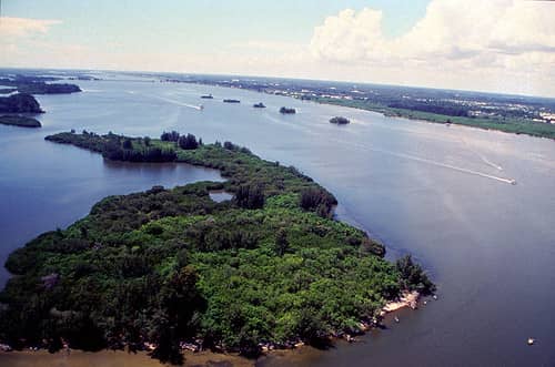
A canal diversion project intended to reduce damaging freshwater discharges into the St. Lucie Estuary was announced complete in September 2026, a milestone in the long running effort to restore water flow patterns across South Florida. Operational testing began in May, and nearly 5 billion gallons were diverted through the project during that period.
The work involves the C-23 canal, part of the drainage network built across South Florida during the twentieth century to move water off agricultural land and out to tide. Once fully online, the diversion is expected to further limit harmful discharges into the estuary and redirect flows toward storage and treatment.
The project sits within the Comprehensive Everglades Restoration Plan framework, a state and federal partnership that has been under construction for more than two decades. Florida has completed or broken ground on more than 90 restoration projects and invested nearly $9.5 billion in restoration and water quality work during the DeSantis administration.
What went wrong with the St. Lucie in the first place
The St. Lucie Estuary is a brackish system, meaning its ecology depends on a specific mixing of fresh and salt water. Oysters, seagrass beds, and the fish and wading birds that depend on them are adapted to that balance.
The canal network built across the region changed it. Canals including C-23, C-24, and C-44 collect stormwater from a watershed far larger than the estuary's natural drainage basin and deliver it in concentrated pulses after heavy rain. Lake Okeechobee discharges, released to protect the aging Herbert Hoover Dike when lake levels rise, add to the volume.
The result is a system that receives too much fresh water too fast. Salinity crashes, oyster beds die, seagrass is smothered by sediment and light limitation, and the nutrients carried in the runoff feed algae blooms. Blue green algae events on the Treasure Coast have repeatedly closed waterways and damaged the local tourism and fishing economies.
Lake Okeechobee itself experiences the most widespread and sustained blue green algae blooms in the system, and discharges carry that biology downstream.
How a diversion project works
The engineering concept is to intercept canal water before it reaches the estuary and route it into storage and treatment features instead. Reservoirs hold water during wet periods, and stormwater treatment areas, which are constructed wetlands, remove nutrients through plant uptake and sediment deposition before water is released.
The restored flow can then move south toward the Everglades, which is where the water historically went before the drainage network redirected it east and west. That is the central logic of Everglades restoration: send the water south, clean it on the way, and stop dumping it into coastal estuaries.
Nearly 5 billion gallons diverted during testing is a meaningful volume. For context, that is enough water to cover a substantial area to significant depth, and every gallon held back is a gallon that did not arrive in the estuary as a salinity shock.
The limitation is that no single project solves the problem. The St. Lucie receives water from multiple canals and from Lake Okeechobee, and relieving one source reduces but does not eliminate the pressure.
The water quality record is mixed
The South Florida Water Management District's 2026 South Florida Environmental Report documented restoration, scientific, and engineering progress across the Kissimmee Basin, Lake Okeechobee, the Everglades, and coastal areas. It also recorded continuing compliance problems.
Data from water year 2026 showed four stormwater treatment areas within partial compliance of the water quality based effluent limitation, the phosphorus standard that governs water entering the Everglades. The fifth treatment wetland was far outside the limit.
Phosphorus is the critical pollutant in the Everglades because the historic system was extraordinarily nutrient poor. Sawgrass communities evolved under those conditions, and even modest phosphorus enrichment converts sawgrass marsh into cattail monoculture, which supports far less wildlife.
Independent analysis has also concluded that pollution persists in the Everglades despite a restoration effort spanning four decades. Much of what remains of the historic Everglades carries phosphorus, nitrogen, and mercury loading from urban and agricultural sources.
What it means for Florida residents
For Treasure Coast residents in Martin and St. Lucie counties, the practical stake is direct. Algae blooms have closed marinas, canceled fishing charters, and produced respiratory irritation along affected waterways. Property values near affected water bodies respond to bloom frequency.
For South Florida more broadly, the Everglades system is the recharge source for the Biscayne Aquifer, which supplies drinking water to millions of people across Miami-Dade, Broward, and Palm Beach counties. Restoration is water supply policy as much as it is ecological policy.
There is a saltwater intrusion dimension as well. Fresh water moving through the Everglades creates hydraulic pressure that holds back saltwater encroachment into the aquifer from the coast. As sea levels rise, that pressure becomes more important, not less.
Statewide, Everglades restoration is among the largest sustained public works efforts in Florida history, and its cost is carried by state and federal taxpayers together.
The politics of the restoration program
Everglades restoration has held unusual bipartisan support in Florida, which distinguishes it from most environmental policy in the state. Funding has generally continued across administrations of both parties, and the federal partnership has survived changes in Washington.
The disagreements are about pace and about agriculture. The Everglades Agricultural Area south of Lake Okeechobee contains sugarcane and vegetable operations, and the question of how much land is converted to storage and treatment has been contested for decades.
The accelerated EAA Reservoir, a large storage project south of the lake, has been a focus of recent state effort, with contracts fully executed as a milestone the governor's office has highlighted. That reservoir is intended to be the central piece that allows large volumes to move south.
How the drainage system was built and why
The canal network at the center of this problem was not an accident. It was a deliberate public works program carried out over decades, and it accomplished exactly what it was designed to accomplish.
The historic Everglades was a shallow sheet of water roughly 60 miles wide, flowing slowly south from Lake Okeechobee to Florida Bay over a period of months. Its extent covered much of what is now South Florida's agricultural land and a substantial portion of its developed area.
Beginning in the late nineteenth century and accelerating through the twentieth, state and federal projects drained that system to create agricultural land and to make settlement possible. Canals moved water east and west to the coasts rather than allowing it to flow south. Levees contained Lake Okeechobee. Pumps and control structures managed levels.
The 1947 hurricane season, which produced catastrophic flooding, prompted the Central and Southern Florida Project, the federal flood control program that built much of the current infrastructure. It succeeded at flood control and at enabling the development that followed.
The ecological consequences were not accounted for at the time. Roughly half the original Everglades was lost, wading bird populations declined by around 90 percent, and the estuaries receiving redirected water were degraded.
Restoration is therefore not a matter of repairing something that broke. It is an attempt to partially reverse a public works program that worked as intended, while preserving the flood protection and water supply that South Florida's eight million residents now depend on.
Why restoration is so expensive and so slow
The Comprehensive Everglades Restoration Plan was authorized in 2000 with a projected cost and timeline that both proved optimistic, and the reasons are instructive.
The fundamental difficulty is that the system must continue performing its existing functions while being modified. Flood protection cannot be suspended during construction. Water supply to municipalities cannot be interrupted. Agricultural operations continue.
Land acquisition is the second constraint. Storage reservoirs require large areas of flat land south of Lake Okeechobee, and that land is in agricultural production and privately owned. Acquiring it requires willing sellers or condemnation, and both are slow and contested.
Cost sharing between the state and federal government adds a layer. Projects require federal authorization and appropriation, which move on congressional timelines independent of state readiness, and the two have frequently been out of sync.
Technical complexity compounds all of it. Moving large volumes of water through constructed wetlands while meeting a stringent phosphorus standard is an engineering problem without simple solutions, and treatment areas have not consistently achieved the required performance.
Florida's investment of nearly $9.5 billion during the current administration reflects the scale, and the work remains well short of complete.
What blue green algae does to communities
The public health and economic consequences of algae blooms are why this infrastructure matters to people who have no interest in wetland ecology.
Cyanobacteria blooms in Lake Okeechobee and in the estuaries receiving its discharges produce toxins including microcystin, which is harmful to the liver. Contact with affected water can cause skin irritation, and aerosolized toxins can cause respiratory symptoms in people near the water.
Health departments issue advisories when sampling detects toxin levels above thresholds, and those advisories close waterways to recreation. For communities on the St. Lucie and Caloosahatchee estuaries, that can mean a summer without swimming, boating, or fishing.
The economic damage extends through marinas, charter operations, waterfront restaurants, and vacation rentals. Severe bloom years have produced documented revenue losses across those sectors, and the reputational effect persists past the bloom itself.
Property values respond as well. Research examining Florida waterfront property has found measurable price effects associated with bloom frequency, which means the cost falls on homeowners who have no role in the water management decisions that produce it.
What's next
The C-23 diversion will move from testing into full operation, and the measure of success is estuary salinity and nutrient data over the coming wet seasons rather than the volume diverted.
The South Florida Water Management District publishes water quality monitoring data and holds public governing board meetings where project status is reported. The annual South Florida Environmental Report is the comprehensive public accounting and is available without cost.
The larger test arrives during the next major wet season. Restoration infrastructure performs adequately under moderate conditions. Whether it holds up when a tropical system dumps a foot of rain across the watershed is the question that determines whether Treasure Coast residents see fewer algae events or the same ones.
Spotted an issue with this article?
Have something to say about this story?
Write a letter to the editor