Fay Closes In on Becoming 2026's First Atlantic Hurricane as Florida's Quiet Season Holds
Tropical Storm Fay strengthened in the open Atlantic on Sunday and is forecast to become the first hurricane of the 2026 Atlantic season, a milestone arriving remarkably late in a year that has so far spared Florida entirely. Forecasters placed the storm more than 2,700 miles from the Florida peninsula, near the Azores, with no path toward the United States mainland at any point in the forecast period. For Floridians, the significance of Fay is not what it might do, but what its timing says about a hurricane season that has refused to behave like a normal one.
Fay became the sixth named storm of the season when Tropical Depression Six was upgraded early Sunday morning. By the late afternoon advisory, the National Hurricane Center put its maximum sustained winds at roughly 65 mph, within about 10 mph of hurricane strength. Forecasters indicated the system could cross the 74 mph hurricane threshold late Sunday night or early Monday, though they cautioned that any such intensification would likely be brief.
That caveat matters. Earlier guidance on Sunday had suggested Fay would probably fail to reach hurricane strength at all, and the shift in the forecast over the course of a single day illustrates how narrow the margin is. Whether Fay is eventually classified as a hurricane or remains a strong tropical storm, the practical effect on Florida is identical: none.
What the National Hurricane Center is forecasting
Fay was tracking slowly to the north-northeast on Sunday, a motion forecasters expected to reverse into a southwestward drift by Monday. That kind of meandering, disorganized track is characteristic of a storm embedded in weak steering currents far from the tropical Atlantic's main development corridor. Systems that wander in the northeastern Atlantic rarely find a route to the Caribbean or the Gulf.
The primary land-based impact in the forecast is elevated surf near the Azores, the Portuguese island chain roughly midway between North America and Europe. No coastal watches or warnings were in effect for any part of the United States, and none were anticipated.
Forecasters also expect Fay to run into hostile conditions within days. Dry air wrapping into the circulation, combined with increasing wind shear, is projected to tear at the storm's structure later in the week. A system that spends its brief peak intensity in the open ocean and then unravels is the textbook profile of a fish storm, the informal term forecasters use for a cyclone that threatens nothing but shipping lanes.
Why a hurricane-free September would be historic
The more consequential story sits behind Fay. Through late September, the 2026 Atlantic basin had produced six named storms and zero hurricanes. September is ordinarily the most active month of the Atlantic season, containing the statistical peak around the second week. A September that passes without a single hurricane forming anywhere in the basin would place 2026 in a very small group of years in the historical record.
With Fay not expected to hold hurricane strength for long and computer forecast models showing little organized development over the following two weeks, that outcome remains plausible even if Fay briefly crosses the threshold. Forecasters have been careful to note that the distinction is partly a technicality, because a storm that is a hurricane for six hours in the mid-Atlantic behaves nothing like a September hurricane churning toward the Gulf.
For Florida, the record-keeping is less important than the lived reality. The state has gone through the heart of the season without an evacuation order, a landfall, or a significant power outage event tied to a tropical system. In a state where four of the last several seasons delivered at least one damaging storm, that absence is the year's dominant weather story.
The El Nino signal behind a quiet season
Seasonal forecasters anticipated a below-normal year well before it began, and the primary reason was a very strong El Nino event in the Pacific. El Nino conditions typically increase wind shear across the tropical Atlantic, which disrupts the vertical structure developing storms need in order to organize and intensify.
The National Oceanic and Atmospheric Administration issued a below-normal outlook ahead of the season and maintained that prediction in its midseason update, an unusual instance of a seasonal forecast tracking closely with what actually unfolded. Seasonal outlooks are frequently revised as conditions evolve, and the consistency of the 2026 call reflects how dominant the El Nino signal was.
State officials have nonetheless resisted treating the forecast as a guarantee. Gov. Ron DeSantis declared September as Florida Preparedness Month, and emergency management messaging through the summer has emphasized that a quiet basin says nothing about any individual storm. The 1992 season produced only seven named storms, and one of them was Hurricane Andrew.
What it means for Florida right now
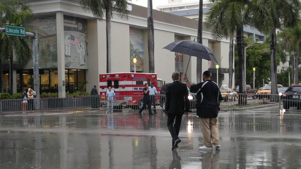
The absence of a tropical threat does not mean the absence of weather trouble. South Florida spent the third week of September under repeated rounds of heavy rain tied to a non-tropical area of low pressure over the eastern Gulf, with parts of Palm Beach County recording more than 10 inches over three days and flood advisories cycling in and out across the region. Flooding in Florida does not require a named storm.
That distinction is worth holding onto as the season winds down. Much of the state's most disruptive flooding in recent years has come from slow-moving, unnamed systems that sit over saturated ground and dump rain for days. Those events do not trigger hurricane watches, do not prompt evacuation orders, and often do not qualify for the federal disaster declarations that follow a landfall.
For residents, the practical guidance has not changed. Supplies purchased in June remain useful in October. Florida's year-round sales tax exemptions on disaster preparedness staples, which replaced the state's older limited-window hurricane tax holidays, mean there is no seasonal deadline attached to restocking.
The insurance and market angle
A season without a Florida landfall carries real financial weight. Catastrophe losses drive the reinsurance pricing that flows through to homeowners, and a quiet year eases pressure on a market that has spent much of the past decade under strain. Citizens Property Insurance Corporation approved rate recommendations that reduce average personal lines rates for the first time since 2015, and a loss-free season strengthens the case that recent reforms are holding.
Insurers price on multi-year expectations rather than single outcomes, so one quiet season will not by itself reset premiums. But consecutive years without major Florida losses would begin to move the actuarial math, and the 2026 season has cleared its most dangerous stretch without a claim event of consequence.
The counterweight is the flood side of the ledger. The National Flood Insurance Program's authorization expires on September 30, and heavy September rainfall across South Florida is a reminder that flood exposure in the state is not confined to hurricane season or to coastal parcels.
Emergency managers kept working through the quiet
A season without a landfall does not translate into a season without work for Florida's emergency management apparatus. The Florida Division of Emergency Management has spent the summer running exercises, refreshing county-level mutual aid agreements and pushing registration for the state's special needs shelter program, which requires advance enrollment that residents routinely postpone until a storm is already approaching. Quiet years are when that backlog gets cleared.
County emergency operations centers have also used the lull to work through staffing and communications gaps identified in recent activations. Several coastal counties have revised evacuation zone maps and public messaging after prior storms exposed widespread confusion about the difference between a zone designation and a flood zone, two unrelated systems that share similar vocabulary and routinely get conflated by residents trying to decide whether to leave.
Utilities have followed a similar pattern. Florida Power and Light and the state's municipal utilities conduct annual storm drills regardless of forecast, and a quiet season allows crews to advance hardening projects, underground conversions and vegetation management that get suspended once a system enters the basin. Work completed in a calm September pays off in a busy October.
The complacency problem officials keep naming
The persistent worry among Florida officials is behavioral rather than meteorological. Preparedness surveys consistently show that household readiness tracks recent experience, meaning residents who have not faced a storm in a year or two let supplies lapse, allow insurance documentation to go stale and lose familiarity with their evacuation zone. A quiet season erodes readiness in a way no public awareness campaign fully offsets.
The population math sharpens the concern. Florida has added hundreds of thousands of residents in recent years, many of them from states with no hurricane exposure at all. A meaningful share of the people living in the state's most vulnerable coastal counties have never experienced a Florida landfall, and a hurricane-free 2026 extends that inexperience by another year.
Officials have leaned on the historical record to make the argument. Seasons with few storms have still produced catastrophic individual events, and the number of named storms in a year has almost no predictive relationship to whether any particular community gets hit. The only figure that matters to a given household is whether a storm crosses its coastline, and that number is either zero or one.
What's next
The Atlantic hurricane season runs through November 30, leaving roughly 10 weeks on the calendar. Late-season development typically shifts away from the deep tropics toward the western Caribbean and the Gulf, which are the basins that matter most to Florida. October storms often form closer to home and with less warning time than the long-tracking August systems that cross from Africa.
Forecast models showed little sign of organized development over the two weeks following Fay's formation. That is a genuine reprieve rather than an all-clear, and hurricane specialists have repeatedly noted that October has delivered damaging Florida storms in seasons that were otherwise unremarkable.
For now, Fay will run its brief course in the open ocean, possibly entering the record books as the season's first hurricane and possibly not. Either way, Florida will watch it from 2,700 miles away, which is the best vantage point the state has had in September for several years running.
Spotted an issue with this article?
Have something to say about this story?
Write a letter to the editor