Seagrass Is Returning to the Indian River Lagoon, and a New Map Shows How
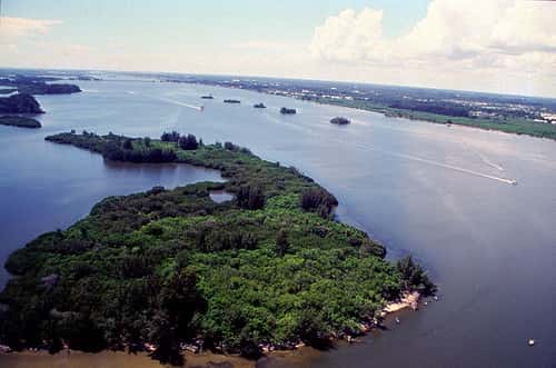
The St. Johns River Water Management District has released an interactive StoryMap documenting the recovery of seagrass in the Indian River Lagoon, one of the most closely watched environmental turnarounds in Florida. The tool combines maps, data, photographs, and video to explain both the scale of the lagoon's collapse and the extent of its rebound.
The underlying numbers are striking. A 2025 aerial mapping study found a 72 percent increase in seagrass coverage since 2023, an expansion of roughly 7,000 hectares. For scale, that is approximately 13,000 football fields of habitat returning to a system that had lost an estimated 75 percent of its seagrass beginning in 2011.
The recovery matters well beyond the boundaries of the lagoon itself. The Indian River Lagoon stretches 156 miles along Florida's Atlantic coast, spanning six counties, and is frequently described as the most biologically diverse estuary in North America. Its condition affects manatees, fisheries, water quality, and the coastal economies of Brevard, Indian River, St. Lucie, Martin, Volusia, and Palm Beach counties.
What the StoryMap contains
The district's Story of Seagrass StoryMap allows users to explore the lagoon's distinct sublagoons, each of which has its own hydrology and its own recovery trajectory. Visitors can examine how seagrass coverage has changed over time and see how scientists track those changes.
The tool explains three monitoring approaches that together produce the district's picture of lagoon health. Aerial mapping provides broad coverage of seagrass extent. In-water monitoring gives ground-level verification and detail on species composition and density that aerial imagery cannot resolve. Seed bank research examines the dormant seeds held in lagoon sediments, which turned out to be central to understanding what happened next.
The StoryMap also covers restoration work: muck removal, wetland restoration, stormwater treatment, and septic-to-sewer conversions. These are the interventions that agencies and local governments have funded across the lagoon watershed over the past decade to reduce the nutrient loading that caused the collapse.
How the lagoon collapsed
The decline began in 2011 with an intense and prolonged algae bloom, sometimes called a superbloom. Algae blooms in estuaries are driven by excess nutrients, principally nitrogen and phosphorus, entering the water from fertilizer runoff, stormwater, wastewater, and failing or inadequate septic systems.
When algae proliferate at the surface, they block sunlight from reaching the bottom. Seagrass, which is a flowering plant rather than an alga, requires light to photosynthesize. Extended shading kills it. Once the grass dies, the sediments it stabilized become mobile, water clarity degrades further, and the system can lock into a degraded state that resists recovery.
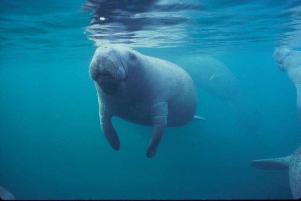
The consequences moved rapidly up the food web. Seagrass is the primary food source for Florida manatees along the Atlantic coast, and the lagoon is critical winter habitat for them. The loss of forage contributed to an unusual mortality event that killed large numbers of manatees, prompting an unprecedented supplemental feeding program by state and federal wildlife agencies.
Fisheries suffered as well. Seagrass beds are nursery habitat for a wide range of species, and their loss affected both recreational and commercial fishing across the lagoon system.
The seed bank surprise
The most scientifically interesting element of the recovery is that it appears to be happening naturally. Researchers found that a previously little-understood seed bank held in the lagoon floor has been driving the regrowth on its own, without the large-scale replanting that many restoration efforts require.
Seed banks function as ecological memory. Seagrass species produce seeds that can remain viable in sediment for extended periods, germinating when conditions become favorable again. The lagoon's seed bank had apparently persisted through more than a decade of degraded conditions, waiting for water clarity to improve enough to permit germination and establishment.
This finding carries practical significance for restoration policy across Florida and elsewhere. If natural seed banks can drive recovery, the most cost-effective intervention may be improving water quality and then allowing the system to rebuild itself, rather than funding labor-intensive replanting programs. It also suggests that degraded estuaries may retain more recovery potential than their surface condition indicates.
The caveat is that seed bank viability is not permanent. A system that stays degraded long enough will exhaust its stored seeds, at which point natural recovery becomes impossible and active replanting becomes the only option.
What made the water clearer
The recovery did not happen in isolation from human effort. Local governments and agencies across the lagoon watershed have invested substantially in reducing nutrient loading over the past decade.
Septic-to-sewer conversion has been among the most significant interventions. Older residential areas along the lagoon relied on septic systems that leach nitrogen into groundwater, which then moves toward the estuary. Brevard County in particular has funded conversions through a dedicated local sales tax approved by voters, one of the larger locally financed environmental programs in the state.
Muck removal addresses a different problem. Decades of accumulated organic sediment on the lagoon bottom holds nutrients that re-release into the water column when disturbed. Dredging that material out removes a source of internal nutrient loading that would otherwise continue regardless of what happens on land.
Stormwater treatment projects capture and filter runoff before it reaches the lagoon, and wetland restoration rebuilds the natural filtration capacity that development had removed. None of these interventions produces immediate results, which is part of why the recent seagrass data has drawn attention: it suggests the cumulative effect is now measurable.
What this means for Florida communities
For residents of the six counties bordering the lagoon, the recovery has practical implications. Water clarity affects property values along the shoreline, recreational use, and the tourism activity that supports local businesses in communities from Titusville south through Stuart.
Fishing guides, kayak outfitters, and marine businesses depend on a functioning estuary. The lagoon's recreational fishery draws anglers from across Florida and beyond, and habitat recovery supports the species those anglers pursue.
Manatee conservation is the most visible dimension. The lagoon's role as winter habitat means seagrass recovery directly affects whether the population can sustain itself without emergency intervention. Wildlife officials have monitored forage availability closely as an indicator of whether the crisis conditions of recent years have genuinely eased.
The work that remains
A 72 percent increase from a badly depressed baseline is not the same as full recovery. The lagoon lost roughly three-quarters of its seagrass beginning in 2011, and current coverage remains below historical levels despite the recent gains.
The system also remains vulnerable to the conditions that caused the collapse. Nutrient loading continues from fertilizer application, from remaining septic systems, and from stormwater in developed areas. A wet season with heavy runoff, or a warm period favorable to algae, could set back the recovery.
Population growth in the watershed adds ongoing pressure. Brevard County and the Treasure Coast counties have continued to add residents, and each new development adds impervious surface, wastewater volume, and landscape fertilizer unless managed carefully.
What seagrass actually does
Seagrass beds perform several ecological functions simultaneously, which is why their loss cascaded through the lagoon so severely and why their return matters beyond the visual improvement in water clarity.
They stabilize sediment. Root and rhizome systems bind the lagoon bottom, preventing resuspension of fine material by wind and boat wakes. When grass dies, sediment mobilizes, which reduces clarity and further inhibits regrowth, creating the self-reinforcing degradation the lagoon experienced.
They produce oxygen and take up nutrients. A functioning seagrass meadow removes nitrogen and phosphorus from the water column, meaning healthy grass beds provide some of the nutrient buffering that their absence eliminates.
They provide habitat structure. Juvenile fish, shrimp, and crabs shelter within the grass canopy, which is why seagrass loss propagates upward through the food web to affect species that never eat the grass itself.
They store carbon. Seagrass meadows sequester carbon in sediments at rates per unit area that exceed many terrestrial forests, a function that has drawn increasing scientific attention.
The manatee dimension
The Indian River Lagoon's role in manatee survival is specific to its geography. Manatees cannot tolerate prolonged exposure to water below approximately 68 degrees, and during Florida winters they congregate at warm water refuges including natural springs and power plant discharge canals.
The lagoon system hosts significant winter aggregations, and animals gathered at a warm water refuge must forage nearby. When seagrass in the surrounding area disappeared, the animals faced a choice between leaving thermal refuge and starving, a situation with no favorable outcome.
The resulting unusual mortality event prompted state and federal wildlife agencies to undertake a supplemental feeding program, providing lettuce at a location near a warm water site. Feeding wildlife is contrary to standard conservation practice, and agencies undertook it as an emergency measure.
Seagrass recovery is the only durable resolution. A supplemental feeding program cannot be sustained indefinitely, and it addresses the symptom rather than the cause.
Manatee population monitoring continues through aerial surveys and mortality tracking, and forage availability in the lagoon remains among the variables wildlife managers watch most closely.
What recovery costs and who pays
The interventions credited with improving lagoon water quality carry substantial price tags, and the funding structure explains why progress has been uneven across the watershed.
Septic-to-sewer conversion is among the most expensive per household. Converting a neighborhood requires installing collection infrastructure, connecting individual properties, and expanding treatment plant capacity. Costs run into the tens of thousands of dollars per connection in some configurations.
Brevard County voters approved a dedicated local sales tax to fund lagoon restoration, creating a revenue stream specifically for this purpose. That local commitment has been a significant factor in the pace of work in the county.
State funding flows through the water management districts and through legislative appropriations, including programs directed at water quality improvement. Federal funding reaches the lagoon through the National Estuary Program and through agencies including NOAA and the Environmental Protection Agency.
Muck dredging costs depend on volume and on disposal, since removed sediment must be dewatered and placed somewhere. Projects of this type are measured in millions of dollars for individual segments of the lagoon.
What's next
The district will continue its annual aerial mapping program, which provides the primary measure of whether the recovery trend holds. The next mapping cycle will indicate whether the gains recorded through 2025 have been sustained or whether the system has plateaued.
Continued funding for septic conversions, muck removal, and stormwater infrastructure will be decided through county budgets and state appropriations. Those decisions, made in local commission chambers and in Tallahassee, will do more to determine the lagoon's long-term trajectory than any single restoration project.
The StoryMap itself is available through the St. Johns River Water Management District, which has positioned it as a public education tool intended to make the lagoon's science accessible to residents who live alongside it.
Spotted an issue with this article?
Have something to say about this story?
Write a letter to the editor