Atlantic Season Sets Record for Latest First Hurricane, Easing Florida Risk
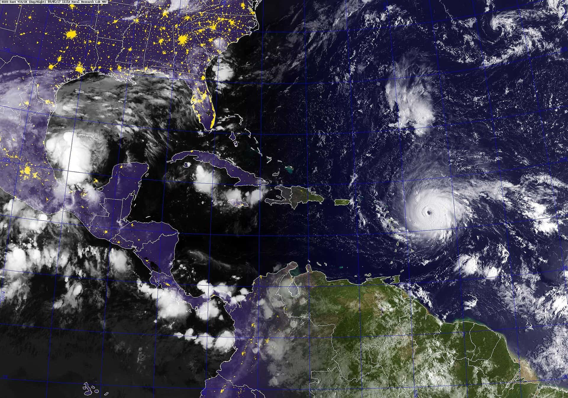
The 2026 Atlantic hurricane season has passed the calendar date on which it normally peaks without producing a single hurricane, setting a record for the latest first hurricane in the satellite era and giving Florida an unusual mid-September in which no tropical system threatens the state. Several named storms have formed since June 1, but none has reached the 74 mph threshold that separates a tropical storm from a hurricane.
The previous record for the latest first Atlantic hurricane was September 11, a date reached in both 2002 and 2013. The 2026 season passed that mark with an empty basin, and forecasters tracking the Atlantic reported no active tropical storms or hurricanes anywhere in the basin during the second week of September.
The National Hurricane Center's tropical weather outlook has been dominated by a single feature: a trough of low pressure more than 1,000 miles east-southeast of Bermuda producing disorganized showers and thunderstorms. Formation odds through 48 hours were listed as near zero, with a low chance, roughly 30 percent, over seven days as the system tracks west-northwest into a marginally more favorable environment. That system poses no threat to Florida.
Why the Atlantic has stayed quiet
The dominant explanation forecasters point to is El Nino. The pattern emerged in the equatorial Pacific in June and has strengthened every month since. El Nino warms the eastern Pacific, which changes atmospheric circulation across the tropics and increases vertical wind shear over the Atlantic basin.
Wind shear is the difference in wind speed and direction between the lower and upper atmosphere. A developing tropical cyclone needs a vertically stacked column of thunderstorms to organize around a center of circulation. Strong shear tilts that column and ventilates its core, which is a technical way of saying it tears the storm apart before it can consolidate. This is why El Nino years reliably suppress Atlantic activity even when ocean temperatures would otherwise support development.
The effect is well documented. In prior Atlantic seasons where an El Nino eventually reached the strongest classification, forecasters recorded only one September hurricane in each of those years, roughly one to two fewer than an average September. What is unusual about 2026 is not that activity is suppressed but the degree: zero hurricanes through the peak is beyond what even a strong El Nino typically delivers.
What NOAA's outlook says
NOAA maintained its below-normal seasonal forecast in its August update, calling for 7 to 13 named storms across the full June 1 through November 30 season, of which 2 to 6 could become hurricanes and 0 to 2 could become major hurricanes at Category 3 strength or above. Those ranges include storms that have already formed.
The lower bound of that hurricane forecast, two, is the relevant number now. With the peak past and the basin empty, the season is tracking toward the bottom of the range rather than the middle. The outlook's inclusion of a zero in the major hurricane range was itself a notable signal when it was issued.
It is worth reading the outlook for what it is: a probabilistic statement about basin-wide activity, not a landfall forecast. NOAA has been consistent for years that seasonal storm counts say almost nothing about whether any particular coastline gets hit. A one-hurricane season that puts that hurricane over Tampa Bay is worse for Florida than a twenty-storm season that keeps everything at sea.
What this means for Florida right now
The practical situation for Florida on September 15 is straightforward: there is no tropical threat to the state, and the only system the Hurricane Center is monitoring is far out in the subtropical Atlantic with low odds and no track toward the United States. Residents do not need to take any storm-related action this week.
The quiet has secondary effects worth noting. The state's emergency management apparatus has not been activated for a storm response this season, which matters given that the Division of Emergency Management recently warned lawmakers about a potential shortfall in the fund it draws on during disasters. A season without landfall is, among other things, a season without new obligations against that fund.
Utilities, insurers, and county emergency managers all plan against a normal season and budget accordingly. A quiet year does not translate into immediate savings for ratepayers or policyholders, since rates are set on multi-year loss expectations, but a run of low-loss years is one of the inputs that eventually moves those numbers.
The complacency problem
Every emergency manager in Florida will make the same point about a season like this one, and it is not boilerplate. The state's two most destructive storms of the past century, measured different ways, both arrived in seasons that had been unremarkable up to that point. A season's storm count has no predictive value for what happens in the remaining weeks.
Florida has roughly two and a half months of season left. The climatological risk curve declines through October and November, but it does not go to zero, and the character of late-season storms is different in a way that matters for the state. October and November systems frequently form in the western Caribbean, which is close enough to South Florida that development-to-landfall can happen in a few days rather than a week.
El Nino's shear does suppress those systems too, and the Caribbean is often the most sheared part of the basin in an El Nino autumn. But the historical record includes El Nino years with damaging late-season Florida landfalls, and a suppressed basin is not a closed one.
What preparedness looks like in a quiet year
The state's disaster preparedness sales tax exemptions are now permanent and year-round rather than confined to holiday windows, which changes the preparedness calendar. There is no longer a specific week in which Florida residents are prompted to buy batteries, and that means the prompting has to come from somewhere else.
The baseline recommendations are unchanged: know your evacuation zone, which is determined by storm surge modeling and is not the same as your flood zone; keep several days of water and non-perishable food; maintain a way to charge a phone and receive alerts if power fails; and keep insurance documents somewhere retrievable. Flood damage is not covered by standard homeowners policies, and flood policies typically carry a 30-day waiting period, which makes September a poor month to start thinking about it.
County emergency management offices publish evacuation zone lookups by address. Residents who have moved since last season, and Florida gets a great many of those every year, are the group most likely to have never checked.
How forecasters measure a season
Storm counts are the number the public sees, and they are the least informative measure available. A season with 20 weak, short-lived tropical storms and a season with six long-lived hurricanes are not comparable, but a raw count treats them as though the first were more active.
The metric forecasters actually use is Accumulated Cyclone Energy, which integrates the intensity of every storm over its lifetime. A season with no hurricanes accumulates very little of it regardless of how many named storms formed, because tropical storm winds contribute a small fraction of what hurricane-force winds do. By that measure, 2026 is not merely below normal. It is anomalously quiet.
This distinction matters for how Floridians should read seasonal forecasts. A prediction of an above-normal storm count in some future year does not mean Florida is more likely to be hit, and a below-normal count does not mean it is safe. The state has been struck in quiet seasons and spared in busy ones, repeatedly, and the correlation between basin activity and Florida landfall is weak enough that emergency managers do not plan around it.
What El Nino does and does not control
El Nino's suppressing effect on the Atlantic is among the most reliable relationships in seasonal hurricane forecasting, but it is a probabilistic relationship rather than a guarantee, and it operates on the basin rather than on any particular storm.
The mechanism is atmospheric rather than oceanic as far as the Atlantic is concerned. Warming in the eastern Pacific shifts the location of deep convection, which alters the upper-level wind pattern across the tropical Atlantic and Caribbean. The result is stronger westerly winds aloft over a region where developing storms need calm conditions through the depth of the atmosphere.
What El Nino does not do is cool the Atlantic. Sea surface temperatures across the basin remain more than warm enough to support major hurricanes, which is why forecasters have been careful not to describe the season as safe. The fuel is present. The environment has been hostile. If the shear pattern relaxes even briefly over a warm patch of water, development can happen quickly.
Late-season storms and why Florida watches them
The climatological risk profile shifts in October and November in a way that is specific to Florida and that residents of other coastal states do not share to the same degree. Early and peak-season storms typically form off Africa and cross the open Atlantic, which gives forecasters a week or more of lead time and gives the storms many opportunities to weaken or curve out to sea.
Late-season storms more often form in the western Caribbean or the southern Gulf, which is close enough to Florida that a system can go from a disorganized cluster of thunderstorms to a landfalling hurricane in a few days. The warning window compresses, and the preparation window compresses with it.
Florida's history includes several destructive late-season storms, and the state's emergency managers treat the November 30 end date as a calendar convention rather than a meteorological one. Storms have formed outside the official season in both directions.
What's next
Forecasters will be watching whether the Bermuda-area trough consolidates later in the week as it moves into a less hostile environment. Even if it does develop, its track keeps it in the open Atlantic on current guidance.
Beyond that, attention shifts to the western Caribbean as the calendar moves into October. That is the region that decides whether a quiet season stays quiet for Florida, and it is where forecasters will be looking for any sign that the shear pattern is relaxing.
The season officially ends November 30. Until then, the record that 2026 has already set stands as a curiosity rather than an all-clear.
Spotted an issue with this article?
Have something to say about this story?
Write a letter to the editor