King Tides Peak on Florida's Atlantic Coast With Coastal Flood Warnings, Dangerous Surf and Gusty Winds
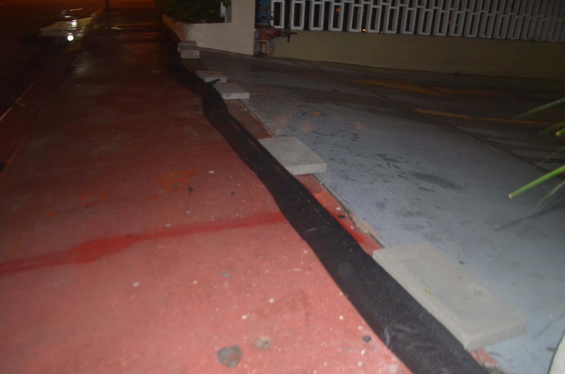
King tides are peaking along Florida's Atlantic coast this weekend, and the National Weather Service has stacked coastal flood warnings, watches and advisories from Fernandina Beach to the Florida Keys as strong northeast winds pile ocean water against the shoreline. Forecasters say moderate saltwater flooding is expected around each high tide in Miami-Dade, Broward and Palm Beach counties, with major flooding possible late this weekend into early next week, while breaking waves of 7 to 12 feet and a high risk of rip currents make the surf dangerous along nearly the entire east coast through at least Monday evening.
The setup combines the highest astronomical tides of the season, timed to the full moon just after midnight Monday, Oct. 26, with a tight pressure gradient between strong high pressure to the north and low pressure near the Bahamas and the northern Caribbean. Rain is the third ingredient: the weather service office in Miami expects showers and storms to increase sharply Sunday and Monday along the east coast metro areas, which could leave water with nowhere to drain.
The weekend follows an earlier round of king tide flooding and rough surf that The Florida Press reported on Oct. 18 as a storm system moved away from the Southeast coast. This is a separate event, and forecasters expect it to be the stronger of the two for tidal flooding.
What the weather service has posted
Active alerts from the National Weather Service offices in Miami, Melbourne, Jacksonville and Key West as of Saturday morning are summarized below.
| Area | Alert | Timing |
|---|---|---|
| Coastal Miami-Dade, Broward, Palm Beach | Coastal Flood Advisory (moderate flooding), then Coastal Flood Watch | Advisory until 2 a.m. Sunday; watch late Saturday night through Monday evening |
| Coastal Palm Beach | High Surf Advisory, 5 to 10 foot breakers | Until 8 p.m. Monday |
| Coastal Martin, St. Lucie, Indian River, southern Brevard | Coastal Flood Warning; High Surf Advisory, 6 to 12 foot breakers | Warning 2 a.m. Sunday to 8 p.m. Monday |
| Coastal Volusia, northern Brevard | Coastal Flood Warning; High Surf Advisory, 7 to 11 foot breakers | Warning 2 a.m. Sunday to 8 p.m. Monday |
| Coastal Duval and St. Johns River basin | Coastal Flood Warning; High Surf Advisory, 7 to 11 foot breakers | Through 8 p.m. Monday |
| Coastal Nassau, St. Johns, Flagler | Coastal Flood Warning; Wind Advisory, gusts to 40 mph | Warning from 5 p.m. Saturday to 8 p.m. Monday |
| Upper Florida Keys | Coastal Flood Warning (major flooding) | Until 5 a.m. Sunday |
| Middle and Lower Keys | Coastal Flood Advisory | Until 5 a.m. Sunday |
A high rip current risk covers every Atlantic beach from Georgia to Miami-Dade through Monday evening, and the weather service office in Mobile has a rip current statement for the Escambia, Santa Rosa and Okaloosa county beaches in the Panhandle through Monday evening as well.
South Florida: moderate to major flooding at high tide, heavy rain Sunday
In its Saturday morning forecast discussion, the weather service in Miami said moderate coastal flooding is expected with each high tide cycle and that major coastal flooding is possible late this weekend into early next week. The warning language for Miami-Dade, Broward and Palm Beach says numerous roads may be closed and that low-lying homes, businesses and some critical infrastructure may be inundated.
Preliminary readings from NOAA tide gauges show the water already running well above normal. At Virginia Key, the gauge peaked a little more than 1.9 feet above the average higher high tide on Saturday morning, after nearly 2 feet on Friday. Lake Worth Pier and South Port Everglades also topped 1.8 feet above that mark Saturday morning.
Saturday is expected to be the calmer of the two weekend days in South Florida, with mostly dry air in place. That changes Sunday. Forecasters put rain chances at 70 to 80 percent for the eastern metro areas Sunday into Monday, and the Miami office said 1 to 1.5 inches of rain through Monday is the most likely outcome, with a lower-confidence scenario of 3 to 4 inches. A slight risk of excessive rainfall is in place for urban and poor-drainage flooding. Gusts over 35 mph are possible Sunday through Monday, and the strongest winds inland may come Monday.
The Miami office warned that elevated coastal water could make it hard for rain to drain from some coastal neighborhoods until low tide, and it said a Flood Watch may be needed if the rain forecast holds. Surf of 10 to 12 feet is possible along northern Palm Beach County beaches through Tuesday.
Cities are already reacting. WPLG Local 10 reported that crews in Hollywood installed orange, water-filled tiger dam barriers along the Broadwalk and that some businesses put sandbags outside their doors, while parts of Fort Lauderdale Beach saw water on the roads Friday before it receded.
When the high tides arrive
NOAA's astronomical predictions put the morning high tides, the higher of the two daily cycles on the Atlantic side, at the following times. Wind and rain can push actual water levels well above these predictions, so flooding can begin before the listed time and linger after it.
| NOAA station | Sat., Oct. 24 | Sun., Oct. 25 | Mon., Oct. 26 | Tue., Oct. 27 |
|---|---|---|---|---|
| Virginia Key (Miami) | 8:11 a.m. | 8:58 a.m. | 9:44 a.m. | 10:31 a.m. |
| South Port Everglades (Fort Lauderdale) | 7:23 a.m. | 8:07 a.m. | 8:52 a.m. | 9:40 a.m. |
| Lake Worth Pier (Palm Beach County) | 7:04 a.m. | 7:49 a.m. | 8:35 a.m. | 9:23 a.m. |
| Trident Pier (Port Canaveral) | 6:41 a.m. | 7:28 a.m. | 8:16 a.m. | 9:04 a.m. |
| Mayport (Jacksonville) | 7:39 a.m. | 8:24 a.m. | 9:10 a.m. | 9:58 a.m. |
Evening high tides come roughly 12 hours later and are predicted to be slightly lower at each of these stations. NBC 6 noted that the astronomical peak may come Tuesday, about a day after the full moon, but that stronger east winds and heavier rain could make Sunday or Monday the worst days for flooding even with slightly lower predicted tides.
Treasure Coast, Space Coast and Volusia
The weather service in Melbourne upgraded to Coastal Flood Warnings for coastal Volusia, Brevard, Indian River, St. Lucie and Martin counties from 2 a.m. Sunday to 8 p.m. Monday, saying coastal roads may be closed and significant shoreline erosion will occur. A Wind Advisory calls for northeast winds of 10 to 20 mph with gusts up to 35 mph, beginning Saturday afternoon in Volusia and northern Brevard.
WKMG News 6 meteorologists said Sunday looks like the windiest and wettest day in Central Florida, with gusts of 35 to 45 mph possible near the coast and rain chances of 70 to 80 percent along the beaches. The station said the Weather Prediction Center placed much of the coast under a Level 1 of 4 risk for excessive rainfall and that the Sunday and Monday morning high tides are the biggest concern. Seas offshore could reach 12 to 15 feet late this weekend, with gale watches posted for the Atlantic waters.
The persistent northeast wind is also backing up the St. Johns River. The Melbourne office has a Flood Warning for the river near Astor in Lake and Volusia counties, where the river was at 3.2 feet Saturday morning, in moderate flood stage, and is forecast to keep rising slowly through the weekend.
Northeast Florida and Southeast Georgia
The weather service in Jacksonville has Coastal Flood Warnings in effect through 8 p.m. Monday for coastal Duval, the St. Johns River basin, the Trout River, and the coasts of Nassau, St. Johns and Flagler counties, plus the Southeast Georgia beaches. The warnings say numerous roads may be closed and homes, businesses and some critical infrastructure will be inundated. A Wind Advisory runs from noon Saturday to 1 a.m. Sunday for northeast winds of 15 to 25 mph and gusts up to 40 mph.
WJXT News4JAX said moderate to potentially major flooding is possible near high tide, that coastal gusts could reach 40 to 45 mph, and that downpours could worsen flooding if they arrive during a high-tide cycle. The station said major beach erosion is likely around high tides through much of next week.
Florida Keys, Tampa Bay and the Gulf Coast
In the Keys, the weather service office in Key West has a Coastal Flood Warning for major saltwater flooding in the Upper Keys until 5 a.m. Sunday, with little relief expected even at low tide, and an advisory for the Middle and Lower Keys.
The Gulf coast is spared the tidal flooding but not the wind. The weather service office in Ruskin said hazardous marine conditions will continue across the coastal waters through the weekend and into early next week, with gusty northeast winds strongest along the coast and a slight chance of showers inland and in Southwest Florida. FOX 13 reported a Small Craft Advisory for local waters from Friday night through Wednesday night.
Tropics stay quiet
The weather is not tied to a tropical system. The National Hurricane Center's 8 a.m. outlook Saturday said tropical cyclone formation is not expected in the Atlantic, Caribbean or Gulf during the next seven days.
What's next
Forecasters expect the peak tides, the strongest winds and the heaviest South Florida rain to overlap Sunday and Monday, and the Miami office said beach hazards will likely need to be extended into the middle of next week. Officials advise residents not to drive, walk or wade through flooded streets, which may hold saltwater, to move vehicles to higher ground before the morning high tide, and to stay out of the ocean. Drier air is expected to return by the middle of the week, though persistent northeast winds may keep coastal flooding and beach erosion going for several more tide cycles.
Spotted an issue with this article?
Have something to say about this story?
Write us a letterComments
No comments yet. Be the first to weigh in.
Related Coverage
NOAA Winter Outlook Favors a Wet Florida Winter as a Very Strong El Niño Builds
2d ago

Josephine Heads Out to Sea, but Florida's Atlantic Coast Faces Strong Winds, King Tide Flooding and Dangerous Surf This Weekend
5d ago
Strong fall cold front brings Florida Saturday rain, cooler air and dangerous surf this weekend
Oct 15
Hurricane Center Gives Atlantic Low Near Cabo Verde a 20% Chance as Florida Gets a Break After Isaias
Oct 12