Heat Advisories Push South Florida Index Values Toward 110 Degrees
The National Weather Service has issued heat advisories covering Miami-Dade and Broward counties running from 11 a.m. to 7 p.m., with heat index values forecast to reach 106 to 110 degrees. Forecasters have also flagged moderate to major HeatRisk across the region through the weekend, a designation indicating conditions capable of affecting anyone without adequate cooling and hydration, not only those in traditional high-risk categories.
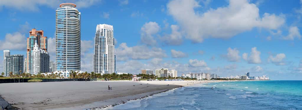
A separate rip current statement is in effect along portions of Florida's coast through 8 p.m. Thursday, warning swimmers of dangerous currents at area beaches. The combination of extreme heat and elevated surf risk creates a difficult trade-off for residents seeking relief in the water.
The heat is arriving with drier air aloft, which is suppressing the afternoon thunderstorm activity that normally provides a temperature break in South Florida during late July. Forecasters expect lower precipitation chances through Friday, with scattered afternoon thunderstorms carrying lightning and gusty winds as the primary threats when they do develop.
Understanding heat index and HeatRisk
Heat index is not the same as air temperature. It combines air temperature with relative humidity to estimate what the heat feels like to the human body, because high humidity impairs the evaporation of sweat, which is the body's principal cooling mechanism. A heat index of 108 degrees can occur with an air temperature in the mid-90s when dew points are high, which is typical for South Florida in summer.
The HeatRisk scale used by the National Weather Service is a separate index, running from minimal through moderate, major, and extreme. It accounts for how unusual the heat is for the location and time of year, how long it persists including overnight, and whether it crosses thresholds associated with elevated health impacts. Moderate to major HeatRisk means the heat is significant enough to affect people beyond the most sensitive groups.
Overnight temperatures matter as much as daytime peaks. When nighttime lows stay in the upper 70s or low 80s, the body does not get the recovery period that mitigates cumulative heat stress. Multi-day heat events with warm nights carry more health risk than a single hot afternoon.
A heat advisory is the National Weather Service product issued when conditions are expected to reach dangerous levels. It is distinct from an excessive heat warning, which is issued for more severe or prolonged conditions. Residents should treat an advisory as an instruction to modify activity, not as a routine summer notice.
Who faces the greatest risk
Outdoor workers carry the heaviest exposure. Construction crews, roofers, landscapers, agricultural workers, utility line crews, and delivery drivers spend the hottest hours of the day in direct sun with limited access to cooling. Florida's construction sector is large and active, and summer heat is a recognized occupational hazard.
Older adults face elevated risk because the body's thermoregulation becomes less efficient with age, and because chronic conditions and common medications, including diuretics and some blood pressure drugs, can impair heat tolerance or fluid balance. South Florida's substantial population of residents over 65 concentrates that risk.
Young children, people with chronic cardiovascular or respiratory disease, people without reliable air conditioning, and people experiencing homelessness round out the highest-risk groups. Pets are also vulnerable, and pavement surface temperatures during peak heat can injure paws well after the air temperature has begun to fall.
Warning signs of heat illness escalate in a recognizable sequence. Heat cramps and heavy sweating with weakness suggest heat exhaustion, which calls for immediate movement to a cool place, fluids, and cooling of the skin. Confusion, hot dry skin, a rapid pulse, or loss of consciousness suggest heat stroke, which is a medical emergency requiring a call to 911 and aggressive cooling while awaiting help.
Rip currents and beach safety
The concurrent rip current statement deserves separate attention. Rip currents are narrow channels of water moving away from shore, and they are the leading cause of surf rescues and drownings at Florida beaches. They form around sandbar gaps, near piers and jetties, and in conditions with persistent onshore wind or elevated swell.
A swimmer caught in a rip current is pulled seaward, not underwater. The standard guidance is to avoid swimming directly against the current toward shore, which exhausts even strong swimmers. Instead, swim parallel to the beach until out of the narrow current, then angle back toward shore. Swimmers who cannot escape should float, tread water, and signal for help.
Florida beaches use a colored flag warning system, with red indicating high hazard, double red indicating the water is closed to the public, yellow indicating moderate hazard, and purple indicating dangerous marine life. Swimming at beaches with lifeguards on duty remains the single most effective safety measure.
What it means for Florida residents
The practical advice for a heat advisory day is specific. Shift strenuous outdoor activity to early morning or evening. Drink water consistently rather than waiting for thirst, and avoid alcohol and heavy caffeine during peak heat. Wear light-colored, loose-fitting clothing and a wide-brimmed hat. Take breaks in shade or air conditioning at regular intervals rather than pushing through.
Never leave a child or pet in a parked vehicle, even briefly and even with windows cracked. Interior vehicle temperatures rise rapidly and reach lethal levels within minutes in Florida summer conditions.
Check on neighbors who live alone, particularly older residents and those without functioning air conditioning. County emergency management offices and municipalities open cooling centers during significant heat events, and library branches, community centers, and shopping centers serve as informal refuges.
The statewide picture
While the formal advisories cover Miami-Dade and Broward, hot and humid conditions extend across much of the Florida peninsula in late July. The Tampa Bay region, Central Florida, and Southwest Florida all experience heat index values in the same general range during this part of the summer, and local National Weather Service offices in Tampa Bay, Melbourne, and Jacksonville issue their own products based on local conditions.
A former Department of Energy official recently warned that data center growth is adding strain to the Florida electrical grid during heat waves, which raises the stakes for peak demand days. Air conditioning load across the peninsula during a widespread heat event represents the largest single driver of summer electricity demand.
Utilities plan for these peaks, and Florida's grid has generally handled summer demand without widespread interruption. Residents can reduce strain and their own bills by setting thermostats a few degrees higher during peak afternoon hours and running major appliances in the evening.
Heat as an occupational hazard
Florida's outdoor workforce is large, spanning construction, agriculture, landscaping, roofing, utilities, delivery, and marine industries. All of them operate through summers in which heat index values routinely exceed 100 degrees.
Heat illness prevention in workplaces rests on a few well-established practices: acclimatization for new and returning workers over a period of days, scheduled rest in shade, access to cool water in sufficient quantity, and a buddy system so that early symptoms are noticed by someone.
Acclimatization deserves particular emphasis because a disproportionate share of serious heat illness occurs in a worker's first days on a job. The body adapts to heat over roughly one to two weeks, and a worker who has not gone through that process tolerates less.
Employers and workers can find heat illness prevention guidance through federal occupational safety resources and through industry associations. The practical measures are inexpensive relative to the cost of a heat stroke incident.
Cooling centers and community response
Florida counties activate cooling centers during significant heat events, typically using libraries, community centers, senior centers, and recreation facilities. Availability and activation criteria vary by county, and information is published by county emergency management offices.
Utility disconnection is a related concern. Households behind on electricity bills face the prospect of losing air conditioning during exactly the conditions that make it a health necessity. Florida utilities and social service agencies operate assistance programs, and the federal Low Income Home Energy Assistance Program provides cooling assistance in Florida.
People experiencing homelessness face the highest exposure and the fewest options. Outreach organizations in Florida's urban counties distribute water and provide transport to cooling locations during heat events.
Neighbors checking on neighbors remains the most effective informal safety net. Older adults living alone, particularly those with limited mobility or without functioning air conditioning, are the population most likely to experience a heat emergency without anyone noticing in time.
The lightning risk that accompanies the heat
Florida leads the United States in lightning strikes and lightning fatalities, and the afternoon thunderstorm pattern that produces them is a defining feature of the state's summer. Even during a drier stretch, scattered afternoon storms develop.
The operative guidance is simple and widely ignored: when thunder is audible, lightning is close enough to strike, and the only safe locations are a substantial enclosed building or a hard-topped vehicle. Open shelters, pavilions, and dugouts provide no protection.
Activity should not resume until 30 minutes after the last thunder. That interval accounts for the fact that lightning can strike well ahead of or behind the visible storm.
Beaches, golf courses, athletic fields, and boats are the settings where Florida lightning fatalities most commonly occur, all of them places where people are reluctant to abandon an activity for a storm that may pass quickly.
What's next
Forecasters expect drier air to hold precipitation chances lower through Friday, with scattered afternoon thunderstorms returning thereafter as moisture increases. Heat risk is forecast to remain in the moderate to major range across South Florida through the weekend.
Residents should check the forecast from their local National Weather Service office each morning, as heat advisories are issued on a daily basis and the specific hours and index values change. Beach conditions and flag status are updated by county beach patrol operations.
Separately, the tropics remain quiet. The National Hurricane Center has indicated that no tropical cyclone formation is expected in the Atlantic basin over the next seven days. That gives Florida a window to focus on heat safety without a concurrent storm threat, but the peak of hurricane season begins in mid-August. The Florida Press will continue reporting on weather conditions statewide.
Spotted an issue with this article?
Have something to say about this story?
Write a letter to the editor