NOAA Forecasts a Below-Normal 2026 Hurricane Season, but Florida Officials Urge Caution
Federal forecasters are projecting a quieter-than-usual Atlantic hurricane season in 2026, but Florida officials are warning residents not to mistake a favorable outlook for a safe one. The National Oceanic and Atmospheric Administration's seasonal outlook gives a roughly 55 percent chance of a below-normal Atlantic hurricane season, with a 35 percent chance of a near-normal season and only a 10 percent chance of an above-normal one. For the most hurricane-exposed state in the country, that probabilistic forecast is welcome news, yet emergency managers stress that the numbers describe likelihood across the entire basin, not a guarantee for any stretch of Florida coastline.
The distinction matters because of how Florida experiences hurricanes. NOAA's outlook covers the season that runs from June 1 to November 30, and it forecasts about 8 to 14 named storms, of which 3 to 6 are expected to become hurricanes and 1 to 3 to reach major hurricane strength. Those ranges sit at or below the long-term average, but they say nothing about where any storm might track. A below-normal season can still produce the single landfalling hurricane that devastates a Florida community, a point state officials have repeated as they open the year's preparedness campaign.
That is the core message Florida leaders are sending as the season begins: an outlook is a probability, not a promise, and complacency is the enemy of readiness. With the state having just launched its preparedness push, officials are urging residents across every region, from the Panhandle to South Florida, to build supply kits, review evacuation plans, and check insurance coverage before any storm appears on the horizon. The forecast may lean quiet, but Florida's exposure does not change with the odds.
What NOAA's Outlook Actually Says
NOAA's seasonal outlook is a probabilistic forecast, and understanding that framing is essential to interpreting it correctly. The agency assigns a 55 percent probability to a below-normal season, a 35 percent probability to a near-normal season, and a 10 percent probability to an above-normal season. Those figures describe the overall level of activity expected across the Atlantic basin, measured by the number and intensity of storms, rather than predicting how many will approach or strike land.
The numerical ranges fill in the picture. NOAA forecasts roughly 8 to 14 named storms for the 2026 season, a count that includes tropical storms and hurricanes alike. Of those, the agency expects about 3 to 6 to strengthen into hurricanes, with sustained winds of at least 74 miles per hour, and 1 to 3 to become major hurricanes, reaching Category 3 strength or higher. The breadth of those ranges reflects the inherent uncertainty in forecasting an entire season months in advance.
Crucially, the outlook offers no information about where storms will go. NOAA itself emphasizes that a seasonal outlook is not a landfall forecast, and the agency does not predict how many systems will reach the United States or which coastlines they might threaten. That limitation is central to why Florida officials treat the favorable odds with caution. A season can finish below normal in total activity while still delivering a destructive storm to a specific community.
The outlook is also a starting point, not a final word. Forecasters update their thinking as the season progresses, and the early projection is best understood as a snapshot of late-spring expectations. For Florida residents, the takeaway is that the outlook informs planning without removing the need to prepare.
The Science Behind a Quieter Season
The expectation of below-normal activity rests on a set of climate signals that forecasters watch closely. The most significant is El Nino, a periodic warming of the eastern and central Pacific Ocean that influences weather patterns worldwide. NOAA expects El Nino to develop and intensify during the 2026 season, and that pattern tends to suppress Atlantic hurricane activity by increasing wind shear, the change in wind speed and direction with height that can tear apart developing storms.
Other factors complicate the outlook and argue against overconfidence. Atlantic Ocean temperatures are expected to run slightly warmer than normal, and warmer water provides the energy that fuels tropical systems. Trade winds are also forecast to be weaker than average, a condition that can favor storm development by reducing the disruptive winds that might otherwise inhibit it. Those two factors pull in the opposite direction from El Nino, which is part of why the season is forecast as below normal rather than dramatically quiet.
The result is a balance of competing influences. El Nino's suppressing effect is expected to outweigh the warmer water and weaker trade winds, tilting the odds toward a below-normal season. But those countervailing factors mean the atmosphere remains capable of producing significant storms if conditions align. Forecasters describe such seasons as lower in overall activity but still able to generate dangerous hurricanes.
This is the scientific reason Florida officials caution against reading too much into the headline probability. The same warm Atlantic that supports a below-normal forecast can also intensify any storm that does form, and El Nino's influence does not extend to steering storms away from land. The science explains why fewer storms are likely; it does not explain away the risk to any individual community.
A Second Forecast Points the Same Direction
NOAA is not the only authority offering a 2026 outlook. Forecasters at Colorado State University, whose seasonal predictions are closely followed in the hurricane research community, expect a season slightly quieter than average. Their forecast calls for about 13 named storms, six hurricanes, and a few major hurricanes, figures that sit just below the long-term norms and broadly align with NOAA's below-normal lean.
For context, a typical Atlantic season produces roughly 14 named storms and seven hurricanes, based on long-term averages. The Colorado State numbers fall modestly under those benchmarks, reinforcing the broader expectation of a season that runs a touch below normal rather than one that is exceptionally calm. The convergence of two independent forecasts toward a similar conclusion lends additional weight to the overall picture for 2026.
The two forecasts use different methods, but their agreement on direction is meaningful. NOAA frames its outlook in probability ranges while Colorado State offers specific storm counts, yet both point to activity at or modestly below the historical average. That consistency gives Florida emergency managers a clear sense of the season's expected character.
Neither forecast, however, changes the fundamental caution that applies to Florida. Colorado State's researchers, like their NOAA counterparts, emphasize that a quieter season is no assurance against a damaging landfall. The history of Atlantic hurricanes includes below-average years in which a single storm caused catastrophic harm, a reminder that the total count matters far less to any given community than whether a storm comes ashore nearby.
Why Florida Cannot Afford Complacency
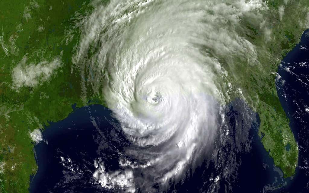
Florida's geography makes it uniquely vulnerable, and that vulnerability does not scale with the seasonal odds. Surrounded by warm water on three sides and home to millions of residents along low-lying coastlines, the state sits in the path of storms that can form anywhere in the Atlantic, Caribbean, or Gulf. A below-normal season reduces the number of storms in the basin, but it does nothing to move Florida out of harm's way for the ones that do develop.
The historical record underscores the point that emergency managers keep making: it only takes one. Florida has been struck in seasons that finished below average overall, and the damage from a single major hurricane can far exceed what the seasonal numbers might suggest. For that reason, state and federal officials consistently warn that a favorable outlook should never be read as permission to skip preparation, because the consequences of being caught unready can be severe regardless of how many storms form basin-wide.
Florida has just opened its preparedness campaign for the season, and officials are using the moment to push residents toward concrete steps. Those include assembling supply kits with water, food, medications, and other essentials; knowing one's evacuation zone and route; securing important documents; and reviewing insurance policies, including flood coverage, well before any storm threatens. The early days of the season, when the tropics are quiet, are precisely when such preparation is most effective and least rushed.
Officials are also careful to communicate the difference between the alerts residents may hear later in the season. A hurricane watch means hurricane conditions are possible within a specified area, generally within 48 hours, and is a signal to prepare. A hurricane warning means those conditions are expected, generally within 36 hours, and is a signal to act, often including evacuation. Understanding that distinction now, before the pressure of an approaching storm, is part of the readiness officials are urging.
A Quiet Start to the Season
As the season opened in early June 2026, the Atlantic was calm, with no tropical cyclone formation expected within the following seven days. That quiet beginning is consistent with a below-normal outlook and with the typical rhythm of the season, which tends to ramp up later in the summer and peak in the late-summer and early-fall weeks when ocean heat and atmospheric conditions are most favorable for development.
A tranquil start, however, says little about what the heart of the season will bring. Hurricane activity is heavily concentrated in the period from roughly mid-August through October, and a quiet June and July offer no assurance about the months that follow. Florida officials note that the early lull is an opportunity to prepare rather than a reason to relax, since the most dangerous stretch of the season typically arrives well after the June 1 start date.
The early calm also illustrates the value of the short-range forecasts that complement the seasonal outlook. While the seasonal projection describes the expected character of the whole season, the seven-day tropical outlooks issued by the National Hurricane Center tell residents what is actually developing in real time. Floridians are encouraged to follow those frequent updates as the season progresses, because they, not the seasonal odds, indicate when an actual threat is approaching.
For now, the below-normal outlook and quiet opening week give Florida a window to get ready without the urgency of an active threat. Emergency managers consider that window valuable and are urging residents to use it, since the absence of storms today is exactly the condition under which careful preparation is possible.
What's Next
The season will unfold over the coming months, and forecasters will refine their expectations as ocean temperatures, El Nino's development, and atmospheric patterns become clearer. NOAA and Colorado State typically issue updates as the peak approaches, and those revisions can shift the outlook in either direction. Floridians should expect the picture to evolve and should treat updated forecasts as refinements of, not replacements for, their own preparation.
Whatever the seasonal numbers ultimately show, the operational guidance for Florida remains constant. Residents are advised to keep their supply kits stocked, their evacuation plans current, and their attention on the National Hurricane Center's short-range outlooks, which will signal any developing threat with far more specificity than a seasonal forecast can. Those near-term advisories, paired with watches and warnings when storms approach, are the tools that translate a basin-wide outlook into actionable local information.
State officials will continue their preparedness messaging throughout the season, reinforcing that a below-normal outlook is a statement of probability rather than a forecast of safety. The 55 percent chance of a quieter year does not lower Florida's exposure or remove the threat that a single landfalling storm represents. The state's posture, accordingly, is one of cautious readiness regardless of the odds.
The bottom line for Florida is that the 2026 outlook is encouraging but not exonerating. NOAA's lean toward a below-normal season and Colorado State's similar projection suggest fewer storms across the Atlantic, yet both carry the same warning: it only takes one. With the season open and the tropics quiet, officials are asking residents to prepare as if a storm is coming, because for the most hurricane-prone state in the nation, that remains the only prudent assumption.
Spotted an issue with this article?
Have something to say about this story?
Write a letter to the editor