Record June Heat Bakes Florida as a Below-Normal Hurricane Season Begins

Florida sweltered through one of its hottest days of the year this week, with highs reaching into the mid-90s across much of the state, as the 2026 Atlantic hurricane season got underway under a forecast for below-normal activity. The combination, intense early-season heat paired with a quieter storm outlook, captures the unusual shape of this Florida summer: dangerous on the thermometer, but, at least for now, calm in the tropics.
The heat gripping the state
Meteorologists flagged this week as potentially the hottest stretch of 2026 so far, with temperatures climbing into the mid-90s and heat index values pushing well higher once humidity is factored in. For a state accustomed to hot summers, the readings still stood out as an early-season reminder of how punishing Florida heat can be before the peak of summer even arrives.
High heat index values are the real danger. When humidity is high, the body struggles to cool itself through sweat, and the apparent temperature can soar far above the actual air temperature. That raises the risk of heat exhaustion and heat stroke, particularly for outdoor workers, older residents, young children, and anyone without reliable access to air conditioning.
The timing of the heat also matters. Early in the season, before the body has had a chance to acclimate to sustained high temperatures, the same readings that feel merely uncomfortable in August can pose a greater risk in June. People tend to be less cautious early in the summer, underestimating how quickly heat can overwhelm them when they have not yet adjusted to weeks of it. That gap between perception and risk is part of what makes early-season heat events especially hazardous.
Heat is consistently one of the deadliest weather hazards in the United States, often surpassing hurricanes, tornadoes, and flooding in annual fatalities even though it draws less dramatic attention. In Florida, where outdoor labor in agriculture, construction, and landscaping is widespread, sustained high temperatures pose a serious occupational hazard as well as a public-health concern.
Unlike a hurricane, which announces itself days in advance and dominates headlines, heat tends to do its damage quietly. There is no single dramatic moment of impact, and the people most affected are often those least visible in the public conversation: laborers working through the hottest hours, elderly residents in homes without functioning air conditioning, and those who cannot easily escape to a cooler place. That quiet quality is precisely why public-health officials work to keep heat in the public mind even when the sky is clear.
A below-normal hurricane season outlook
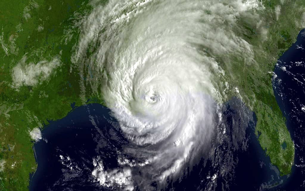
While the heat dominates the immediate forecast, the longer-term story of the summer is the tropics, and there the news is comparatively reassuring. NOAA's 2026 Atlantic hurricane season outlook, released in late May, predicts a below-normal season, assigning a 55 percent chance of below-normal activity, a 35 percent chance of a near-normal season, and only a 10 percent chance of an above-normal year.
In concrete terms, NOAA forecast a total of 8 to 14 named storms for the season that runs from June 1 through November 30, with 3 to 6 of those expected to become hurricanes and 1 to 3 reaching major hurricane strength. Those figures sit below the long-term averages that define a normal season, reflecting forecasters' expectation of a quieter year in the basin.
It is worth keeping the nature of a seasonal outlook in perspective. These forecasts describe the basin as a whole and the overall level of activity expected across six months, not where or whether any particular storm will form or make landfall. A below-normal outlook narrows the range of likely outcomes, but it cannot rule out a damaging storm, and it offers no guidance about which stretch of coastline might be at risk. The forecast is best understood as a statement about the odds, not a prediction of what any single community will experience.
As of early this week, the Atlantic basin showed little tropical activity, with no named storms threatening Florida. The early calm aligns with the seasonal outlook, though forecasters stress that a below-normal season is not a quiet guarantee. It only takes one landfalling storm to make a destructive year for any given community, and Florida's exposure to the entire basin means vigilance remains essential.
The El Nino factor
The driving force behind the muted forecast is an emerging El Nino in the Pacific. NOAA's Climate Prediction Center has indicated a high likelihood that El Nino conditions will develop and strengthen during the season, with an 82 percent chance of emergence in the May-through-July window and a 96 percent chance of persistence into the winter months.
El Nino tends to suppress Atlantic hurricane activity by increasing wind shear over the basin. Strong upper-level winds can tear apart developing storms before they organize, making it harder for systems to strengthen into hurricanes. That mechanism is the primary reason forecasters lean toward a below-normal season despite some factors that would otherwise favor storms.
The influence of El Nino reaches across the entire tropical Atlantic, which is why it figures so prominently in seasonal forecasts. A warming of the Pacific thousands of miles away reshapes wind patterns over the waters where Atlantic hurricanes form, a reminder that the climate system is deeply interconnected. Forecasters watch the development of El Nino closely because its strength and timing can shift the odds for the hurricane season as the months unfold.
Those competing factors are why the outlook is not even quieter. Ocean temperatures in the Atlantic are expected to run slightly warmer than normal, and trade winds are likely to be weaker than average, both of which support storm development. The forecast represents a balance between the suppressing influence of El Nino and the supporting influence of warm water, tilting toward fewer storms overall.
That tension also introduces uncertainty. If El Nino develops more slowly or stays weaker than expected, the warm Atlantic waters could exert more influence and push activity toward the higher end of the forecast range. This is one reason forecasters update their outlooks as the season progresses rather than treating the early prediction as the final word. The balance of forces that produces a below-normal forecast in May can shift by August, and the people most exposed to the consequences are well served by treating the outlook as provisional.
The Florida context
No state has more at stake in hurricane forecasting than Florida. With extensive coastline on both the Gulf and the Atlantic, a low-lying geography, and a population concentrated near the water, Florida is uniquely exposed to tropical systems. The state's recent history includes destructive and costly storms, and hurricane preparedness is woven into the rhythm of life from June through November.
A below-normal outlook offers some comfort, but Florida emergency managers consistently caution residents not to let a quiet forecast breed complacency. Several of the most damaging hurricanes in the state's history occurred during seasons that were not especially active overall. The relevant risk for any household is whether a storm hits their community, not how many storms form in total.
That distinction is easy to lose sight of when headlines emphasize the seasonal numbers. A household that prepares based on the overall forecast rather than its own exposure may be caught off guard by the one storm that matters. Emergency managers therefore frame preparation in terms of personal risk, urging residents to think about their own evacuation zone, their own home, and their own family rather than the basin-wide statistics. The forecast is a backdrop, not a substitute for individual readiness.
The early heat adds a second layer to the summer's weather story. Extreme temperatures strain the power grid as air-conditioning demand spikes, and a heat-related stress on infrastructure can compound the challenges that arise if a storm later knocks out power. The two hazards, heat and hurricanes, are linked in the practical reality of summer preparedness.
What it means for Floridians
In the near term, the priority is heat safety. Health officials routinely advise residents to stay hydrated, limit strenuous outdoor activity during the hottest parts of the day, check on vulnerable neighbors and relatives, never leave children or pets in parked vehicles, and seek air-conditioned spaces when possible. Employers of outdoor workers are urged to provide water, shade, and rest breaks.
Recognizing the warning signs of heat illness is part of staying safe. Symptoms such as heavy sweating, dizziness, nausea, and confusion can signal that the body is struggling to cope, and they call for prompt cooling and rest. Because heat illness can escalate quickly, knowing when a situation has become an emergency, and acting before it does, can make the difference between a manageable scare and a life-threatening event. Public-health messaging during heat waves emphasizes these signs precisely because early intervention is so effective.
Looking ahead to the tropics, the below-normal outlook is a reason for measured optimism, not relaxation. Emergency managers recommend that every Florida household use the early, quiet part of the season to build or refresh a hurricane plan: assembling supplies, confirming evacuation zones, reviewing insurance coverage, and identifying where to get reliable information if a storm approaches.
The start of the season is the ideal time for that preparation precisely because the basin is calm. Supplies are easier to find and lines are shorter before any threat appears, and a household that prepares in June is far better positioned than one scrambling as a storm bears down later in the summer or fall.
What's next
The immediate forecast keeps the focus on heat, with elevated temperatures expected to persist before any meaningful relief. Residents should treat the heat as the serious hazard it is while the tropics remain quiet.
For the season as a whole, forecasters will continue to monitor the development of El Nino and the temperature of Atlantic waters, updating their outlooks as conditions evolve. A below-normal forecast sets the baseline expectation, but the Atlantic can still produce dangerous storms in any year. For Florida, the prudent course is the same one emergency officials repeat every summer: hope for a quiet season, but prepare as if a storm is coming.
Spotted an issue with this article?
Have something to say about this story?
Write a letter to the editor