Florida's 2026 Hurricane Season Forecast to Be Below Normal, but Bertha Is an Early Reminder Risk Never Rests
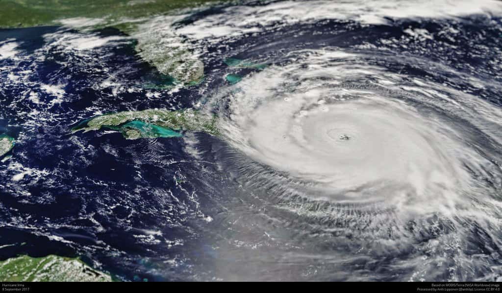
Federal forecasters expect the 2026 Atlantic hurricane season to be quieter than usual, with the National Oceanic and Atmospheric Administration placing roughly a 55 percent chance on below-normal activity across the basin this year. The outlook calls for 8 to 14 named storms, 3 to 6 of them strengthening into hurricanes, and 1 to 3 reaching major hurricane strength of Category 3 or higher. On paper, that is a reassuring set of numbers for a state that has absorbed more than its share of destructive landfalls over the past decade.
The forecast landed against an inconvenient backdrop. Tropical Storm Bertha, the second named system of the year, formed in the Gulf on July 20 and began tracking toward the Florida Panhandle, an unusually early Gulf development for a month that is historically among the quietest of the season. For emergency managers and residents alike, the timing underscored a lesson that seasonal outlooks can never fully capture: a below-normal season is a statement about total activity, not a promise about any single storm or any single stretch of coastline.
Florida remains the most hurricane-exposed state in the country, and that exposure does not scale down when a forecast trends quiet. A single landfall in the wrong place can define a season regardless of how many storms form basin-wide. Bertha's early arrival gives the state a low-stakes but real opportunity to test plans, restock kits, and shake off any complacency the below-normal headline might invite.
What NOAA's 2026 Outlook Actually Says
The seasonal outlook is a probabilistic snapshot, not a schedule. NOAA's roughly 55 percent chance of below-normal activity means forecasters judge a quieter-than-average year more likely than not, while still leaving meaningful odds for a near-normal or even above-normal season. The ranges reflect that uncertainty: 8 to 14 named storms is a wide band, and the low end and high end imply very different summers for coastal Florida.
It helps to read the numbers in context. A named storm is any system with sustained winds of at least 39 miles per hour, whether it stays a tropical storm or grows into a hurricane. Of the 8 to 14 named storms projected, forecasters expect 3 to 6 to become hurricanes with winds of 74 miles per hour or greater, and 1 to 3 to reach major hurricane intensity. Even the low end of that major-hurricane range is enough to devastate a community if it comes ashore in a populated area.
Seasonal outlooks lean on large-scale climate signals such as ocean temperatures, wind patterns, and the state of the El Nino or La Nina cycle in the Pacific. Those signals shape the odds for the basin as a whole. What they cannot do is tell anyone where a storm will track, how quickly it will intensify, or which counties will end up under a watch or a warning. That level of specificity only comes days out, from the National Hurricane Center, once a system exists.
Why an Early Gulf Storm Like Bertha Stands Out
July is typically a lull. The Atlantic season officially runs from June 1 to November 30, but the bulk of activity, and nearly all of the strongest storms, clusters between mid-August and mid-October when ocean heat and atmospheric conditions align. Early summer systems tend to be weaker and shorter-lived, which is part of what makes Bertha's formation and its Gulf track toward the Panhandle notable this year.
The Gulf of Mexico is a particular concern for Florida because storms there have little room and little time to be watched before they reach land. A system that forms close to the coast can give residents a narrower window to prepare than one that spends days crossing the open Atlantic. That compressed timeline is exactly why forecasters urge people to have supplies and plans ready before a storm appears, rather than scrambling once a name is attached.
Bertha does not, on its own, overturn the below-normal outlook. One early storm is not a trend, and a quiet basin can still produce a handful of memorable systems. What Bertha does is illustrate the gap between a seasonal average and a lived experience. For a family in the path of an early Gulf storm, the fact that the season is forecast to be below normal offers no protection at all.
Below Normal Is Not the Same as No Risk
The most dangerous way to read a below-normal forecast is as permission to skip preparation. History is full of quiet seasons that still delivered catastrophe. It only takes one storm making landfall near a given community to produce a life-altering event, and seasonal totals say nothing about whether that one storm will be yours. Florida has learned this repeatedly, sometimes in years when the broader Atlantic was calm.
Part of the problem is how averages work. A season can finish with fewer storms than usual and still include a major hurricane that strikes a densely populated stretch of coast. The count that goes into the record books does not reflect the human cost of a single bad track. Emergency managers consistently warn that the number to focus on is not the seasonal total but the one storm that could reach your neighborhood.
Complacency also compounds over time. Residents who go a few quiet years without a direct hit can let evacuation plans lapse, allow supplies to expire, and lose familiarity with their zone. A below-normal forecast can accelerate that drift precisely because it sounds like good news. The healthier posture is to treat every season as a season that could bring a storm to your door, and to let the forecast inform planning without dictating it.
Florida's Outsized Exposure
No state faces the hurricane threat that Florida does. With coastline on both the Atlantic and the Gulf, a long peninsula that juts into warm tropical waters, and millions of residents living near the shore, the state sits in the crosshairs of systems approaching from multiple directions. That geography does not change with the seasonal outlook, and it is the reason Florida's preparation calculus differs from almost anywhere else in the country.
The peninsula's shape means a storm can threaten the Gulf coast, the Atlantic coast, or both as it crosses. Panhandle communities, like those in Bertha's early path, face Gulf systems that can form and strengthen quickly in warm, shallow water. South Florida contends with fast-moving Atlantic storms, and the interior is not immune to inland flooding and wind damage that can extend far from any coastline.
Population density magnifies the stakes. Florida has added residents rapidly, many of them new arrivals who have never experienced a major hurricane and may not know their evacuation zone or their home's flood risk. Newcomers are a particular focus for emergency officials, who stress that arriving during a quiet stretch is no guarantee of a quiet tenure. The state's exposure is a constant, and a below-normal season does nothing to soften it.
Building a Plan Before the Peak Arrives
The window before mid-August, when activity historically ramps up, is the ideal time to prepare. Officials with the state's emergency management apparatus consistently point to a short list of essentials that make the difference between a stressful storm and a dangerous one. The first is knowing your evacuation zone, because orders are issued by zone and a resident who does not know theirs cannot act quickly when one is called.
A supply kit is the next priority. Emergency managers recommend enough water and non-perishable food for several days, a supply of any needed medications, batteries, flashlights, and the means to stay informed if power fails. Building the kit before a storm is on the map avoids the last-minute rush on stores that empties shelves as soon as a system enters the forecast. A family communication plan rounds out the basics, so household members know how to reach one another and where to reunite if they are separated.
Just as important is knowing where reliable information comes from. Official advisories from the National Hurricane Center are the authoritative source for a storm's track, intensity, and timing, and they carry a crucial distinction that residents should understand. A watch means hazardous conditions are possible within roughly 48 hours and is a signal to prepare. A warning means those conditions are expected within about 36 hours and is a signal to act, including evacuating if ordered. Confusing the two can cost precious time.
The Insurance Angle Florida Cannot Ignore
Preparation in Florida is not only about supplies and evacuation routes. It is also about financial readiness, and here the state faces a distinct pressure. Florida homeowners already contend with some of the highest property-insurance costs in the nation, a burden that has grown heavier as insurers have absorbed years of storm losses and litigation. A below-normal forecast does not erase that exposure, and it should not lull anyone into deferring a coverage review.
A common and costly gap is flood coverage. Standard homeowners policies generally do not cover flood damage, which is often the most destructive element of a hurricane, especially from storm surge and inland rainfall. Residents who assume they are protected can discover otherwise only after water has already entered the home. Reviewing whether flood coverage is in place, and whether it is adequate, is a step that pays off most in exactly the years no one expects a storm.
The below-normal outlook creates a subtle risk of its own on the financial side. A quiet forecast can tempt homeowners to trim coverage or postpone shoring up gaps in an effort to control rising premiums. Insurance and emergency experts caution against that logic, because the forecast describes the basin, not the individual home, and a single landfall can generate losses no seasonal average anticipates. The prudent move is to treat coverage as protection against the outlier, which is precisely what a hurricane can be.
What's Next
As of July 22, Florida's near-term attention is on Tropical Storm Bertha and its approach to the Panhandle, with the National Hurricane Center issuing the official advisories that will define any watches or warnings in the days ahead. Residents in the potential path should monitor those advisories closely and follow the guidance of local officials, treating a warning as a call to act rather than a suggestion to keep watching.
Beyond Bertha, the season's true test is still weeks away. The mid-August to mid-October peak is when the below-normal forecast will meet reality, and when the difference between an average season and a damaging one will be decided by where storms track rather than how many form. The interlude before then is the moment to finish preparations while the pressure is low.
The through-line from the forecast, from Bertha, and from Florida's own history is consistent. A below-normal season lowers the odds of a busy basin, not the odds that any one storm reaches a given community. For the most hurricane-exposed state in the country, the responsible response to a quiet outlook is the same as the response to a busy one: know the zone, build the kit, review the insurance, and watch the official advisories until the season ends on November 30.
Spotted an issue with this article?
Have something to say about this story?
Write us a letterComments
No comments yet. Be the first to weigh in.
Related Coverage

Storm-Force Low Off Southeast Coast Has 40% Chance to Turn Subtropical as Florida Coast Faces Tidal Flooding, Rough Surf
2d ago
Strong fall cold front brings Florida Saturday rain, cooler air and dangerous surf this weekend
4d ago

Hurricane Center Gives Atlantic Low Near Cabo Verde a 20% Chance as Florida Gets a Break After Isaias
Oct 12

Tallahassee and the Big Bend Escape Isaias' Worst, With Downed Trees, Brief Outages and Rising Rivers to Watch
Oct 9