NOAA Forecasts a Below-Normal 2026 Hurricane Season, but Florida's It-Only-Takes-One Warning Holds
The federal government's official outlook for the 2026 Atlantic hurricane season arrived with cautious good news for Florida, the most hurricane-exposed state in the country: forecasters at the National Oceanic and Atmospheric Administration expect a below-normal year. NOAA assigned a 55% chance of below-normal activity, a 35% chance of a near-normal season, and just a 10% chance that activity climbs above normal across the basin between June 1 and November 30. For a peninsula that sits in the path of storms forming from the deep tropics to the Gulf, the outlook shapes everything from property-insurance expectations to county evacuation planning.
Florida's emergency managers, however, paired the forecast with a familiar caution the moment it landed. A quieter-than-average season is measured in basin-wide storm counts, not in where any single storm chooses to come ashore. State planners returned to a phrase they repeat every June: it only takes one. A single major hurricane striking a populated stretch of the Florida coast can produce more death, damage, and disruption than several busy seasons whose storms spin harmlessly out to sea.
NOAA's numbers put the season in concrete terms. The agency forecasts 8 to 14 named storms, the threshold a system crosses when sustained winds reach 39 miles per hour. Of those, NOAA expects 3 to 6 to strengthen into hurricanes with winds of at least 74 miles per hour, and 1 to 3 to become major hurricanes of Category 3 strength or higher. Those ranges sit at or below long-term averages, reflecting the atmospheric and oceanic signals forecasters are tracking as the season opens.
What the federal outlook is, and what it is not
The seasonal forecast is a probability statement about the basin as a whole, not a track map for any individual storm. NOAA's forecasters cannot say in late spring whether Florida specifically will be struck, where a hurricane might come ashore, or how strong it might be at landfall. The outlook instead tells residents and officials how active the broader Atlantic is likely to be, information that helps allocate resources and set expectations months before any cyclone forms.
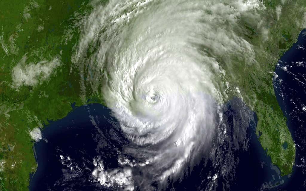
That distinction carries enormous weight for a state surrounded on three sides by warm water. Florida can be threatened by systems brewing in the deep tropical Atlantic, the Caribbean, and the Gulf alike, and a below-normal headline number offers no guarantee about the coastline. History is full of otherwise quiet seasons defined by one devastating strike, and forecasters stress that the seasonal total is a poor predictor of any single community's risk.
As of early June 2026, the immediate picture was calm. The National Hurricane Center expected no tropical cyclone formation anywhere in the Atlantic basin over the following seven days, meaning the season opened without a named system on the map. That quiet start hands Florida households and agencies a window to finalize preparations, but it is a snapshot, not a forecast for the months ahead.
Forecasters also caution that confidence in a seasonal lean does not translate into confidence about timing. The Atlantic season historically peaks from mid-August through October, and a slow June and July reveal little about how the heart of the season will unfold over Florida.
The El Nino factor and warmer Atlantic waters
Two competing signals underpin NOAA's below-normal lean. The first is El Nino. Forecasters expect El Nino conditions to develop and intensify during the season. El Nino, a periodic warming of the eastern and central Pacific, tends to suppress Atlantic hurricane activity by increasing wind shear, the change in wind speed and direction with height that can tear developing storms apart before they organize. When El Nino is in control, the Atlantic typically produces fewer and weaker systems.
The second signal cuts the other way. Atlantic ocean temperatures are expected to run slightly warmer than normal, and warm water is the fuel that powers tropical cyclones. Forecasters also expect trade winds to blow weaker than average, a condition that can reduce disruptive shear and give storms a more favorable environment to spin up. The net effect of these crosscurrents is what tips NOAA toward a below-normal but not inactive season: El Nino's suppressing influence is expected to outweigh the warm water and slack trade winds without erasing the threat.
For Florida, the warm-water caveat is the part worth remembering. Even in a season with fewer storms, the ones that do form can find ample fuel close to home, and rapid intensification near the coast has become one of the most dangerous features of recent Florida hurricanes. A storm that strengthens quickly in the final hours before landfall leaves little time for last-minute evacuation, regardless of how many other systems the basin produced that year.
Forecasters will revise the outlook as the season progresses and the El Nino signal becomes clearer. Seasonal forecasts are updated through the summer, and Floridians are urged to treat the June numbers as a starting point rather than a final word.
Why a quiet forecast is no reason to relax in Florida
No state has more at stake in hurricane season than Florida. Its long coastlines, dense coastal development, and low-lying terrain combine to make it the most hurricane-prone state in the nation. That exposure is why state and county emergency managers treat every forecast, busy or quiet, as a call to prepare rather than a reason to stand down.
The seasonal outlook also feeds directly into Florida's property-insurance landscape, one of the most stressed in the country. Insurers, reinsurers, and state programs weigh hurricane risk in setting rates and reserves, and a below-normal forecast can shape expectations for the year even as a single major landfall could upend them. For homeowners already grappling with high premiums, the forecast is one more variable in an affordability equation that a hurricane can rewrite overnight.
Emergency managers emphasize that preparedness is a household responsibility best settled before a storm is on the radar. That means knowing whether a home sits in an evacuation zone, identifying where to go and how to get there, assembling supplies to last several days without power, securing important documents, and reviewing insurance coverage including the separate flood policies that standard homeowners insurance does not provide. None of that preparation depends on the seasonal total.
The psychological risk of a quiet forecast is complacency. Officials worry a below-normal headline could lead some residents to delay or skip preparations, precisely the outcome the it-only-takes-one message is meant to prevent. A single Category 3 or stronger storm striking a Florida metropolitan area would dwarf the consequences of a statistically calm season.
Lessons from past below-normal seasons
Florida's emergency managers anchor the it-only-takes-one warning in the state's own history. Some of the most destructive hurricanes to strike Florida arrived in seasons that were, by basin-wide measures, unremarkable. Storm counts that ended near or below average gave no hint to the communities that absorbed a direct hit, and the damage they suffered bore no relationship to how busy the rest of the Atlantic had been that year.
That record is the reason officials distrust the comfort a low seasonal number can provide. A season can produce only a handful of named storms and still rank among the costliest if one of them reaches a major-hurricane intensity and tracks into a densely populated stretch of coast. For planning purposes, Florida treats the possibility of a single catastrophic landfall as a constant, independent of the headline forecast.
The pattern also shapes how the state communicates risk to the public. Rather than emphasize the odds of a quiet season, emergency officials foreground the consequences of being unprepared for the one storm that matters. The framing is deliberate: a probability statement about the basin is easy to misread as reassurance, while the memory of past strikes keeps the focus on readiness.
For residents, the takeaway from those seasons is simple. The relevant question is never how many storms the Atlantic produces, but whether a household is ready for the one that could come ashore nearby. That readiness looks identical whether NOAA forecasts a busy year or a calm one.
How Florida prepares before the first storm forms
The early-June lull, with no formation expected over the following week, is exactly the window emergency managers urge Floridians to use. The first step is knowing one's evacuation zone, a determination based on a home's vulnerability to storm surge rather than its distance from the coast. Many residents assume they are safe because they live inland, only to discover during a threat that they sit in a designated zone.
Supplies are the next priority. Officials recommend assembling enough food, water, and medication to last several days without power or access to stores, along with batteries, flashlights, and a way to receive emergency alerts when the electricity fails. Building that kit before a storm is named avoids the picked-over shelves and long lines that accompany every Florida hurricane warning.
Insurance deserves a careful review well ahead of any threat. Standard homeowners policies do not cover flood damage, and flood insurance typically carries a waiting period before it takes effect, meaning a policy bought as a storm approaches offers no protection. Floridians are urged to confirm their coverage, including separate flood policies, while the skies are clear.
Finally, households are encouraged to settle a plan that does not depend on a storm appearing first: where they would go, how they would get there, how family members would stay in contact, and what they would do for pets and vulnerable relatives. Signing up for county alert systems closes the loop, ensuring residents receive evacuation orders and updates directly rather than relying on chance.
What's next for Florida this season
With the season officially underway as of June 1, Florida's attention now shifts from the forecast to readiness. State and county emergency management agencies will continue running preparedness campaigns through the summer, and the National Hurricane Center will issue routine outlooks for the basin, increasing the frequency and detail of its advisories whenever a system threatens to develop.
Floridians can track the season through the National Hurricane Center, which provides the authoritative forecasts and the watches and warnings that drive local evacuation decisions. Residents in evacuation zones are encouraged to confirm their zone now, sign up for county alert systems, and build a plan that does not depend on a storm appearing first. The early-June calm, with no formation expected over the following week, is the ideal time to act.
Forecasters will sharpen the outlook as El Nino and Atlantic conditions evolve, and any update could shift the numbers in either direction. Florida officials, however, are framing the message consistently: the federal forecast is a planning tool, not a guarantee, and the appropriate response to a below-normal season is the same as the response to a busy one.
For now, the takeaway for Florida is twofold. The basin is likely to be quieter than average, which is genuinely encouraging news. But the state's exposure has not changed, the fuel for a damaging storm remains in place, and a single landfall can define the season no matter what the seasonal numbers say. Preparedness, officials stress, should be complete well before the first storm ever earns a name.
Spotted an issue with this article?
Have something to say about this story?
Write a letter to the editor