Dangerous Heat Grips Florida as the Tropics Stay Quiet
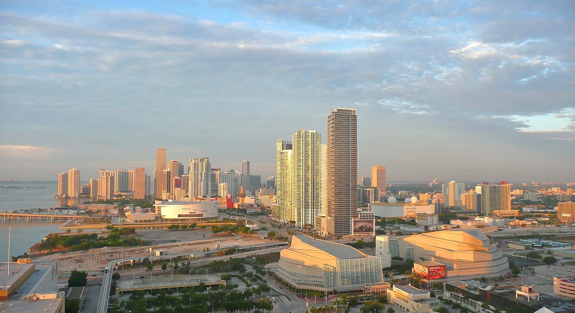
Dangerous heat blanketed Florida on July 22, 2026, pushing heat index values into triple digits across much of the state and prompting the National Weather Service to issue heat advisories. In South Florida, the combination of high temperatures and heavy humidity drove heat index readings to roughly 100 to 108 degrees, the kind of oppressive conditions that pose a genuine risk to human health during prolonged outdoor exposure.
The heat arrived at a time when the Atlantic basin, by contrast, remained notably calm. With no direct tropical threat bearing down on the state, the story on July 22 was the searing air itself rather than any approaching storm. Forecasters urged residents to treat the heat with the same seriousness they would give a more visible hazard.
Overnight conditions added another layer of concern. Morning lows in Miami and Fort Lauderdale held in the mid-80s, warm enough that they could set records for high overnight temperatures. Nights that fail to cool down deprive the body of relief and compound the strain of consecutive hot days, a pattern that public-health officials watch closely during extended heat.
Across the state, the day's weather followed a familiar Florida summer rhythm: intense heat building through the morning and midday, followed by scattered afternoon sea-breeze thunderstorms in South Florida and drier conditions farther north. The result was a landscape of heat advisories, cautious outdoor activity, and reminders about the basics of staying safe.
How Hot It Got in South Florida
In South Florida, the National Weather Service reported heat index values reaching about 100 to 108 degrees on July 22. The heat index blends air temperature and humidity to estimate how hot conditions actually feel to the human body, and in a place as humid as South Florida, that felt temperature can climb well above the number on a thermometer.
The morning offered little respite. Low temperatures in Miami and Fort Lauderdale stayed in the mid-80s, unusually warm for overnight readings and warm enough to threaten records for high daily minimum temperatures. When nighttime air remains that warm, the body has fewer hours to recover from daytime heat stress, which is one reason forecasters flag warm overnight lows as a health concern rather than a mere curiosity.
Scattered afternoon sea-breeze thunderstorms developed across the region, a hallmark of Florida's summer pattern in which contrasting temperatures over land and water spark convection. Those storms can bring brief downpours and gusty winds, but they typically do little to erase the day's heat and can add humidity that keeps conditions uncomfortable even after the rain moves through.
For residents, the practical effect was a day that demanded caution from morning to night. The warm start meant the heat never fully reset, and the afternoon storms offered only fleeting relief in the areas they touched.
Central Florida Bakes as Well
Central Florida did not escape the heat. In the Orlando and Gainesville areas, afternoon highs reached the mid-90s, with heat index values of about 100 to 105 degrees, according to the National Weather Service. Those readings placed the region near record highs for the date, underscoring how widespread the hot spell was across the peninsula.
Unlike South Florida, Central Florida saw low rain chances, running around 20 percent. That relative dryness meant fewer cooling downpours and less cloud cover to blunt the sun, allowing temperatures to climb steadily through the afternoon. In summer, even a passing thunderstorm can knock a few degrees off the heat, and its absence leaves the full force of the sun on display.
Near-record highs in the interior of the state reflect the same broad pattern responsible for the South Florida heat: a hot, humid air mass parked over Florida with little in the way of weather systems to break it down. When that kind of stagnant setup settles in, the heat tends to build day over day rather than ease.
For communities across Central Florida, the combination of high temperatures and limited rain reinforced the advice coming from forecasters and health officials alike: treat the heat as a serious hazard and adjust outdoor plans accordingly.
Heat Advisories and the Safety Message
The National Weather Service issued heat advisories in response to the conditions, a step the agency takes when heat is expected to reach levels that threaten public health. A heat advisory is a signal to change behavior: to hydrate, seek shade or air conditioning, and limit strenuous activity during the hottest part of the day.
Standard heat-safety guidance is straightforward but easy to overlook during a busy day. Officials urge people to drink water regularly rather than waiting until they feel thirsty, to limit midday outdoor exertion when the sun is strongest, and to take frequent breaks in cool or shaded areas when work or activity outdoors cannot be avoided.
The guidance also emphasizes looking out for others. Checking on vulnerable neighbors, including older adults and people without reliable air conditioning, can prevent heat-related illness among those at greatest risk. Officials repeat one warning above almost all others during hot weather: never leave people or pets in parked cars, where interior temperatures can rise to deadly levels within minutes.
These measures are the same ones public-health agencies stress during every significant heat event, and their repetition reflects how preventable most heat-related illness is. The danger of extreme heat lies partly in how ordinary it can feel until it becomes an emergency, which is why forecasters press the safety message even on days without a dramatic storm to point to.
A Quiet Tropical Atlantic
While Florida sweltered, the tropics stayed calm. Tropical Storm Bertha, the named system of note, was already inland and moving toward the upper Texas coast, far from Florida. The National Hurricane Center reported that Bertha carried maximum sustained winds near 45 mph and was expected to dissipate over Texas from late Thursday into Friday.
Bertha posed no direct threat to Florida. Its track and its position well to the west meant the storm's impacts, such as they were, would be felt along the Texas coast rather than the Florida peninsula. The rest of the Atlantic basin, meanwhile, was quiet, with no other systems demanding attention.
It is worth distinguishing the terminology that governs tropical alerts, even when none apply. A watch means conditions are possible within a specified area, generally within 48 hours, while a warning means those conditions are expected. On July 22, no tropical watches or warnings were active for Florida, and the state faced no imminent tropical hazard.
The calm reflected a broader seasonal picture. NOAA has predicted a below-normal 2026 Atlantic hurricane season, and the quiet stretch on July 22 was consistent with that outlook. For Florida, the absence of a tropical threat left the extreme heat as the day's dominant weather story.
What a Below-Normal Season Means
NOAA's forecast for a below-normal 2026 Atlantic hurricane season sets expectations for fewer storms than an average year, but it is not a guarantee of a quiet stretch for any single location. Seasonal outlooks describe overall basin activity; they do not predict where or whether an individual storm will form and make landfall.
Florida's own history offers a cautionary reminder that quiet seasons can still produce damaging storms. A single system reaching the state can cause significant harm regardless of how many storms form across the basin as a whole. For that reason, emergency-management officials consistently caution against reading a below-normal forecast as a reason to lower one's guard.
The 2026 season runs through the traditional Atlantic hurricane calendar, and July falls within the early portion of that window. The most active stretch of the season typically arrives later, which means a calm July does not foreclose the possibility of activity in the weeks and months ahead.
Understood correctly, a below-normal forecast is useful context rather than a promise of safety. It shapes expectations while leaving the fundamental advice unchanged: prepare as though a storm could come, because the number of storms across the basin says little about the risk to any one community.
Staying Prepared in Peak Season
Even during a quiet tropical stretch, July sits within the heart of the Atlantic hurricane season, which runs from June through November. Peak activity historically builds through the late summer and into the fall, making the current period a natural moment for Florida residents to review their readiness rather than assume the calm will hold.
Preparedness during a lull tends to be easier and less stressful than scrambling as a storm approaches. Reviewing supplies, confirming evacuation plans, and knowing local resources are tasks best handled when there is no immediate threat on the map. A quiet week offers exactly that kind of opening.
The July 22 conditions illustrated how Florida's summer hazards can arrive in different forms. On that day, the danger came not from wind or storm surge but from heat, a reminder that weather risk is not limited to the systems that dominate hurricane-season headlines. Extreme heat can be just as consequential, and it demands its own precautions.
For now, the message from forecasters blended two threads: take the heat seriously today, and stay prepared for the tropics even in a calm stretch. Both reflect a broader truth about living in Florida during the summer, where the sky can be clear of storms and still pose a serious threat from the sun alone.
What's Next
In the near term, forecasters expected the pattern of intense heat to remain the central concern for Florida, with heat advisories the most likely tool for communicating the risk. Residents can anticipate continued attention to heat index values, warm overnight lows, and the daily rhythm of afternoon storms in the south and drier heat farther north.
On the tropical side, the immediate outlook pointed to a continued quiet basin as Tropical Storm Bertha dissipated over Texas late in the week. With no other systems of concern and NOAA's below-normal seasonal forecast as the backdrop, Florida faced no direct tropical threat in the short term.
Health and emergency officials are likely to keep reinforcing the same guidance as long as the heat persists: hydrate, avoid midday exertion, check on vulnerable neighbors, and never leave people or pets in vehicles. Those steps carry the greatest weight during extended hot spells, when the cumulative strain of consecutive hot days grows.
Looking further ahead, the coming weeks will bring the traditional ramp toward the season's peak. Whether the Atlantic stays quiet or turns active, the prudent course for Florida remains the same: use calm periods to prepare, respect the immediate hazard of extreme heat, and stay alert to updates from the National Weather Service, the National Hurricane Center, and NOAA.
Spotted an issue with this article?
Have something to say about this story?
Write us a letterComments
No comments yet. Be the first to weigh in.
Related Coverage

Storm-Force Low Off Southeast Coast Has 40% Chance to Turn Subtropical as Florida Coast Faces Tidal Flooding, Rough Surf
2d ago
Strong fall cold front brings Florida Saturday rain, cooler air and dangerous surf this weekend
5d ago

Hurricane Center Gives Atlantic Low Near Cabo Verde a 20% Chance as Florida Gets a Break After Isaias
Oct 12

Tallahassee and the Big Bend Escape Isaias' Worst, With Downed Trees, Brief Outages and Rising Rivers to Watch
Oct 9