Dangerous Heat Grips Florida Before a Wet Weekend as a Tropical Wave Boosts Rain Chances
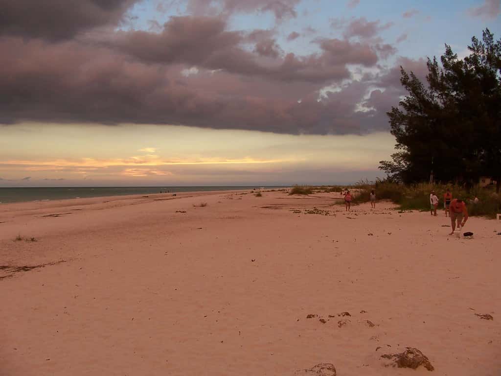
Florida is closing the week under a dome of dangerous summer heat, with afternoon high temperatures in the low 90s and heat index values climbing toward 105 degrees across much of the peninsula. Forecasters say the sweltering conditions will give way to a wetter and stormier pattern this weekend as a tropical wave pushes moisture over the state, raising the risk of heavy downpours and localized flooding from Orlando southward and along both coasts.
The setup is a familiar one for late summer in Florida, when the combination of long daylight hours, warm surrounding waters, and a moisture-rich atmosphere primes the peninsula for both extreme heat and afternoon storms. What makes this stretch notable is the sharp transition, from a hot and comparatively dry finish to the week into an unsettled, storm-prone weekend. Residents across the state are being encouraged to prepare for both hazards rather than focusing on one at the expense of the other.
Weather officials describe the coming days as a two-part story. The first part is the heat, which peaks through the end of the week and demands the usual precautions against heat-related illness. The second part is the rain, which arrives as the tropical wave draws in moisture and lifts storm coverage well above the summertime baseline. Both parts carry real safety implications, and forecasters are urging Floridians to keep a close watch on updates as the pattern evolves.
A hot and steamy end to the week
Meteorologists across the state have highlighted the combination of high temperatures and oppressive humidity as the main hazard heading into the weekend. In South Florida, forecasters described another hot and steamy afternoon with highs soaring into the low 90s and feels-like readings pushing into the triple digits when humidity is factored in. Along the Treasure Coast and Palm Beaches, Friday shaped up as one of the drier days in recent memory, with sunshine and only an isolated chance of an inland shower, but the reprieve is expected to be short-lived.
The heat index, sometimes called the apparent temperature, reflects how hot it actually feels to the human body once humidity is combined with the air temperature. When moisture in the air is high, sweat evaporates more slowly, and the body loses one of its most effective ways of cooling itself. That is why forecasters place so much emphasis on feels-like readings during Florida summers, when air temperatures in the low 90s can translate into apparent temperatures that stress even healthy adults who spend extended time outdoors.
The National Weather Service routinely urges Floridians to take heat seriously during these stretches, advising residents to drink plenty of water, limit strenuous outdoor activity during the hottest part of the day, take frequent breaks in the shade or air conditioning, and check on older neighbors and those without reliable cooling. Officials also remind the public never to leave children or pets in parked vehicles, where interior temperatures can turn deadly within minutes.
Certain groups face elevated risk during hot weather, including outdoor workers, athletes, older adults, young children, and people with chronic health conditions. Forecasters and health officials often note that heat-related illness can escalate quickly, from cramps and heavy sweating to more serious warning signs such as dizziness, nausea, confusion, or a lack of sweating despite the heat. Recognizing those symptoms early and moving to a cooler place can prevent a dangerous situation from becoming a medical emergency.
Storm chances climb this weekend
The pattern is set to shift as the weekend approaches. Forecasters expect rain chances to increase each day into early next week as a tropical wave moves in from the east, adding moisture to an already humid airmass. Scattered to numerous afternoon and evening thunderstorms are in the forecast, with the greatest coverage likely from the Orlando area southward and along the east coast as sea breezes collide and lift the moist air.
Florida's daily sea breeze is a defining feature of its summer weather. As land heats faster than the surrounding water, breezes push inland from both the Atlantic and the Gulf, and where those two boundaries meet they force air upward, fueling the towering clouds that produce the state's characteristic afternoon storms. When an outside source of moisture such as a tropical wave is layered on top of that daily engine, storm coverage tends to expand and the rainfall totals tend to climb.
The heaviest activity is expected during the late afternoon and evening hours, the classic timing for Florida's summer storms. Some neighborhoods could see brief but intense downpours capable of dropping several inches of rain in a short period, raising the potential for flooding in urban areas and low-lying spots with poor drainage. Frequent lightning, gusty winds, and reduced visibility in heavy rain will accompany the strongest cells.
Because summer storms in Florida often develop quickly and move slowly, conditions can change dramatically over short distances. One neighborhood may see bright sun while another a few miles away is under a downpour with frequent lightning. Forecasters advise residents to build flexibility into outdoor plans this weekend, to keep an eye on the sky in the afternoon and evening, and to have a reliable way to receive short-term warnings when storms are approaching.
Flooding is the main concern
With saturated ground in some areas and repeated rounds of storms expected, forecasters have flagged localized flooding as the primary threat into next week. Florida's flat terrain and heavily developed urban corridors are especially vulnerable to street flooding when slow-moving storms park over the same neighborhoods and dump rain faster than drainage systems can carry it away.
Urban flooding tends to build gradually as rain overwhelms storm drains and gutters, then spreads across roadways and into low spots where water has nowhere to go. In a state with as little natural slope as Florida, water can pool quickly on streets, in underpasses, and in parking lots, and it can linger long after the rain has stopped. The risk grows when heavy storms move over ground that is already wet from previous days of rainfall.
Emergency managers routinely urge drivers never to attempt to cross flooded roadways, since it can be impossible to judge the depth or whether the road beneath has washed out. The longstanding safety message, turn around and do not drown, remains the guidance whenever water covers a road. Residents in flood-prone areas are encouraged to move vehicles to higher ground and to clear storm drains near their homes of leaves and debris before the heaviest rain arrives.
Officials often point out that it takes surprisingly little moving water to sweep a vehicle off a roadway or to knock an adult off their feet. Nighttime flooding is particularly dangerous because standing water is hard to see, and a road that looked clear earlier in the day may be submerged by evening. Planning routes in advance, avoiding known low spots during heavy rain, and simply staying home when storms are at their worst are among the simplest ways to stay safe.
The tropical wave and the broader picture
The tropical wave responsible for the increased weekend moisture is not currently forecast to develop into a named storm as it crosses Florida, but it serves as a reminder that the peak of hurricane season is still weeks away. The Atlantic basin has been unusually quiet through the first part of the summer, with dry air, Saharan dust, and wind shear suppressing tropical development for much of the past month.
Tropical waves are common features of the summer and early autumn months, rolling westward off Africa and traveling across the Atlantic on a regular schedule. Most never organize into anything more than an area of enhanced clouds and rain, yet they play an important role in the tropics by delivering pulses of moisture that can enhance rainfall far from where they began. The wave affecting Florida this weekend fits that pattern, acting mainly as a rain producer rather than an organized system.
Even a disorganized wave can produce significant rainfall and dangerous lightning, and forecasters stress that Floridians should treat every summer system with respect. The state's afternoon storm season routinely produces some of the highest lightning strike densities in the country, and lightning remains one of the deadliest weather hazards Floridians face each year. When thunder roars, officials advise, go indoors.
Forecasters also use quieter stretches like this one to remind residents that conditions in the Atlantic can change. A lull in tropical activity is a reason to prepare, not to relax, and officials encourage households to review their hurricane plans, restock emergency supplies, and confirm their sources of trusted weather information well before any threat appears on the horizon.
Staying prepared through the weekend
Preparedness during a stretch like this comes down to a handful of practical habits. Forecasters and emergency officials commonly recommend keeping phones charged, knowing more than one way to receive alerts, and staying aware of the daily forecast rather than relying on a single glance in the morning. Because the hazards shift from heat early in the period to storms and flooding later, the right precaution depends on the time of day and the latest update.
For families, that might mean scheduling outdoor activities for the cooler morning hours, keeping water on hand, and being ready to move indoors when storms build in the afternoon. For drivers, it means allowing extra travel time during heavy rain and avoiding flooded streets entirely. For pet owners and those responsible for older or vulnerable relatives, it means checking in regularly and making sure everyone has access to cooling and shelter.
Officials also encourage residents to secure loose outdoor items ahead of gusty storms and to be mindful of the potential for brief power interruptions when lightning and wind move through. Small steps taken before the weather turns, such as clearing a nearby storm drain or charging a backup battery, can make a meaningful difference when a fast-moving storm arrives with little warning.
What to watch into next week
The unsettled pattern is expected to linger into early next week, with daily rounds of storms and continued high humidity. Temperatures will remain hot, though the increased cloud cover and rain may take the edge off the most extreme heat index values on the wettest days. Forecasters will be watching how much moisture the tropical wave delivers and whether any additional disturbances follow behind it.
Rainfall totals over the coming days will depend heavily on where the strongest storms set up and how long they linger over the same areas. Repeat rounds over the same neighborhoods raise the flooding risk the most, while a more scattered distribution would spread the rain out and ease the threat. That level of detail is difficult to pin down far in advance, which is why forecasters emphasize the value of checking short-term updates as the weekend unfolds.
For now, the practical guidance for Floridians is twofold: guard against the heat through the end of the week, and prepare for a stormy, potentially flooding weekend. Keeping a close eye on local forecasts, having a way to receive weather alerts, and building a little flexibility into outdoor plans will help residents ride out a stretch of classic Florida summer weather that pairs punishing heat with the threat of heavy rain.
Spotted an issue with this article?
Have something to say about this story?
Write us a letterComments
No comments yet. Be the first to weigh in.
Related Coverage
NOAA Winter Outlook Favors a Wet Florida Winter as a Very Strong El Niño Builds
23h ago

Josephine Heads Out to Sea, but Florida's Atlantic Coast Faces Strong Winds, King Tide Flooding and Dangerous Surf This Weekend
3d ago
Strong fall cold front brings Florida Saturday rain, cooler air and dangerous surf this weekend
6d ago

Hurricane Center Gives Atlantic Low Near Cabo Verde a 20% Chance as Florida Gets a Break After Isaias
Oct 12