Saharan Dust and Dangerous Heat Grip Florida With Heat Index Near 110
A plume of Saharan dust drifting across the Atlantic has settled over Florida, choking off the afternoon thunderstorms that normally cool the peninsula in August and leaving large portions of South and Central Florida under National Weather Service heat advisories with feels-like temperatures approaching 110 degrees.
Forecasters say the combination is unusual for early August. Afternoon convection is a defining feature of Florida summer, and the daily storm cycle typically knocks temperatures down by mid-afternoon. With dry, dusty air aloft and a strong ridge of high pressure suppressing rising motion, that relief has largely not materialized.
Actual air temperatures have been running in the mid to upper 90s. The heat index, which combines temperature and humidity to estimate how the air feels to the human body, has been reaching 105 to 110 degrees across advisory areas. Heat advisories have been in effect for large portions of the southern and central peninsula and are expected to persist through the late workweek.
What Saharan dust is doing to the forecast
The Saharan Air Layer is a mass of dry, dusty air that forms over the Sahara Desert and moves west across the Atlantic during summer months. It typically rides between roughly 5,000 and 20,000 feet, and it carries mineral dust particles that scatter sunlight and create the hazy, milky skies Florida residents have seen this week.
The layer's effect on weather is mostly a function of its dryness. Thunderstorms require deep moisture through the mid-levels of the atmosphere to sustain themselves. When dry air is entrained into a developing storm, it evaporates cloud droplets and undercuts the updraft, which is why dust outbreaks tend to produce suppressed rain chances even during a season when afternoon storms would otherwise be routine.
The dust also degrades air quality. Fine particulate matter from the plume can aggravate asthma, chronic obstructive pulmonary disease and other respiratory conditions, and health officials generally advise sensitive groups to limit prolonged outdoor exertion during heavy dust episodes.
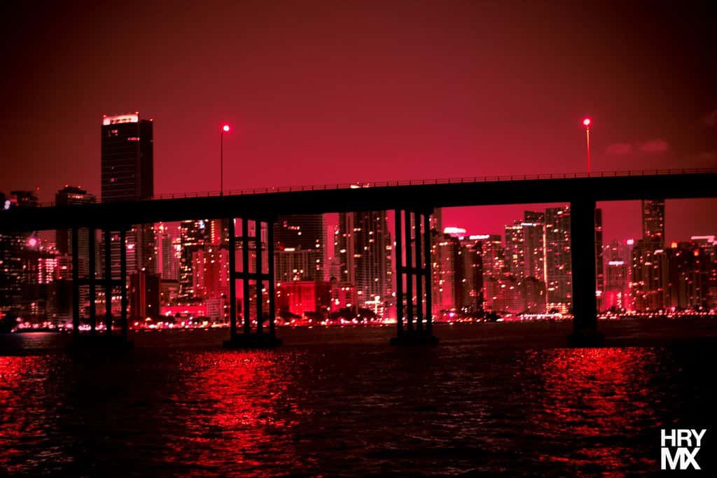
One side effect that draws attention every summer is the sunsets. The suspended particles scatter shorter wavelengths of light, which produces unusually vivid orange and red sunrises and sunsets. That visual signature is often the first thing residents notice about a dust outbreak.
The heat risk in practical terms
A heat advisory is issued when the heat index is expected to reach thresholds that pose a meaningful risk of heat-related illness. In Florida the relevant threshold is generally a heat index at or above 105 degrees for a sustained period, and the advisory is a signal to change behavior rather than a routine summer notice.
Heat illness progresses along a spectrum. Heat cramps and heat exhaustion involve heavy sweating, weakness, nausea and dizziness, and generally respond to moving into a cool environment and rehydrating. Heat stroke is a medical emergency characterized by a core temperature above 104 degrees, altered mental status and, often, the cessation of sweating.
Risk is not distributed evenly. Outdoor workers in construction, agriculture, landscaping and roofing face the highest sustained exposure. Older adults, young children, people with cardiovascular conditions and people taking certain medications including diuretics and some psychiatric drugs have reduced ability to regulate body temperature.
Vehicle interiors are a specific and recurring danger. On a day with air temperatures in the mid 90s, the interior of a parked car can exceed 130 degrees within minutes even with windows cracked. Florida has repeatedly recorded pediatric vehicular heat stroke deaths, and the risk peaks during exactly this kind of stretch.
Why the storms are not coming
Florida's typical summer pattern is driven by sea breezes. The Atlantic sea breeze pushes inland from the east coast and the Gulf sea breeze pushes inland from the west, and where the two collide, usually over the interior of the peninsula, air is forced upward and thunderstorms fire in the early to mid afternoon.
That mechanism still operates during a dust outbreak, but the resulting storms struggle. Without sufficient mid-level moisture, the updrafts weaken quickly and storms either fail to develop or produce brief, disorganized showers rather than the drenching downpours that reset afternoon temperatures.
The strong high pressure ridge compounds the problem. Subsiding air associated with high pressure warms as it descends and creates a capping inversion that resists the vertical motion storms depend on. When both a cap and dry air are present, the atmosphere can look primed on paper and still produce almost nothing.
The practical effect for residents is a hotter afternoon and a hotter evening. Without evaporative cooling from rainfall, overnight low temperatures also run higher, which reduces the recovery period the body relies on after a day of heat exposure. Consecutive hot nights are a documented driver of heat-related hospitalizations.
What it means for Floridians
Health guidance during a heat advisory is straightforward but genuinely matters. Limiting strenuous outdoor activity to early morning or evening, drinking water before feeling thirsty, wearing light-colored loose clothing and taking scheduled breaks in shade or air conditioning all reduce risk substantially.
Employers with outdoor workforces face particular exposure. Florida does not have a state-level heat standard for outdoor workers, and practices vary by employer. Industry safety guidance generally recommends acclimatization periods for new workers, mandatory rest breaks scaled to heat index, and access to shade and water at the work site.
Utility demand rises sharply during sustained heat, and residents can expect higher August electric bills. Florida Power and Light and other utilities typically publish conservation guidance during heat events, though the state's grid has generally handled summer peaks without emergency measures.
Pet owners face a parallel set of risks. Pavement temperatures during peak afternoon heat can cause paw burns, and dogs cool primarily through panting rather than sweating, which makes them vulnerable during walks that would be routine in cooler months.
Local impact across the state
South Florida has been at the center of the advisory area. Miami-Dade, Broward and Palm Beach counties have seen the most consistent combination of high heat index values and suppressed rain chances, with hazy skies visible from the coast.
Southwest Florida has seen the dust arrive as well, with reduced visibility and limited storm coverage across Lee, Collier and Charlotte counties. The Gulf sea breeze in that region normally produces reliable afternoon activity, and its absence has been notable.
Central Florida, including the Orlando metro, sits at the convergence zone where the two sea breezes typically meet. Storm coverage there has been below normal for the date, which affects everything from theme park operations to afternoon outdoor youth sports schedules as schools prepare to reopen.
Northeast Florida and the Panhandle have seen somewhat more variable conditions, with the dust signal present but the heat regime less extreme than on the southern peninsula. Jacksonville and Tallahassee have both recorded hazy conditions during the outbreak.
The urban heat island effect
Heat is not distributed evenly within a metro area. Dense urban cores with extensive pavement, roofing and limited tree canopy absorb and retain substantially more heat than surrounding areas, a phenomenon that can produce temperature differences of several degrees within a single county.
The effect is most pronounced at night. Concrete and asphalt release stored heat slowly after sunset, which keeps urban overnight lows higher than suburban or rural readings. Because overnight recovery is what allows the body to reset after a day of heat exposure, elevated urban minimums translate directly into health risk.
Neighborhoods with less tree canopy experience the effect more sharply. Canopy coverage in Florida cities varies substantially by neighborhood, and the areas with the least shade frequently correspond to areas where residents have less access to reliable air conditioning.
Municipalities across Florida have pursued tree planting and cool roof programs in response, though those interventions operate on decade timescales rather than providing relief during any particular heat event.
Where the dust comes from and where it goes
The Saharan Air Layer originates over North Africa, where strong winds lift mineral dust from the desert surface into the atmosphere. Those dust masses then travel west across the Atlantic on the prevailing easterly flow, a journey of roughly five to seven days.
Outbreaks are most frequent from late June through mid-August, peaking in intensity during that window and declining thereafter. That seasonal pattern is one reason the deep tropics tend to become more favorable for storm development in late August and September.
The dust has ecological effects beyond weather. Mineral dust deposited into the Atlantic and into the Amazon basin delivers iron and phosphorus that function as nutrients, a long-range fertilization effect that has been documented by atmospheric researchers.
In Florida, deposited dust settles on surfaces and can produce a visible film on vehicles and outdoor furniture. That deposition is generally harmless beyond the air quality effects during the suspension phase, and rainfall clears it once the normal storm pattern resumes.
What's next
Forecasters expect the dust plume to displace westward, with a return to more typical summer conditions including scattered afternoon rainstorms and slightly lower temperatures by the weekend. That timing is a forecast rather than a certainty, and dust outbreaks can linger or be reinforced by successive plumes moving off Africa.
Heat advisories will remain in effect through the late workweek according to National Weather Service guidance, and residents should expect them to be extended or reissued day by day as conditions warrant rather than as a single continuous product.
The dust also has a secondary consequence worth watching. The same dry air that suppresses Florida thunderstorms suppresses tropical cyclone development across the Atlantic, and the National Hurricane Center currently forecasts no tropical formation over the next seven days. When the dust clears, both the local storm cycle and the tropical development window reopen.
School districts across Florida begin the 2026-2027 academic year on August 10, with most districts starting that Monday. Athletic departments and district transportation offices typically adjust practice schedules and bus procedures during heat advisories, and parents should expect district-level guidance if the pattern persists into the opening week.
Spotted an issue with this article?
Have something to say about this story?
Write a letter to the editor