St. Johns River Sets Record at Cocoa as Lake Harney Heads for All-Time Crest, Rescues Mount and Putnam Braces for Weeks of Flooding
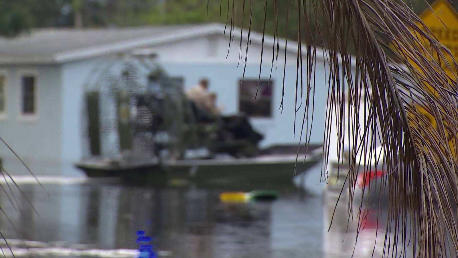
The St. Johns River is in record flood near Cocoa and is heading for record or major crests along nearly 100 miles of its course through Brevard, Seminole, Volusia and Lake counties, with downstream Putnam County bracing for major flooding starting Sunday. The river stood at 18.8 feet near Cocoa early Saturday, more than a foot above the old record set in 1953, and wildlife officers spent Friday pulling residents out of flooded homes by airboat. Forecasters and water managers say the high water will not leave quickly: some stretches of the river could stay above moderate flood stage for two to three months.
The flooding is the slow downstream consequence of a historic rain event across east Central Florida, where totals topped 28 inches in some areas, falling on a watershed that was still swollen from heavy rain earlier in November. The St. Johns River Water Management District said water levels will keep rising and stay elevated as runoff works its way through the basin, even in places where the rain has stopped.
Where the river stands, gauge by gauge
National Weather Service river forecasts issued Saturday morning show major or record flooding at most gauges between Cocoa and Astor, with crests still days away for the middle and lower stretches.
| Gauge | Saturday morning stage | Major flood stage | Forecast crest | Record |
|---|---|---|---|---|
| Near Cocoa (Brevard) | 18.8 ft, record | 17 ft | 18.8 ft Saturday afternoon | 17.55 ft, 1953 (now broken) |
| Above Lake Harney, near Geneva (Seminole) | 12.2 ft, major | 10 ft | 13.0 ft Sunday afternoon | 12.67 ft, 2022 |
| Near Sanford (Seminole, Volusia) | 6.9 ft, minor | 8 ft | 8.1 ft Wednesday afternoon | 8.96 ft, 2022 |
| Near DeLand (Volusia) | 5.0 ft, moderate | 5.3 ft | 6.0 ft Wednesday morning | 6.33 ft, 2022 |
| At Astor (Volusia, Lake) | 4.0 ft, major | 4 ft | About 4.0 to 4.2 ft through midweek | 4.81 ft, 2024 |
The Lake Harney forecast is the most striking number on the list. A crest of 13.0 feet would top the all-time record of 12.67 feet set in October 2022 after Hurricane Ian, and the weather service's flood statement for that gauge says plainly that the forecast level is above the flood of record. At Sanford and DeLand, the weather service warns that additional rises are possible after Wednesday's forecast levels, so those crests could still climb.
The water management district's own outlook, shared Friday, put the time the river would spend at or above moderate flood stage at two to three months near Cocoa, one to two months above Lake Harney and at Astor, about a month near DeLand and two to three weeks near Sanford.
Record water and rescues in Cocoa
The Cocoa gauge first broke its 1953 record early Thursday and kept climbing, reaching 18.8 feet by Friday night and holding there into Saturday. The weather service expects the river to stay near that level through the weekend and into next week. Its impact statement for the gauge says that at 17.2 feet water enters homes in the Lake Poinsett area west of Cocoa, low-lying homes in the Silver Pines subdivision in Rockledge and the Shakespeare Park area of Cocoa, and that the Providence Road area becomes impassable, cutting off access to homes around Mullet Lane and Bass Road. The gauge reading is river elevation, not the depth of water in streets or houses.
WKMG News 6 reported that Florida Fish and Wildlife Conservation Commission officers ran airboats down flooded residential streets on Friday to carry people to dry ground. FWC Lt. Grant Eller told the station that about 80 officers and 13 airboats were working the area alongside the Brevard County Sheriff's Office, the Florida Highway Patrol and the Florida National Guard. As of about 4 p.m. Friday, FWC counted roughly 120 people rescued in Brevard County and well over 150 in Volusia County. Responders said many residents had been reluctant to leave, hoping the water would drop, and some were trapped with pets.
One rescued resident, Christine Andrews, told the station she spent the night on her bed in her flooded home and expects it could be months before she can return. Asked what she had lost, she said: "Everything. Everything." Guardsmen from Bravo Battery, 1st Battalion, 260th Air Defense Artillery Regiment, also assisted with high-water rescues in Rockledge early Friday.
Brevard County has opened shelters for the general population, people with special medical needs and families with pets at the Walter Butler Community Center, 4201 N. Cocoa Blvd. in Cocoa, and the Joseph N. Davis Community Center, 2547 Bruce D. Buggs Street in Melbourne.
Lake Harney, Geneva and the SR 46 closure
Upriver from Sanford, the Lake Harney area is already in major flood. The Florida Highway Patrol closed State Road 46 on Thursday evening between Prevatt Road and Morgan Alderman Road, where the highway crosses the rising St. Johns River near Geneva, and drivers traveling between Mims and Sanford are being sent around on SR 415, SR 44 and Interstate 95. The weather service's impact statement notes that water covers SR 46 at 10.8 feet on the Lake Harney gauge, a level the river passed days ago, and that standing water on secondary roads near the river can exceed three feet.
WESH 2 reported Friday that Lake Harney Road at North Jungle Road in Geneva was under water, with canoes tied to a stop sign and some trucks, including lifted ones, turning back from the road toward Whitcomb and the west shore of the lake.
Seminole and Volusia brace for a long rise
Seminole County Emergency Manager Alan Harris said Thursday that river flooding in the county could last through mid-December, according to WESH 2. Seminole County Emergency Management expects water levels near Sanford to keep rising through the Thanksgiving weekend. At 8 feet on the Sanford gauge, the weather service says flooding becomes more significant for low-lying structures and marinas in Volusia and Seminole counties, including Sanford, Enterprise and the Lake Monroe shoreline.
That rising water has already reached parts of the parking lot at HCA Florida Lake Monroe Hospital in Sanford, the county's only Level II trauma center. WKMG reported that crews, with help from the Florida National Guard and Seminole County emergency management, installed 23 water-filled temporary barriers known as Tiger Dams around the facility. The hospital remains open and fully operational, and it is urging patients not to delay emergency care because of the flooding.
Volusia County has declared a local state of emergency. Downstream at DeLand, the weather service says major flooding at 5.3 feet affects many structures and marinas along the river and in the Hontoon Island area. At Astor, where the river reached major flood stage Saturday morning, the agency's warning says water enters many structures on canals and along the river, water rescues will be necessary and levels will take weeks to months to fall back below flood stage. It lists River Road as inaccessible, with 1 to 2 feet of water in numerous homes on Wildhog, Possum and Bonnet roads, and roads along Blue Creek, Camp South Moon Road and Juno Trail cut off.
Putnam County prepares for major flooding Sunday
The water is headed north. Putnam County Emergency Management said the river is expected to reach moderate to major flood stages, with major flood levels forecast to begin Sunday, Nov. 22, according to News4JAX. The county said flooding will be prolonged, lasting over the next couple of weeks, because high tides will keep water trapped in the river. Gauges in the county already showed moderate flooding Saturday morning, including the St. Johns River at Welaka.
Two factors make the lower river worse. Strong northeast winds are pushing water into the river mouth and slowing drainage through Saturday, and astronomical king tides beginning Sunday could keep the river's tidal stretches high. The weather service in Jacksonville has a coastal flood warning in effect through 7 a.m. Sunday for eastern Putnam County, warning that numerous roads may close and low-lying homes and businesses could be inundated.
Putnam County has self-serve sandbag sites, where residents should bring a shovel, at Bostwick Volunteer Fire Department, 110 Mulberry St. in Palatka; Riverside Volunteer Fire Department, 101 Gail Dr. in Satsuma; and 51 Sportsman Dr. in Welaka.
Why the St. Johns drains so slowly
The water management district says the river falls only about an inch per mile, so floodwater moves north at a crawl. Stetson University ecologist Jason Evans told Central Florida Public Media the combination of saturated soil, sluggish flow and northeast winds is a "triple whammy" that could produce historic flooding in some areas, and that recession would take weeks even if the rain stops.
To limit what reaches the middle river, the district said it is storing about 60 billion gallons, or 185,000 acre-feet, of water in the Upper St. Johns River Basin. It is also making controlled releases through the S-96 structure into the C-54 Canal, diverting water through Three Forks Marsh toward the Indian River Lagoon under a federally approved water management plan.
What's next
The Cocoa gauge is expected to crest Saturday afternoon and then hold near 18.7 feet through next week. Lake Harney's record-setting crest is forecast for Sunday afternoon, while Sanford, DeLand and Astor keep rising toward Wednesday, with more rises possible after that. Putnam County's major flooding is expected to begin Sunday as king tides arrive. Officials across the basin are urging residents not to drive through flooded roads or wade into floodwater, which can carry sewage, chemicals and debris, and to plan for weeks, not days, of high water. Brevard residents can call 2-1-1 for recovery help and text BREVARDEOC to 888777 for alerts, and drivers can check closures on Florida 511.
Spotted an issue with this article?
Have something to say about this story?
Write us a letterComments
No comments yet. Be the first to weigh in.
Related Coverage

Space Coast and Volusia Begin Cleanup After More Than 24 Inches of Rain as Melbourne Logs Its Wettest Month and Palm Bay Estates Evacuates
1h ago
Northeast Florida Flood Watch Extended Into Saturday as Flagler Opens Sandbag Sites, Putnam Faces Coastal Flood Warning and Weekend Events Fall
2d ago
Hurricane Center Drops Odds for Low Off Florida to 10 Percent, but Tidal Flooding, High Surf and Rip Currents Linger Along the East Coast
2d ago
Southern Broward Begins Flood Cleanup as Water Slowly Recedes in Hollywood and Davie, With Schools Still Closed and a Recovery Fund Activated
5d ago