Thanksgiving Week Storms Threaten Florida Travel as Northeast Florida Tidal Flooding Drags On
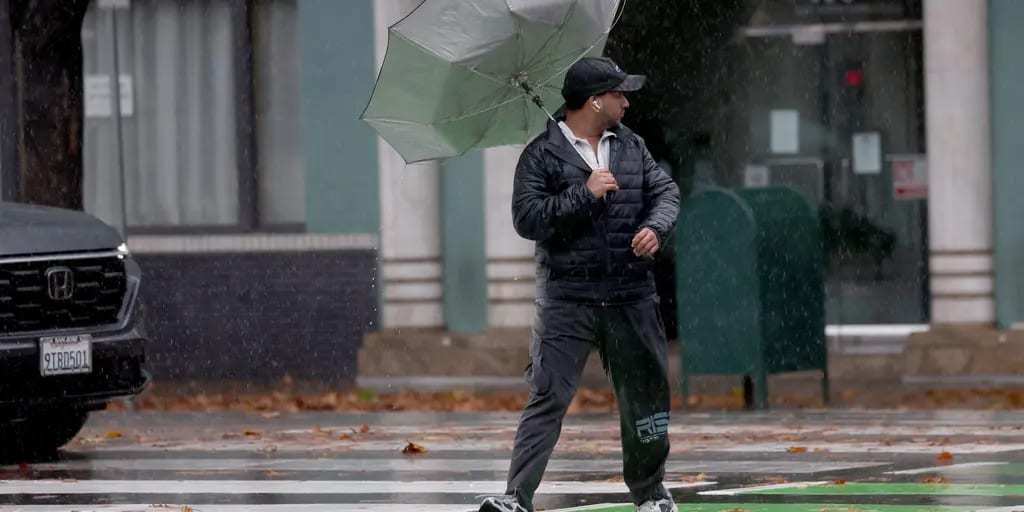
Thanksgiving travelers in Florida face a messy week of weather on both coasts: tidal flooding along the St. Johns River and the Northeast Florida coast is expected to linger, and a new coastal low is forecast to form off the state Tuesday night and bring wind-driven rain to the East Coast on Wednesday, the day before Thanksgiving, according to the National Weather Service in Jacksonville. The broad low that drenched eastern Florida last week was moving away to the northeast on Sunday, Nov. 22, without becoming Tropical or Subtropical Storm Kyle, but forecasters warned that its effects on tides and surf would last well into the holiday week.
Where things stand Sunday
In its Sunday morning forecast discussion, the Jacksonville weather office placed the center of the broad low about 50 miles from Jacksonville, moving northeast, with a trailing trough bringing light showers and drizzle to southeast Georgia and dense fog inland early in the day.
A Coastal Flood Warning remains in effect until 5 a.m. Monday for coastal Flagler and Putnam counties and along the St. Johns River north to downtown Jacksonville, with a Coastal Flood Advisory for an adjacent zone. Minor to moderate tidal flooding is continuing in the St. Johns basin, and moderate to locally major flooding is possible on the river south of downtown Jacksonville, forecasters said. There is a high risk of rip currents at Northeast Florida and southeast Georgia beaches through Sunday evening.
The flooding will not end when the warning expires. "Prolonged coastal flooding appears very likely through the upcoming week," the weather service wrote, noting only small drops in water levels between tide cycles through Tuesday afternoon, another tidal rise possible Wednesday and Thanksgiving Day, and high astronomical tides lasting into next weekend. News4JAX meteorologist Chris Holtzman said each high tide will bring minor to moderate tidal flooding and urged drivers to avoid roads covered in water.
No Kyle, but the hazards remain
For much of last week, forecasters watched the system as a possible late-season named storm. On Friday the National Hurricane Center gave it a 30% chance of becoming a tropical or subtropical cyclone within two days and 50% within seven days, and hurricane hunter flights were scheduled to investigate. Kyle is the next name on the 2026 Atlantic list.
The low never organized enough to earn the name, and by Sunday the Jacksonville office was describing it simply as a broad low pulling away from the coast. The hurricane center stressed throughout that development would not change the outcome, saying strong winds, dangerous surf and coastal flooding were likely along portions of the Southeast and mid-Atlantic coasts into early this week regardless. CNN reported Friday that travel delays from the system were most likely along the coast from Jacksonville to Charleston, South Carolina, as it lifted north over the weekend.
A record week on the St. Johns
The weekend's tidal flooding comes on top of a historic rain event in East Central Florida. A slow-moving storm stalled over the Space Coast and Volusia County from Nov. 17 to 20, and the St. Johns River near Cocoa passed its 1953 record of 17.6 feet on Thursday, Nov. 19, according to WESH and Central Florida Public Media. The St. Johns River Water Management District shared crest forecasts on Friday showing record or major flooding down much of the river:
| Location | Forecast crest | Category | Time at or above moderate flood |
|---|---|---|---|
| Cocoa | 18.8 ft (Sunday) | Record | 2 to 3 months |
| Lake Harney (Geneva) | 13 ft (Sunday) | Record | 1 to 2 months |
| Sanford | 8.2 ft (Thursday) | Major | 2 to 3 weeks |
| DeLand | 6 ft (Wednesday) | Major to near-record | About 1 month |
| Astor | 4.3 ft (Thursday) | Major | 1 to 2 months |
Seminole County Emergency Manager Alan Harris said flooding along the river there could last through mid-December, WESH reported. Stetson University ecologist Jason Evans told Central Florida Public Media the combination of northeast winds pushing water into the river, widespread rain and the river's slow drainage amounted to a "triple whammy of a storm," and that levels could take weeks to recede. The storm followed an earlier flood event in early November, when Melbourne recorded 11.51 inches of rain on Nov. 2, its wettest day since records began in 1937.
The second storm: Tuesday night into Thanksgiving
The next round arrives Tuesday. The Jacksonville forecast calls for a weak cold front to move through Northeast Florida Tuesday afternoon and a wave of low pressure to develop along it over the southern Florida peninsula Tuesday night. That low is expected to strengthen and lift north, east of the peninsula, on Wednesday and Thursday.
Forecasters expect numerous coastal showers and isolated thunderstorms to push onshore Tuesday night toward U.S. 301, with very breezy conditions along the coast: sustained northeast winds of 15 to 25 mph and gusts of 30 to 35 mph, and inland winds of 10 to 20 mph gusting to 25 mph. Wednesday looks wet along the coast, with rain totals of about half an inch to 1 inch and isolated amounts of 2 to 3 inches, and more if the low tracks closer to shore. The rip current risk is expected to climb again Tuesday evening and stay high Wednesday with rough surf. Models still disagree on how close the low will come to the coast.
Thanksgiving Day itself looks drier and cooler in Northeast Florida, with a few lingering showers possible early as the system exits. The News4JAX forecast calls for a mostly cloudy holiday with a high near 68 and little if any daytime rain.
Farther north, the storm could become a bigger problem. Fox Weather reported that the second system could strengthen into a major rain and wind storm for the Northeast on Thanksgiving Day, with delays possibly lingering into the Nov. 27 to 29 return weekend.
What it means for Florida travelers
For drivers, the main concerns are wind-driven rain along the coast Tuesday night and Wednesday, where Interstate 95 and State Road A1A carry heavy holiday traffic, and water over low-lying roads near the St. Johns and the coast at high tide. Officials across the region have repeated the same warning all week: never drive into flooded roads.
For fliers, the heaviest Thanksgiving Day weather is forecast for the Northeast, so travelers connecting through Northeast hubs on Wednesday and Thursday, or flying to the West Coast, could feel ripple effects. Checking flight status before leaving for Jacksonville International or Orlando International is a sensible precaution this week.
Trouble on the West Coast, too
A wet, windy Pacific storm is forecast to reach Northern California, Oregon and Washington on Tuesday, Nov. 24, according to Fox Weather, which flagged Seattle-Tacoma and San Francisco international airports for possible delays. The National Weather Service office for the San Francisco Bay Area warned of an extreme risk of coastal flooding along the San Francisco and San Pablo Bay shorelines Tuesday and Wednesday as the storm coincides with king tides. San Francisco Mayor Daniel Lurie asked residents on Friday to consider avoiding nonessential travel from Monday afternoon into Wednesday, and parts of Highway 101, including near San Francisco International Airport, could be inundated.
What's next
Forecasters in Jacksonville will refine the track of Wednesday's coastal low over the next two days, and a closer track would mean more rain, wind and tidal flooding along the First Coast. Even after the holiday, high astronomical tides are expected to keep coastal flooding a concern into next weekend, and the St. Johns River in Central Florida is forecast to stay at major or record levels for weeks. Residents and visitors should monitor updates from the National Weather Service and local emergency managers before setting out.
Spotted an issue with this article?
Have something to say about this story?
Write us a letterComments
No comments yet. Be the first to weigh in.
Related Coverage

Stock Market Correction Hits Florida Retirees as S&P 500 and Dow Close More Than 10% Below Records
27m ago
Coast Guard Sends 10 Chinese Nationals Back to Bahamas After Miami Interdiction as Florida Straits Cases Continue
5h ago

Appeals Court Keeps Venezuelan TPS Frozen at Trump's Request, Leaving South Florida Families in Limbo
7h ago
Trump Presses Congress for $50 Billion FAA Overhaul After Ground Stop as Florida Airports Brace for Thanksgiving Rush
1d ago