Tropical Storm Cristobal Forms as Forecasters Track Two Systems Behind It
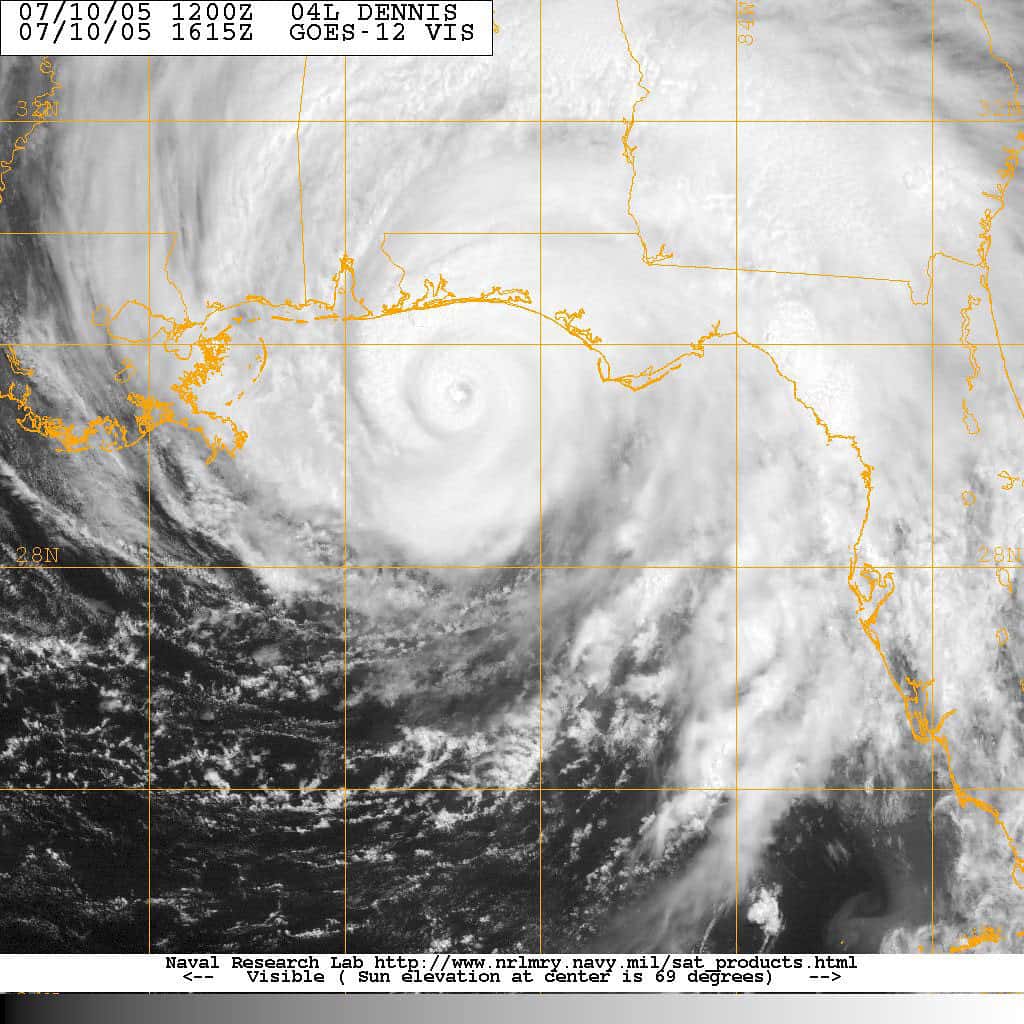
The Atlantic produced its third named storm of the 2026 season this week when Tropical Storm Cristobal formed over the open North Atlantic, far from land and on a track that carries it away from the United States. The more consequential development for Florida is behind it: the National Hurricane Center is tracking two disturbances in the tropical Atlantic, one of which forecasters give a high probability of becoming a tropical depression in the coming days.
Cristobal itself is a short-lived system. It formed Wednesday roughly 880 miles west of the Azores with maximum sustained winds near 45 mph, moving east at about 25 mph, and forecasters expect it to weaken rapidly over cooler water while contending with dry air and strong northerly wind shear. It is not projected to make landfall anywhere.
The systems worth watching are the tropical waves that have emerged from Africa into the Atlantic's main development region. That corridor has been unusually quiet this season, and its activation in mid-August is the seasonal signal Florida emergency managers watch for, regardless of whether any individual system ever threatens the state.
Where the tropics stand
Cristobal is the third named storm of 2026, following Arthur and Bertha. Neither of those reached hurricane strength, and as of this week the season has produced no hurricanes at all, which is unusual this deep into August.
Behind Cristobal, forecasters designated Invest 92L in the central tropical Atlantic earlier this week. The system has been given a high chance of development, with forecasters indicating a tropical depression is likely to form as it moves west or west-northwest into a more favorable environment late this week. If it strengthens to tropical storm force, meaning maximum sustained winds of at least 39 mph, it would take the name Dolly.
A second area, designated 93L, is also being monitored. Multiple systems under watch simultaneously is normal for mid-August and is the expected consequence of the African wave train activating as the season approaches its climatological peak.
Forecast guidance places 92L moving toward the Caribbean by the weekend. Forecasters have been explicit that there is no threat to Florida at this time, and that the system faces obstacles as it tracks west, including dry air and wind shear that could limit how much it strengthens.
What the seasonal outlook says
NOAA updated its 2026 Atlantic hurricane season outlook this month and lowered its expectations further, putting the chance of a below-normal season at 75 percent, up from 55 percent in the May outlook. The updated forecast calls for 7 to 13 named storms, of which 2 to 6 could become hurricanes, including 0 to 2 major hurricanes of Category 3 strength or higher.
The driver is El Niño. Forecasters expect a strengthening El Niño in the Pacific to continue suppressing Atlantic tropical cyclone development through the remainder of the season. El Niño conditions typically increase wind shear over the Atlantic basin, and wind shear tears developing storms apart before they can organize.
Atlantic sea surface temperatures remain slightly warmer than normal, which cuts the other way. Warm water is fuel, and a season with suppressed development but abundant fuel can still produce an intense storm if a system finds a window of low shear. That combination is why forecasters have been careful to describe below-normal as a statement about counts, not about risk to any particular coastline.
Why a quiet season is not a safe season
Florida's hurricane history contains the clearest possible argument against reading a seasonal forecast as a personal risk assessment. Andrew struck South Florida in 1992 during a season that produced only seven named storms, one of the quietest on record. The number of storms in a basin has almost no relationship to whether any of them hits a given stretch of coastline.
The state's climatological peak runs from mid-August through late September, with the statistical maximum around September 10. Florida is entering that window now, and the systems currently under watch are the first meaningful test of whether the main development region will produce organized storms this year.
Emergency managers have made the same point in every recent season: the preparation window closes when a storm is named, not when it makes landfall. Supplies, fuel, prescriptions, evacuation plans and insurance documentation are all easier to assemble in a quiet week than in the 72 hours after a cone appears over the state.
What Floridians should do now
Know your evacuation zone. Florida evacuation orders are issued by zone, not by county, and the difference matters enormously. An evacuation order affecting Zone A in a coastal county does not mean every resident of that county must leave, and residents who evacuate unnecessarily add to congestion that slows the people who genuinely have to go. County emergency management websites publish zone lookups by address.
Understand the difference between a watch and a warning. A tropical storm or hurricane watch means those conditions are possible in the specified area, generally within 48 hours. A warning means those conditions are expected, generally within 36 hours. A warning is a shorter fuse and a firmer statement, and evacuation decisions in most counties are keyed to it.
Check your insurance now rather than later. Most Florida property insurance carriers impose binding restrictions once a storm is named and approaching, meaning new policies and coverage increases cannot be written. Flood coverage through the National Flood Insurance Program carries a standard 30-day waiting period, which makes mid-August the last practical moment to add flood coverage that would be in force during the season's peak.
Assemble supplies for at least a week. The most common failure in Florida storm recovery is not the storm itself but the days without power afterward, and August and September heat makes that dangerous for older residents and anyone dependent on refrigerated medication or powered medical equipment.
Local impact across the state
The Florida Keys and South Florida face the most immediate exposure to any system that tracks through the Caribbean and turns north, which is the general pathway that guidance suggests for 92L in the coming days. Monroe County's evacuation logistics are the most constrained in the state given the single highway out, and its emergency managers order evacuations earlier than mainland counties for that reason.
The Gulf Coast from Tampa Bay south through Southwest Florida remains the most storm surge vulnerable stretch of the state, with shallow shelf waters and low-lying development that amplify surge for any given storm intensity. Recent seasons have repeatedly demonstrated that surge, not wind, drives fatality counts on that coast.
The Panhandle sits under a different threat pattern, more often exposed to storms that form in or cross into the Gulf rather than to long-track Atlantic systems. Northeast Florida and the Atlantic coast face the classic recurving-storm risk, where a system running parallel to the coast delivers days of surf, erosion and rip currents without ever making landfall.
Reading the forecast cone correctly
When a system does eventually threaten Florida, the graphic most residents will see is the National Hurricane Center's forecast cone, and it is the most misread product in weather communication. The cone shows the probable track of the storm's center, and it is drawn so that the center stays inside it roughly two thirds of the time based on historical forecast error.
Three consequences follow, and all three are routinely missed. The cone says nothing about the storm's size, so impacts routinely extend far outside it. The cone says nothing about intensity, so a narrow cone does not mean a weak storm. And the center falls outside the cone roughly one third of the time, which means being outside the cone is not the same as being safe.
Storm surge, wind field extent and rainfall all operate on different geographies than the track. A storm whose center passes 100 miles west of a coastline can still deliver damaging surge to that coastline, and rainfall bands routinely produce inland flooding hundreds of miles from the center. The National Hurricane Center publishes separate storm surge and wind arrival products for exactly this reason.
Residents making decisions should use the local products, meaning the hurricane local statement issued by their National Weather Service forecast office and the guidance from their county emergency management agency, rather than the cone alone.
What a suppressed season looks like
El Niño's effect on Atlantic hurricanes operates through wind shear. When the eastern Pacific warms, atmospheric circulation shifts in ways that increase upper-level winds over the Atlantic basin. Developing tropical systems need a vertically stacked circulation to organize, and shear tilts and disrupts that structure before it can consolidate.
The effect is strongest over the deep tropics, which is why the main development region between Africa and the Caribbean has been so quiet this season. Storms that form closer to the United States, in the Gulf or off the southeastern coast, are less affected by basin-wide shear patterns and can develop quickly with little warning.
That distinction matters for Florida. Long-track systems from Africa give the state a week or more of warning. Homegrown systems that spin up in the Gulf can go from a disorganized area of storms to a landfalling hurricane in roughly 48 hours, which is inside the window in which most preparation has to happen.
A suppressed season shifts the risk profile toward the second category. Fewer long-track major hurricanes, but no reduction in the possibility of a rapidly intensifying Gulf system, and considerably less time to react when one forms.
What's next
The immediate watch is on 92L, which forecasters expect to organize into a tropical depression in the coming days as it approaches the Caribbean. Track guidance beyond that point is where the uncertainty lives, and forecast cones at five-day range routinely shift by hundreds of miles.
Cristobal should dissipate within days over cold water. Its only lasting significance is as the season's third name, which advances the list toward Dolly for the next system that reaches tropical storm strength.
Beyond the current systems, the African wave train is the thing to watch through late August and September. Its activation is the seasonal turn, and even in a season forecast to run below normal, the peak weeks are when Florida's risk is concentrated.
Advisories are issued by the National Hurricane Center in Miami at 5 a.m., 11 a.m., 5 p.m. and 11 p.m. Eastern, with intermediate updates when systems are near land. Those advisories, and county emergency management offices, are the sources that matter when a storm is actually approaching.
Spotted an issue with this article?
Have something to say about this story?
Write a letter to the editor