Atlantic Disturbances Lose Steam, Leaving Florida With No Tropical Threat for Now
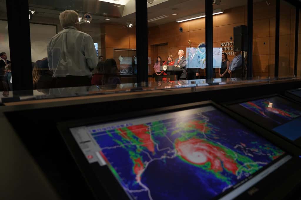
Hurricane forecasters tracking the Atlantic basin this weekend reported decreasing development odds for the disturbances under watch, leaving Florida without a tropical threat as the season moves into its historically most active stretch.
The National Hurricane Center has been monitoring two areas of disturbed weather, including a tropical wave near the Windward Islands producing gusty winds along with showers and thunderstorms. Development chances for each of the areas being tracked decreased over the course of the week.
The system designated Invest 92L, which earlier in the month had been given elevated development odds, became disorganized as it approached the Lesser Antilles and is no longer expected to become a tropical depression. Forecasters lowered its development probability substantially, and its principal effect is expected to be rain and squally weather across the islands rather than an organized cyclone.
Reading the tropical weather outlook
The National Hurricane Center publishes a graphical tropical weather outlook that assigns development probabilities to areas of disturbed weather over 48-hour and seven-day windows. Those probabilities describe the chance a system will organize into at least a tropical depression, not the chance it will affect any particular location.
For the 2026 season, the outlook incorporates a gray X symbol to mark disturbances with a low chance of development, a change from prior seasons intended to give the public more complete information about what forecasters are watching.
Alongside the highlighted areas, the hurricane center has been monitoring additional tropical waves moving across the basin. Tropical waves are the seedling disturbances from which many Atlantic systems eventually form, and several are typically in transit across the ocean at any point during peak season.
An invest designation, such as 92L, simply indicates that forecasters have flagged a system for closer examination and additional model guidance. It is not a forecast of development and carries no implication about eventual strength or track.
Watch versus warning
Because the terminology matters when a system does threaten land, it is worth restating the distinction. A tropical storm or hurricane watch means the associated conditions are possible within the specified area, generally within 48 hours. A warning means those conditions are expected, generally within 36 hours.
A warning is the more urgent product and the one that should prompt completion of preparations. A watch is the signal to finish planning and monitor closely.
Storm surge watches and warnings are issued separately from wind products, because surge and wind hazards do not always align geographically. In Florida, surge has historically been the deadliest hazard associated with landfalling tropical systems.
Evacuation decisions in Florida are made by county emergency management officials, not by the National Hurricane Center, and they are issued by zone. A resident's evacuation zone is determined by surge vulnerability rather than by distance from the water, and inland residents in low-lying areas along rivers and bays are sometimes included.
The seasonal context
The quiet conditions are consistent with the seasonal outlook. Federal forecasters raised the probability of a below-normal 2026 Atlantic hurricane season to 75 percent in their updated August outlook, citing El Nino and the increased wind shear it produces over the tropical Atlantic.
The season has produced two named storms, Arthur and Bertha, and no hurricanes to date. The updated seasonal projection calls for 7 to 13 named storms overall, of which 2 to 6 could become hurricanes, including 0 to 2 major hurricanes.
Wind shear is the mechanism most directly responsible for the disorganization forecasters have observed in the systems they are tracking. A disturbance encountering strong shear has its thunderstorm activity displaced from its low-level circulation, which prevents the vertical alignment a tropical cyclone requires.
Dry air associated with the Saharan air layer is a second factor common in the Atlantic during summer, and it can suppress the deep convection developing systems need.
What it means for Floridians
A quiet week is an opportunity rather than an all-clear. The climatological peak of the Atlantic season falls around September 10, and the highest-activity portion of the year runs from mid-August through October.
Preparations completed during quiet weeks are substantially easier and cheaper than those attempted when a storm is approaching. Supplies remain available, contractors have capacity, and insurance policies purchased now will have cleared any applicable waiting period before a storm develops.
Insurance is the item most often left too late. Policies commonly impose waiting periods before coverage takes effect, and carriers routinely suspend binding new coverage once a system is designated and threatens the state. Flood coverage in particular is usually purchased separately and carries its own waiting period.
Residents should confirm their evacuation zone through their county emergency management office, verify that shutters or protective materials fit and are accessible, and establish a plan covering pets, medications and important documents.
Local impact across the state
South Florida and the Keys sit closest to the traditional Cape Verde tracks that produce the Atlantic's strongest late-season hurricanes, and Monroe County's dependence on a single evacuation route makes early decisions there especially consequential.
The Tampa Bay region carries some of the highest storm surge vulnerability in the country given the shallow bay and dense low-lying development across Pinellas and Hillsborough counties.
Southwest Florida communities continue rebuilding from recent seasons, and residents in Lee and Collier counties have direct recent experience with how quickly conditions can change.
The Big Bend and Panhandle have absorbed multiple landfalls in recent years along a stretch of coast with limited elevation and extensive marsh, terrain that amplifies surge inundation.
How systems organize, and why most do not
The great majority of tropical waves that leave the African coast never become named storms, and understanding why clarifies what forecasters are watching for.
A developing system requires several conditions simultaneously. Sea surface temperatures generally need to be around 80 degrees Fahrenheit or warmer through a sufficient depth of ocean. The atmosphere needs enough moisture to sustain deep thunderstorm activity. Wind shear must be low enough to allow a vertical structure to form. And the system needs to be far enough from the equator for the Earth's rotation to impart spin.
Failure of any one condition prevents development, which is why forecasters can watch a system with abundant thunderstorm activity and still assign it low development odds. A disturbance moving into a region of strong shear or dry air will typically weaken regardless of how impressive it appears on satellite imagery.
The organizational sequence proceeds from disturbance to tropical depression, which has a closed circulation and sustained winds below 39 mph, to tropical storm at 39 mph, at which point it receives a name, to hurricane at 74 mph. Each step requires the favorable conditions to persist.
Preparing during a quiet stretch
Emergency management officials consistently emphasize that preparation completed in calm conditions is worth substantially more than preparation attempted under pressure, and the reasons are practical rather than rhetorical.
Supply availability collapses quickly once a storm threatens. Water, batteries, fuel, plywood and generators sell out across affected regions within a day or two of a watch being issued, and restocking during an active threat is unreliable.
Document preparation is best done without time pressure. Insurance policies, identification, medical records, property deeds and photographs of household contents are all far easier to organize now than during an evacuation. Digital copies stored remotely provide redundancy if physical documents are lost.
Structural preparations including shutter fitting, roof inspection and tree trimming require contractor availability, which disappears entirely when a storm approaches. Households that identify problems now can address them; those that wait generally cannot.
Special needs registration through county emergency management is another item best handled in advance. Residents requiring medical support or transportation assistance during an evacuation must be enrolled before an event to receive it.
Where Atlantic storms come from
The systems forecasters track during peak season originate from several distinct sources, and each carries different implications for Florida.
Cape Verde systems form from tropical waves moving off the West African coast and cross the Atlantic over roughly one to two weeks. These have the longest development window and produce a disproportionate share of the season's strongest hurricanes. The disturbances currently being monitored fall into this category.
Homegrown systems develop closer to land, in the Gulf, the Caribbean or off the southeastern United States coast. They offer far less warning time because they can organize within a day or two of forming, and Florida has been affected by systems that went from disturbance to landfall in under 72 hours.
Frontal systems that stall over warm water in the western Atlantic can also acquire tropical characteristics, a process more common early and late in the season than during the peak.
The distinction matters for preparedness because it determines available lead time. A Cape Verde system provides days of tracking, while a homegrown Gulf system may allow only hours of meaningful preparation.
Understanding forecast uncertainty
When a system does threaten, the products forecasters issue are frequently misread, and understanding their construction prevents dangerous conclusions.
The cone of uncertainty depicts the probable track of the storm's center, historically containing the actual center roughly two thirds of the time. It says nothing about the storm's size or its impacts, and hazardous conditions routinely extend well beyond the cone.
The center line within the cone receives disproportionate attention and deserves the least. Small shifts in track occur routinely, and planning around an exact centerline location is unreliable.
Impacts are described in separate products addressing wind, surge and rainfall, and those are the products relevant to decisions about whether to evacuate or shelter. Surge in particular can affect areas far from where the center crosses the coast.
Intensity forecasting remains less accurate than track forecasting, and rapid intensification near landfall has occurred in several recent Florida storms, which argues for preparing based on the reasonable worst case rather than the current forecast intensity.
What's next
The National Hurricane Center issues tropical weather outlooks several times daily during the season and begins advisory products when a system organizes. Those products are the authoritative source for any developing storm.
National Weather Service forecast offices in Miami, Tampa Bay, Jacksonville, Tallahassee, Melbourne and Key West issue local forecasts and any watches and warnings applying to Florida counties.
The Florida Division of Emergency Management coordinates state preparedness and response, and county emergency management offices are the source for evacuation zones, shelter locations and local orders.
Conditions in the Atlantic can change within days, and the current lull carries no implication about the remainder of the season.
Spotted an issue with this article?
Have something to say about this story?
Write a letter to the editorComments
No comments yet. Be the first to weigh in.
Related Coverage
Florida's First Fall Cold Front Delivers Cooler Air and Strong Coastal Winds as a Nor'easter Develops Offshore
1d ago
Atlantic Passes Late September Without a Hurricane for the First Time in 112 Years
3d ago
Hurricane Season Enters Its Final Weeks With Six Named Storms and No Atlantic Hurricanes
5d ago
Soggy September: More Than 10 Inches of Rain Swamps Palm Beach County as Flood Risk Lingers
Sep 21