Atlantic Stays Quiet as Hurricane Season Enters Its Most Active Stretch
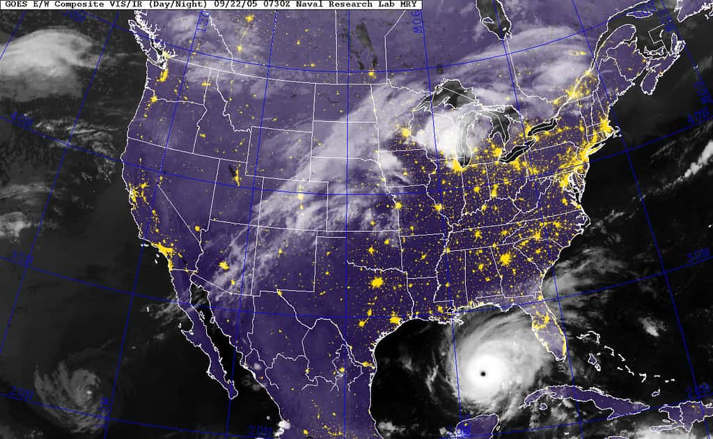
Florida is entering the most dangerous stretch of the Atlantic hurricane season with an unusually quiet basin. The National Hurricane Center's outlook this week showed no tropical development expected in the main Atlantic basin over the following five days, though a tropical wave moving off Africa carries increased potential for development as it moves west.
The season has produced three named storms to date. Arthur formed in mid-June in the Gulf off the Texas coast and delivered record rainfall to portions of Louisiana while spawning tornadoes along the Gulf coast. Bertha also formed in the Gulf, originating south of the Florida Panhandle before making landfall in St. Bernard Parish, Louisiana. Neither reached hurricane strength, and the basin has not produced a hurricane this season.
None of that means Florida is out of danger. The climatological peak of the Atlantic season falls in early to mid September, and the six weeks beginning now have historically produced the majority of Florida's damaging landfalls.
Why the season has been quiet
El Niño conditions emerged in the equatorial Pacific in June, and that is the dominant explanation for the suppressed activity. El Niño increases vertical wind shear across the tropical Atlantic, and shear disrupts the vertical structure that developing storms need to organize and intensify.
NOAA's seasonal outlook called for a below-normal Atlantic season and the agency maintained that prediction in its August update. Three named storms by late August is consistent with a below-normal season, though it is not so far below normal as to be extraordinary.
Wind shear suppresses formation but does not eliminate it. Storms can and do develop in shear-prone seasons, particularly when they form close to land where they have less distance to travel through hostile conditions before reaching a coast.
Sea surface temperatures across the basin remain warm enough to support development. The limiting factor this season has been atmospheric, not oceanic, which means a change in the shear pattern could allow activity to resume relatively quickly.
What the quiet season does not mean
The single most important thing for Florida residents to understand about a below-normal season is that seasonal storm counts do not predict individual landfalls. A season can produce a small number of storms and still produce a catastrophic Florida hurricane.
The historical examples are well documented. Hurricane Andrew struck South Florida in 1992 during a season that produced only seven named storms, well below normal. Andrew remains one of the most destructive hurricanes ever to hit the United States.
The relationship works the other way as well. Highly active seasons have passed without a single Florida landfall while below-normal seasons have produced multiple. Basin-wide activity and Florida-specific risk are different quantities.
The practical implication is that preparation should not be adjusted based on the seasonal count. A household that would have prepared for an active season should prepare identically for a quiet one.
What forecasters are watching
The tropical wave exiting Africa is the feature that most warrants attention. Waves moving off the African coast in late August and September are the source of the classic Cape Verde hurricanes, which have the longest track over open water and the greatest opportunity to intensify.
Development from any single wave is far from certain, and most waves that leave Africa never become named storms. The point is that the season's source region is now active, which changes the risk profile from where it stood in July.
In the eastern Pacific, the Hurricane Center has been issuing advisories on separate systems, including Hurricane Lala, which is a distinct basin from the Atlantic and does not affect Florida. Pacific activity is often elevated during El Niño for the same reason Atlantic activity is suppressed.
A tropical wave south of southern Mexico has also been producing disorganized shower and thunderstorm activity with conditions favorable for gradual development, which would be a Pacific rather than Atlantic system.
Understanding watches, warnings and zones
Terminology matters when advisories begin, and the distinctions are frequently misunderstood in the moment.
A tropical storm or hurricane watch means conditions are possible within the specified area, generally within 48 hours. A warning means conditions are expected within the specified area, generally within 36 hours. A watch is the point at which preparations should be completed, not the point at which they should begin.
Evacuation orders in Florida are issued by county emergency management, not by the state or the National Hurricane Center, and they are zone-specific. An evacuation order for a county does not mean every resident of that county must leave. Residents should know their evacuation zone letter, which is determined by storm surge modeling and is available from county emergency management offices.
Storm surge is the deadliest hazard in most Florida landfalls, and surge risk depends on elevation and proximity to water rather than on distance from the storm's center. Evacuation zones are built around surge, which is why a home several miles inland can be in a lower zone than one closer to the center of a projected track.
Where Florida stands on preparedness
Florida's building code, strengthened substantially after Andrew and revised again after subsequent storms, is among the strongest in the country for wind resistance. Homes built after 2002 generally perform far better in high wind than older construction.
Flood risk is a separate matter from wind, and the insurance that covers it is separate as well. Standard homeowners policies do not cover flood damage. Flood coverage comes through the National Flood Insurance Program or private flood carriers.
That program faces a deadline. NFIP authorization expires September 30, 2026, in the middle of the season's peak. If Congress does not reauthorize it, FEMA loses authority to write new policies or renew existing ones, though it retains authority to pay valid claims on policies already in force.
Florida has more NFIP policies than any other state, which makes the reauthorization question a Florida question more than a national one.
What preparation actually involves
Florida emergency managers have converged on a standard set of preparations, and the reason to complete them now rather than later is availability. Supplies sell out within hours of a watch being issued, and prices rise.
The basic supply recommendation is seven days of water at one gallon per person per day, seven days of non-perishable food, a battery-powered or hand-crank radio, flashlights, batteries, a first aid kit, and a two-week supply of prescription medications.
Documents matter as much as supplies. Insurance policies, identification, deeds, medical records and photographs of the home's contents should be stored in a waterproof container or backed up digitally. Insurance claims after a storm move faster when a homeowner can document what existed before it.
Fuel and cash are the two items households most often overlook. Gas stations without power cannot pump, and card payment systems fail when networks go down. Both problems persist for days after a landfall.
The insurance picture heading into peak season
Florida's property insurance market has stabilized relative to its worst period. Litigation reforms reduced claim litigation volume, new carriers have entered the market, and Citizens Property Insurance has moved a large share of its book to private insurers.
Citizens' policy count fell from a peak of roughly 1.42 million in October 2023, with the depopulation program transferring more than 546,000 policies to private carriers in 2025. Rate filings for 2026 have trended toward reductions for many policyholders.
Homeowners should nonetheless review their policy before a storm rather than after. Hurricane deductibles in Florida are typically percentage based rather than flat, meaning a 2% deductible on a $400,000 home is $8,000 out of pocket before coverage begins.
Flood damage is not covered by standard homeowners policies. The National Flood Insurance Program's 30-day waiting period means coverage purchased after a storm forms will not apply to that storm, which is why the decision has to be made now.
Knowing your zone and your route
County emergency management offices publish evacuation zone maps, and every Florida resident in a coastal county should know their zone letter. Zones are assigned based on storm surge modeling, not on distance from the coast or on flood insurance rate maps.
The distinction between evacuation zones and flood zones causes recurring confusion. A property can be outside a mapped flood hazard area and still be in an evacuation zone, and the reverse is also true.
Evacuation in Florida is generally about leaving the surge zone, not leaving the state. Emergency managers consistently advise going tens of miles inland rather than hundreds, since long-distance evacuations clog highways and strand people in vehicles.
Households with pets, medical equipment or mobility limitations should identify appropriate shelter options in advance. Special needs shelters require pre-registration through county emergency management, and that registration cannot be completed once a storm is approaching.
Reading forecasts responsibly
The information environment during hurricane season has become as much a hazard as the storms themselves, and distinguishing official products from social media amplification matters.
The National Hurricane Center issues tropical weather outlooks several times daily during the season and full advisories on active systems every six hours, with intermediate updates when watches or warnings are in effect. Those are the authoritative products.
Individual model runs circulating on social media are not forecasts. A single deterministic model showing a storm striking a specific location eight days out carries essentially no skill at that range, and the Hurricane Center's own forecast reflects the consensus of many models plus forecaster judgment.
The forecast cone shows the probable track of the storm's center, not the extent of its effects. Impacts routinely extend well outside the cone, and a location outside it is not a location that is safe.
What's next
The next several weeks are the period to watch. Climatologically, the second week of September marks the statistical peak of Atlantic activity, and Florida's historical landfall distribution is heavily weighted toward late August through early October.
Residents should verify their evacuation zone, confirm their insurance coverage including whether they carry flood insurance, and check supplies. Supplies purchased before a storm is named are cheaper and available; supplies purchased after a watch is issued frequently are neither.
Watch the National Hurricane Center's tropical weather outlook, issued multiple times daily during the season, rather than social media forecast graphics that circulate ahead of official advisories. Model output showing a storm eight days out is not a forecast.
Watch also for whether the El Niño-driven shear pattern holds. A relaxation in shear during September would allow the basin to become active quickly, and the warm water that has been present all season would be available to whatever develops.
Spotted an issue with this article?
Have something to say about this story?
Write us a letterComments
No comments yet. Be the first to weigh in.
Related Coverage

Isaias Brings Surge, Flooding Rain and Tornado Risk to Tallahassee and the Big Bend
3h ago

FPL Stages 12,000 Workers as Isaias Threatens Long Power Outages in the Panhandle
4h ago

Panhandle Evacuations Widen From Perdido Key to St. George Island as Major Hurricane Isaias Nears
1d ago

Soaked Northeast Florida Faces More Flooding as Tropical Storm Isaias Takes Aim at the Gulf Coast
1d ago