Atlantic Tropics Stir as NHC Tracks Invest 92L and Two More Waves
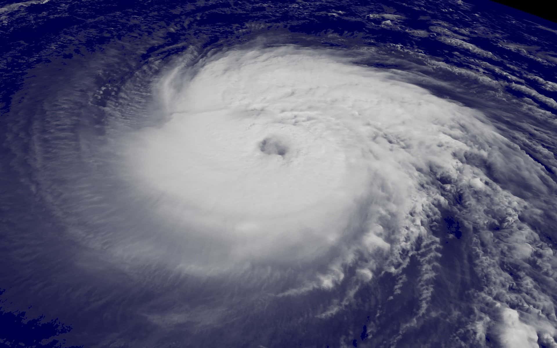
The Atlantic basin has begun to stir after a historically quiet start to the 2026 hurricane season. The National Hurricane Center is tracking Invest 92L in the tropical Atlantic with a 70 percent chance of development over seven days, along with a wave in the eastern Atlantic given roughly a 20 percent chance and another wave emerging off the coast of West Africa with about a 40 percent chance.
Forecasters covering the systems have said neither of the leading disturbances currently appears likely to affect Florida. That assessment is based on current steering patterns and is subject to change, which is the standard caveat on any tropical outlook issued a week ahead of possible development.
The season has produced two named storms, Arthur and Bertha, and no hurricanes. That is well below the climatological pace for late August, a period when the Atlantic normally begins its most active stretch.
Two named storms by Aug. 20 is a genuinely unusual figure. Climatologically, the Atlantic averages roughly five named storms by this date, and the basin has typically produced at least one hurricane well before late August. The absence of any hurricane this deep into the season is the single most distinctive feature of 2026 so far, and it is consistent with the suppressed conditions NOAA forecast in its seasonal outlooks.
What an invest actually is
An invest, short for investigative area, is not a storm. It is an administrative designation the National Hurricane Center applies to a disturbance so that forecast models can be run on it and data can be collected in a standardized way. Numbers between 90 and 99 are assigned and recycled through the season.
A 70 percent chance of development over seven days means the NHC's forecasters believe there is a 70 percent probability the system becomes at least a tropical depression at some point in that window. It says nothing about where the system goes, how strong it gets, or whether it affects land.
That distinction matters because of how these numbers circulate. A high development probability generates attention that can imply an imminent threat when none exists. The development probability and the track forecast are separate questions, and the NHC does not issue a track forecast until a system is designated a tropical depression or higher.
Model guidance is the other thing worth understanding before storms arrive. The spaghetti plots that circulate widely on social media show individual model runs, many of which are experimental, poorly performing, or not designed for tropical forecasting at all. The National Hurricane Center's official forecast cone is a blend produced by human forecasters using the models that have demonstrated skill, and it is the only track guidance that carries an official error history.
Storm surge is the hazard that kills the most people in Florida hurricanes, and it is forecast and warned separately from wind. The National Hurricane Center issues storm surge watches and warnings on their own schedule and with their own graphics, because surge risk depends on bathymetry, coastline shape, and the angle of approach rather than on wind speed alone. A Category 1 storm approaching a shallow, gently sloping shelf can push more water than a stronger storm hitting a steeper coast. Florida's Gulf Coast, particularly the Big Bend and the Tampa Bay region, is among the most surge-vulnerable coastlines in the United States for exactly that reason.
Watches versus warnings
Because storm coverage tends to compress the terminology, the distinction is worth restating before any system approaches Florida. A tropical storm or hurricane watch means those conditions are possible within the specified area, generally within 48 hours. A warning means those conditions are expected within roughly 36 hours.
A watch is a signal to complete preparations. A warning is a signal that preparations should already be complete and that the window for outdoor work, travel, and evacuation is closing. Evacuation decisions in Florida are made at the county level and are zone-specific, not county-wide.
That last point is the most frequently misunderstood element of Florida hurricane response. When a county issues an evacuation order, it applies to specified evacuation zones, generally lettered A through E, based on storm surge vulnerability. Residents outside the ordered zones are not being asked to leave, and unnecessary evacuation from inland areas adds traffic that impedes the people who genuinely need to move.
The forecast cone itself is also widely misread. It represents the probable track of the storm's center, historically containing that center about two-thirds of the time. It says nothing about the size of the storm's impacts, which routinely extend hundreds of miles beyond the cone. A community outside the cone can still receive damaging wind, storm surge, and flooding rain, and the phrase outside the cone should never be treated as a signal to stand down.
The season so far
NOAA has maintained its prediction of a below-normal Atlantic hurricane season. The agency's updated outlook calls for 7 to 13 named storms, of which 2 to 6 could become hurricanes, including 0 to 2 major hurricanes at Category 3 strength or above. NOAA has assigned a 75 percent chance to below-normal activity, 20 percent to near-normal, and 5 percent to above-normal.
Two named storms and no hurricanes by Aug. 20 is consistent with that outlook. The Atlantic's Main Development Region, the corridor between West Africa and the Caribbean where the strongest and longest-tracked hurricanes typically form, has been notably inactive.
The climatological peak of the season falls in early to mid-September. Historically, roughly half of all Atlantic named storm activity occurs between mid-August and late September, which means a quiet August does not settle the season.
Saharan dust has been a recurring suppressing factor in recent Atlantic seasons. Dry, dusty air moving off Africa across the Main Development Region inhibits the deep convection tropical systems need to organize, and it also stabilizes the atmosphere. Wind shear, sea surface temperatures, and the phase of larger atmospheric oscillations all interact with it, which is why seasonal forecasts carry wide ranges rather than point estimates.
Category ratings compound the confusion. The Saffir-Simpson scale measures sustained wind speed and nothing else. It does not account for storm surge, rainfall, storm size, or forward speed, all of which drive damage. Hurricane Harvey caused catastrophic flooding in Texas as a weakening system, and inland freshwater flooding from slow-moving tropical systems has killed Floridians far from any coast. Treating the category number as a proxy for total risk is the most common error in how the public interprets a forecast, and emergency managers spend considerable effort every season trying to correct it.
Florida's dry summer
The tropics have been quiet, and so has the rain in much of Florida. Jacksonville is running a rainfall deficit of nearly five inches, putting it on pace for its tenth-driest year on record. Tallahassee is approximately 11.5 inches below average, the area's sixth-driest year on record.
Those deficits create their own set of problems. Low soil moisture increases wildfire risk, stresses agriculture, and affects water levels in the aquifer systems that supply much of North and Central Florida. The Florida Forest Service monitors drought conditions through the Keetch-Byram Drought Index, which drives burn authorization decisions.
Storms in mid-August brought a flash flood threat to the Panhandle and North Florida, with the Weather Prediction Center placing the region under a marginal risk for flash flooding and accumulations generally between one and two inches. Heavy rain on dry, hardened soil runs off rather than soaking in, which is why drought and flash flooding are not contradictory conditions.
Wildfire is the hazard Floridians most often overlook during a dry stretch. The Florida Forest Service manages wildfire response statewide, and drought conditions combined with lightning from summer thunderstorms create ignition risk even in a state most people associate with water. Burn authorizations are issued or withheld based on drought index readings, and residents in rural and wildland-urban interface areas should check restrictions before any outdoor burning.
What Floridians should do now
A quiet season is the right time to complete preparations, not a reason to skip them. Florida's disaster supply kit guidance calls for seven days of water at one gallon per person per day, seven days of non-perishable food, medications, and cash, since card systems fail when power does.
Homeowners should confirm their insurance situation before a storm is named. Standard homeowners policies do not cover flood damage. Flood coverage comes through the National Flood Insurance Program or private flood carriers, and NFIP policies carry a 30-day waiting period before taking effect, which means buying coverage once a storm is in the forecast does not work.
Residents should also confirm which evacuation zone they live in. Every coastal Florida county publishes a zone lookup tool, and the answer is based on surge vulnerability rather than on distance from the water or on flood insurance rate maps.
Preparation costs almost nothing when done in August and becomes impossible when done in the 48 hours before landfall. Plywood, generators, batteries, and bottled water disappear from shelves across an entire metropolitan area once a warning is issued, and gas stations run dry along evacuation routes. Every year Florida emergency managers make the same request, and every year the same shortages occur.
Insurance and preparedness intersect in ways worth planning around now. Florida law requires insurers to offer coverage with hurricane deductibles that are typically a percentage of the dwelling's insured value rather than a flat dollar amount, which means a homeowner with a $400,000 policy and a 2 percent hurricane deductible faces $8,000 out of pocket before coverage begins. Knowing that number in advance changes how a household plans, and it is stated in the policy declarations page. Homeowners can also pursue wind mitigation inspections, which document features like roof attachment and opening protection that generate premium credits under Florida law.
What's next
The National Hurricane Center issues tropical weather outlooks four times daily during hurricane season, at 2 a.m., 8 a.m., 2 p.m., and 8 p.m. Eastern. Those outlooks are the authoritative source for development probabilities and are updated more often when systems are active.
If Invest 92L develops, it would receive the next name on the 2026 Atlantic list. Development would trigger NHC advisories with track and intensity forecasts, issued every six hours, with intermediate updates when watches or warnings are in effect.
Hurricane season runs through Nov. 30. Florida's peak risk window historically extends from mid-August through early October, with the state's landfall climatology heaviest in September.
Floridians can find county-specific evacuation zone lookups, shelter locations, and emergency alerts through the Florida Division of Emergency Management and their county emergency management office. The National Hurricane Center at hurricanes.gov remains the authoritative source for advisories, and local National Weather Service forecast offices in Miami, Tampa Bay, Jacksonville, Tallahassee, Melbourne, and Key West issue the local statements that translate a basin-scale forecast into what a specific community should expect.
Spotted an issue with this article?
Have something to say about this story?
Write a letter to the editorComments
No comments yet. Be the first to weigh in.
Related Coverage

King Tides Set Record at Port Everglades Gauge, Flooding Streets From Fort Lauderdale to Miami Beach
2d ago
Florida's First Fall Cold Front Delivers Cooler Air and Strong Coastal Winds as a Nor'easter Develops Offshore
6d ago

Atlantic enters October without a hurricane, a satellite-era first
Sep 25

Hurricane Season Enters Its Final Weeks With Six Named Storms and No Atlantic Hurricanes
Sep 23