DeSantis Declares State of Emergency for 25 North Florida Counties as Isaias Takes Aim at the Gulf Coast
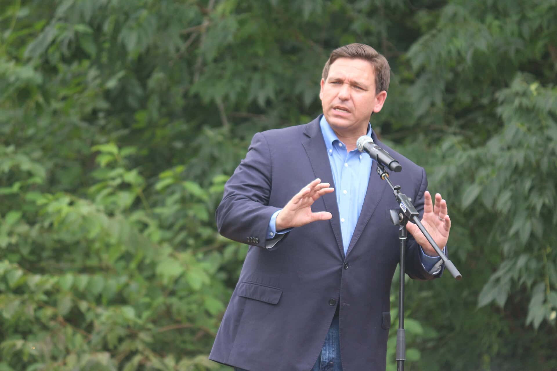
Gov. Ron DeSantis has declared a state of emergency for 25 counties across the Florida Panhandle, the Big Bend and part of North Florida, clearing the way for the state to stockpile generators, fuel, water and flood barriers ahead of Tropical Storm Isaias, which the National Hurricane Center now expects to reach the northern Gulf Coast on Friday as a significant hurricane.
The governor signed Executive Order 26-202 on Tuesday, Oct. 6, when the system was still Tropical Depression Nine in the southwestern Gulf. It strengthened into Tropical Storm Isaias early Wednesday, and forecasters expect rapid strengthening over the next two days. Counties and cities from Pensacola to Tallahassee spent Tuesday and Wednesday opening sand sites, draining retention ponds and lining up supply distribution plans.
What the governor's order does
According to the Executive Office of the Governor, the order allows the Florida Division of Emergency Management to stage critical preparedness resources before the storm arrives rather than after. In a statement released with the order, DeSantis said it "will allow the Florida Division of Emergency Management to stage critical preparedness resources and ensure Florida is ready to respond." He added that Floridians "should take this time to get disaster plans in place and ensure their hurricane supply kit is stocked."
The governor's office said the State Emergency Response Team, known as SERT, is mobilizing resources and will stage them in two places, Tallahassee and the Santa Rosa County area, so they can be moved quickly once the landfall point becomes clearer. The staged assets listed by the state include:
- Generators
- Fuel
- Flood barriers and Tiger Dams
- Pallets of boxed water
- Shelf-stable meals
- Flood buckets
- Tarps
- Sandbags
The release warned that impacts are expected well beyond wherever the center comes ashore, with heavy rain, strong winds, coastal flooding and isolated tornadoes possible across North Florida. It also noted that more rain could further saturate soils and raise the risk of flash flooding after the state's recent heavy rainfall. The full text of the order is posted on the governor's website, and the state is directing residents to FloridaDisaster.org and the @FLSERT account on X for updates.
The 25 counties under the emergency
The order covers every county from the Alabama line east through the Big Bend, plus a band of inland North Florida counties along the Interstate 10 and Suwannee River corridors. Baker and Columbia counties, west of Jacksonville, are also included. The counties are:
- Baker County
- Bay County
- Calhoun County
- Columbia County
- Dixie County
- Escambia County
- Franklin County
- Gadsden County
- Gilchrist County
- Gulf County
- Hamilton County
- Holmes County
- Jackson County
- Jefferson County
- Lafayette County
- Leon County
- Liberty County
- Madison County
- Okaloosa County
- Santa Rosa County
- Suwannee County
- Taylor County
- Walton County
- Wakulla County
- Washington County
Notably absent are the Jacksonville-area coastal counties, including Duval, Nassau and St. Johns, which have been dealing with their own flooding from a stalled front and nor'easter this week but are farther from Isaias' projected path.
Why the state is moving now
The timing reflects how quickly the forecast has sharpened. At 10 a.m. CDT Wednesday, the National Hurricane Center issued a Hurricane Watch from Bay St. Louis, Miss., to Indian Pass in Gulf County, a Tropical Storm Watch from east of Indian Pass to the Aucilla River, and a Storm Surge Watch from the mouth of the Mississippi River to Yankeetown, covering the entire Panhandle and Big Bend coastline. Isaias had 45 mph winds and was expected to become a strong hurricane before approaching the northern Gulf Coast on Friday, with possible surge of 5 to 7 feet from Ocean Springs, Miss., to Indian Pass. The hurricane center told residents in the surge watch area to follow the advice of local officials and evacuate if told to do so, and urged those in the Hurricane Watch to prepare for possible long-duration power outages.
The Florida Division of Emergency Management's daily weather outlook on Wednesday told Panhandle residents to closely monitor the storm and said direct impacts, including strong winds, storm surge, heavy rainfall and tornadoes, are becoming increasingly likely across the Panhandle.
Acting days before landfall gives the state time to move supplies and crews into position while roads are open and the weather is calm, which is the purpose the governor's office cited for the order.
Escambia County: stormwater, supplies and the National Guard
In Escambia County, emergency officials held a call Tuesday morning with the state emergency management division to discuss resources the county may need, WEAR-TV reported. The National Weather Service, city and county staff, and volunteer groups including the Be Ready Alliance Coordinating for Emergencies (BRACE) and the Community Emergency Response Team took part.
Escambia County Emergency Manager Travis Tompkins told the station the state keeps "a catalog of things that we can request from them, if need be." The National Guard has been placed on standby, and points of distribution for food and water have been mapped out, according to the report. "Be prepared. Be weather aware," Tompkins said. "Don't let this catch you."
The county is also still clearing water from rain that fell the previous weekend. Commissioner Steve Barry said the county maintains about a thousand stormwater ponds, and crews spent Tuesday checking retention areas, problem creeks and culverts, pumping down ponds that were too full and opening sluices and overflows on those without pumps. The City of Pensacola's public works department is doing similar work, lowering pond levels, checking storm sewers and clearing debris, WEAR reported.
Tompkins advised households to pick up yard furniture, have a week of food on hand and check on elderly neighbors.
Where to get sand in the western Panhandle
Several western Panhandle governments opened free sand sites before Isaias was named. Escambia's eight sites are open around the clock on a first come, first served basis, and residents must bring their own bags and shovels. The locations reported by WEAR-TV are below.
| Area | Sites | Notes |
|---|---|---|
| Escambia County | Baars Field Athletic Park, Brent Athletic Park, Don Sutton Park (Molino), Equestrian Center, County Road Department on Highway 297-A, Ferry Pass Middle School (Parazine Street side), John R. Jones Jr. Athletic Park, Travis M. Nelson Park (Century) | Open 24 hours; bring bags and shovels |
| Santa Rosa County | Leisure Street and Citrus Drive (Navarre), Tiger Point Park (Gulf Breeze), Pace Fire Rescue (Pace), Pine Forest Road and Carroll Road (Milton) | First come, first served |
| Okaloosa County | 714 Essex Road (Fort Walton Beach), 1759 South Ferdon Boulevard (Crestview) | Sand and bags from 4 p.m. Wednesday |
| Destin | Public Works facility, 3949 Commons Drive | Limit 12 bags per household; shovels provided |
Emergency managers routinely note that sandbags help with rainwater flooding but do little against storm surge.
Federal closures and school disruptions
The National Park Service announced Tuesday that several Florida areas of Gulf Islands National Seashore would close for day use at noon Wednesday, Oct. 7, including the Fort Pickens Management Area, the Opal Beach complex on Santa Rosa Island, the Perdido Key area at Johnson Beach and the Okaloosa Area and Crab Island. Check-ins at the Fort Pickens campground were suspended immediately, and the campground was to be evacuated by 4 p.m. Wednesday. The Naval Live Oaks and Fort Barrancas areas were to stay open until further notice, though programs were canceled, WEAR reported. The park said the area of potential impact stretches from the western Florida Panhandle to Louisiana.
Rain was already disrupting routines before the storm formed. In Jackson County, the school district's transportation department kept buses off dirt roads Tuesday because heavy rain made them too slick, picking students up only on paved roads, WFSU reported. Students who missed school were given excused absences. Transportation director Rex Suggs told the station that bus service was expected to return to normal for the rest of the week during a break in the rain.
Parents in the emergency counties should watch school district channels for any closure decisions as the forecast firms up.
What residents should do now
State officials are steering residents to FloridaDisaster.org for checklists, evacuation zone lookups and shelter information, and to their county emergency management offices for local orders. Evacuation orders in Florida are issued by counties and by zone, so residents should look up their zone now rather than waiting for the storm. Under a state law that took effect in 2025, select disaster preparedness supplies are permanently exempt from Florida sales tax; the Florida Division of Emergency Management points shoppers to FloridaRevenue.com for the full list of eligible items.
What's next
The hurricane center planned an intermediate advisory at 1 p.m. CDT and its next full advisory at 4 p.m. CDT Wednesday, and said more watches and warnings could be needed. Watches mean hurricane or surge conditions are possible; warnings, which typically follow, mean they are expected. Tropical-storm conditions could begin in the watch areas around midday Friday, so county decisions on evacuation zones, shelter openings and school closures in the western Panhandle are likely to come Wednesday night or Thursday. The governor can expand the emergency declaration to more counties by amending the order if the track or the surge watch area shifts; the Storm Surge Watch already extends to Yankeetown in Levy County, which is not among the 25 counties in the current order.
Spotted an issue with this article?
Have something to say about this story?
Write us a letterComments
No comments yet. Be the first to weigh in.
Related Coverage
Hurricane Watch Posted for Florida Panhandle as Tropical Storm Isaias Takes Aim at the Northern Gulf Coast
2d ago

Flash Flooding Hits the Emerald Coast as Flood Watch Holds Across the Panhandle and Big Bend
2d ago

King Tides Set Record at Port Everglades Gauge, Flooding Streets From Fort Lauderdale to Miami Beach
6d ago
Florida's First Fall Cold Front Delivers Cooler Air and Strong Coastal Winds as a Nor'easter Develops Offshore
Sep 27