Hurricane Center Tracks Invest 96L as El Nino Shear Limits Atlantic Development
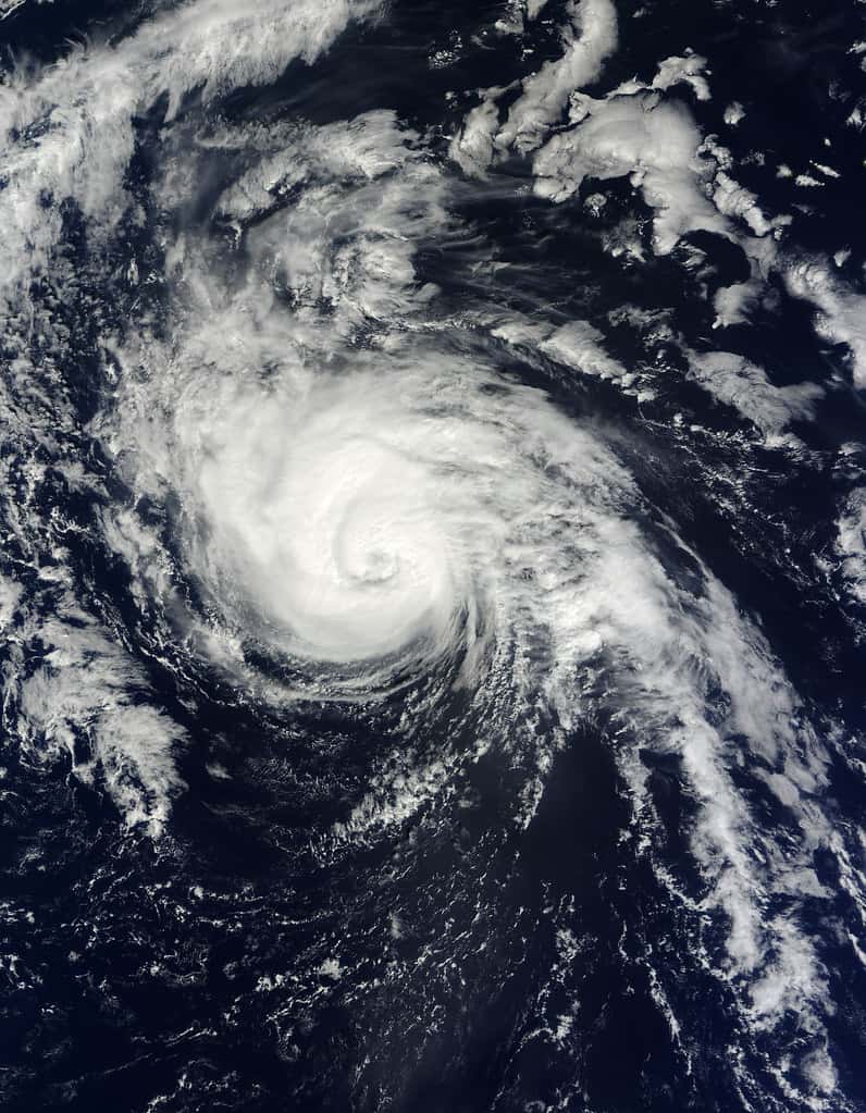
The National Hurricane Center is tracking Invest 96L, a tropical disturbance moving westward across the Atlantic, giving it roughly a 70 percent chance of development into a tropical cyclone over a seven-day window. Forecasters expect the system to reach the vicinity of the northern Lesser Antilles by late this weekend as it continues moving west-northwest at a brisk pace.
There is no immediate threat to Florida, and the environment the system is heading into is described as hostile. Strong upper-level winds associated with a strengthening El Nino are expected to make organization difficult once the disturbance reaches the Caribbean, and forecast guidance shows dry air intruding toward the center within the coming days.
The system is worth watching anyway, because the peak of the Atlantic hurricane season falls in the first half of September and because forecasters have flagged a scenario in which the disturbance could find a more favorable environment later in its life.
What forecasters are seeing
An invest designation is an administrative label. Forecasters assign it to a disturbance to trigger dedicated model runs and closer analysis, and the number cycles through a range and is reused across seasons. The label indicates a system is being examined, not that it has organized.
The seven-day development probability sits at approximately 70 percent, which is high, but a development probability and a Florida impact probability are different things. Most Atlantic systems that develop never affect the United States, and the majority of Cabo Verde season disturbances either fail to organize or recurve into the open ocean.
The specific obstacles are wind shear and dry air. Wind shear, meaning a change in wind speed or direction with height, tilts a developing storm and disrupts the vertical alignment a tropical cyclone requires to intensify. Dry air entrained into the circulation suppresses the thunderstorm activity that drives development. Model output has shown mid-level relative humidity dropping below the threshold generally needed for development within the next two days.
The scenario that keeps forecasters interested is conditional. If the wave remains north of the Caribbean shear axis, retains low-level rotation and survives the dry air, ensemble guidance suggests upper-level winds could become more supportive over the subtropical western Atlantic or even the Gulf. Water temperatures in that region are running above average, and the system's forward speed is expected to slow, which could open a mid-week or late-week window for recovery. Each of those conditions is uncertain, and they compound.
The season so far
NOAA maintained its forecast for a below-normal Atlantic hurricane season in its August update, raising confidence relative to the initial May outlook. Forecasters put the chance of a below-normal season at 75 percent, with a 20 percent chance of near-normal activity and a 5 percent chance of above-normal activity.
The updated ranges call for 7 to 13 named storms, of which 2 to 6 could become hurricanes, including 0 to 2 major hurricanes at Category 3 strength or higher. NOAA noted that Tropical Storms Arthur and Bertha had formed by the time of that update, both in the Gulf.
El Nino is the primary driver of the suppressed forecast. The pattern emerged in the equatorial Pacific during June, and its effect on the Atlantic operates through wind shear: warming in the Pacific alters atmospheric circulation in a way that increases shear across the Atlantic basin, making storm formation and intensification harder.
A below-normal seasonal forecast is not a forecast of a quiet Florida. Seasonal outlooks predict basin-wide activity, not landfall, and the relationship between the two is weak. Several destructive Florida hurricanes have occurred in seasons forecast to be below normal, because it takes only one storm on the wrong track.
Watches, warnings and what they mean
The distinction between a watch and a warning is the single most useful piece of terminology for Florida residents during hurricane season, and it is frequently confused. A tropical storm or hurricane watch means the associated conditions are possible within the specified area, generally within 48 hours. A warning means those conditions are expected within roughly 36 hours.
The gap between those two announcements is the window in which preparation actually happens. Once a warning is issued, the time available for securing property, filling fuel tanks and completing an evacuation is compressed, and shortages of supplies are already underway.
Evacuation orders are separate from watches and warnings and are issued by county emergency management, not by the Hurricane Center. They are also zone-specific rather than countywide. An order affecting evacuation zone A in a coastal county does not require every resident of that county to leave, and residents should know their specific zone rather than acting on a county-level headline.
What it means for Floridians
The practical guidance during a period of no active threat is preparation rather than monitoring. Supply kits assembled in late August are cheaper and easier to complete than the same kit assembled during a warning, and the standard recommendation is enough water, non-perishable food, medication and batteries to cover several days.
Documentation is the step people most often skip. Photographing the interior and exterior of a home, retaining insurance policy numbers and storing those records where they remain accessible without power substantially reduces friction in a claim. Florida policies typically carry a separate hurricane deductible expressed as a percentage of insured value, and knowing that figure before a storm avoids an unpleasant discovery afterward.
Knowing an evacuation zone and a destination matters more than any other single preparation. County emergency management offices publish zone maps, and zones are based on storm surge vulnerability rather than distance from the water. Surge is the deadliest hazard in most landfalling hurricanes.
Local impact across the state
Southwest Florida carries the most acute surge vulnerability given the shallow continental shelf offshore, and communities in Lee, Collier and Charlotte counties are still completing recovery from recent storms. Building elevation requirements and insurance costs in those areas reflect the demonstrated risk.
Tampa Bay faces a comparable geographic problem. The bay's shape and the shallow shelf can amplify surge substantially, and the region's dense coastal development means large populations sit in the lowest zones. Evacuation clearance times in Pinellas County are among the longest in the state because of limited road capacity off the peninsula.
The Panhandle, the Keys and the Atlantic coast each carry distinct exposures, from the compact and intense storms that have historically struck Northwest Florida to the narrow evacuation route out of Monroe County. Inland counties are not exempt: freshwater flooding from slow-moving systems has produced significant damage well away from any coastline.
How a Cabo Verde system reaches Florida, or does not
Disturbances that emerge off the west coast of Africa follow a long path, and most of them never reach the United States. The steering pattern that determines the outcome is dominated by the subtropical ridge, a semi-permanent area of high pressure over the Atlantic that pushes systems westward along its southern edge.
Where a system turns depends on where that ridge weakens. A strong ridge extending far west steers a storm deep toward the Caribbean and potentially toward Florida or the Gulf. A ridge with a break in it allows the storm to turn north and recurve into the open ocean without affecting land.
Forecast models disagree most about that ridge configuration at long ranges, which is why development probability and track guidance carry very different confidence levels. A seven-day development forecast is a statement about the atmosphere immediately around the system; a seven-day track forecast depends on a steering pattern that has not yet formed.
This is the reason forecasters emphasize the cone of uncertainty and discourage focus on individual model runs. Long-range track guidance for a system that has not yet organized into a closed circulation is among the least reliable products in operational meteorology.
What El Nino does to the basin
El Nino affects Atlantic hurricane activity through a chain that begins thousands of miles away. Warming in the equatorial Pacific alters the position and strength of atmospheric circulation cells, and one consequence is stronger upper-level westerly winds across the tropical Atlantic and Caribbean.
Those winds create shear. A developing tropical system requires a vertically stacked circulation, with the low-level center aligned beneath the upper-level outflow, and shear tilts that structure so that thunderstorm activity is displaced from the center. The system cannot organize efficiently in that configuration.
El Nino also tends to produce a more stable atmosphere over the Atlantic, with sinking motion that suppresses the deep convection storms need. The combined effect is fewer named storms and, importantly, a lower proportion of those storms reaching major hurricane strength.
The limitation of that relationship is that it operates on basin-wide statistics rather than on individual storms. El Nino seasons have produced destructive United States landfalls, because the pattern reduces the number of opportunities without eliminating any single one. A season with fewer storms is not a season without risk to any particular coastline.
What is next
The Hurricane Center issues tropical weather outlooks at regular intervals and will update the development probability for Invest 96L as the system approaches the Antilles. Whether it survives the shear and dry air over the next several days determines whether it remains a subject of discussion at all.
Even if this system dissipates, the calendar argues for continued attention. The climatological peak of the Atlantic season falls around September 10, and the weeks on either side of that date historically produce the most activity. A below-normal seasonal forecast shifts the odds without eliminating the risk.
Residents can follow official products directly from the National Hurricane Center and their local National Weather Service office, which issue the advisories that county emergency managers act on. Those sources, rather than social media forecast graphics, are the basis for evacuation decisions.
Spotted an issue with this article?
Have something to say about this story?
Write us a letterComments
No comments yet. Be the first to weigh in.
Related Coverage

Tallahassee and the Big Bend Escape Isaias' Worst, With Downed Trees, Brief Outages and Rising Rivers to Watch
2d ago

FPL Targets 95% Restoration by Monday as Isaias Outages Linger Across the Panhandle
2d ago

Panhandle Evacuations Widen From Perdido Key to St. George Island as Major Hurricane Isaias Nears
3d ago

Soaked Northeast Florida Faces More Flooding as Tropical Storm Isaias Takes Aim at the Gulf Coast
4d ago