Miami Hits 100 Degrees for Only the Second Time on Record in Statewide Heat Wave
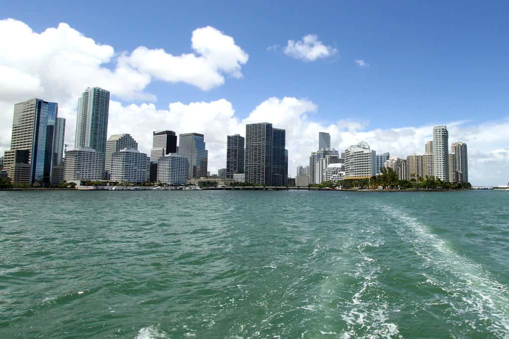
Miami reached 100 degrees Fahrenheit on Aug. 18, tying its all-time high temperature and marking only the second time the city has hit that mark in the official record, the first having occurred on July 21, 1942. The reading came during a heat episode that at one point placed heat advisories over the entire state of Florida and pushed heat index values as high as 113 degrees in parts of North Central Florida.
What the numbers show
Miami's 100-degree reading is remarkable specifically because South Florida's maritime climate normally caps afternoon temperatures. Surrounded by warm water on three sides, Miami typically sees sea breeze circulation develop by early afternoon, capping highs in the low-to-mid 90s even in the hottest months. Reaching 100 requires that circulation to fail or to be displaced.
Fort Lauderdale tied its record high on the same date. A heat advisory covering the full state was extended into a third consecutive day, and forecasters urged precautions statewide.
In Central Florida, an extreme heat warning was issued for Marion and Flagler counties with heat index values forecast to reach 110 to 113 degrees. Across Northeast Florida and Southeast Georgia, peak heat index values were forecast at 108 to 112 degrees over nearly the entire region.
Advisory, warning and what the difference means
The distinction between the products matters for how residents should respond. A heat advisory indicates that heat index values are expected to reach a threshold at which heat illness becomes likely for vulnerable people and for anyone working or exercising outdoors. An extreme heat warning indicates a higher threshold, at which heat illness becomes likely for the general population, not just vulnerable groups.
Heat index combines air temperature and relative humidity into a measure of how heat stress affects the body. Florida's persistently high dewpoints mean the state routinely produces heat index values well above the actual air temperature, and the humidity is precisely what makes the heat dangerous: it impairs evaporative cooling, which is the body's primary mechanism for shedding heat.
National Weather Service offices in Miami, Tampa Bay, Melbourne, Jacksonville, Tallahassee and Key West issue these products for their respective forecast areas, and the thresholds are calibrated regionally.
The Saharan dust factor
Forecasters noted hazy skies during the episode with the Saharan air layer overhead. That layer, a mass of dry dusty air that periodically crosses the Atlantic from Africa, has two competing effects on Florida weather.
It suppresses tropical cyclone development, which is one reason the Atlantic basin has been comparatively quiet during a period that normally begins ramping toward the season's peak. Dry air aloft and increased wind shear associated with the layer both work against organized tropical systems.
At the same time, the layer suppresses afternoon convection. Florida's characteristic summer thunderstorms provide daily cooling, and when dry air aloft prevents them from forming, afternoon temperatures climb higher and stay high later into the evening. That is a significant part of why this particular heat episode produced record readings.
Who is most at risk
Heat is consistently among the deadliest weather hazards in the United States, and the risk is concentrated in identifiable groups: outdoor workers, older adults, young children, people without reliable air conditioning, people with cardiovascular or respiratory conditions, and people taking certain medications that impair thermoregulation.
Florida's outdoor workforce is large. Agriculture, construction, landscaping, roofing and road work all involve sustained physical exertion in direct sun, and those sectors employ hundreds of thousands of Floridians. Heat illness in these settings typically develops over hours rather than minutes, which makes scheduled rest and hydration breaks the most effective intervention.
Vehicle heat is a separate and preventable danger. Interior temperatures in a parked car can rise dozens of degrees above ambient within minutes, and Florida has recorded pediatric vehicular heatstroke deaths in past summers.
What it means for Floridians
The practical guidance during advisories is straightforward: limit strenuous outdoor activity to early morning or evening, drink water before feeling thirsty, wear light-colored loose clothing, take breaks in shade or air conditioning, and check on elderly neighbors and relatives living alone.
Recognizing the progression matters. Heat exhaustion presents with heavy sweating, weakness, nausea, headache and cool clammy skin, and it is treated by moving to a cool place, loosening clothing and rehydrating. Heat stroke, characterized by a body temperature above 103 degrees, hot dry skin, confusion or loss of consciousness, is a medical emergency requiring an immediate call to 911 and aggressive cooling while awaiting help.
Counties including Miami-Dade have urged residents to take precautions during the episode and have publicized cooling locations. Residents without air conditioning should identify public cooling options in advance rather than during a peak-heat afternoon.
Electricity and infrastructure
Sustained statewide heat drives electricity demand to seasonal peaks as air conditioning systems run continuously. Florida's utilities plan generation capacity around summer peak load, and extended heat episodes test both generation and distribution infrastructure.
Transformers and distribution equipment operate less efficiently at high ambient temperatures, which raises the probability of localized equipment failures. Utilities typically increase field crew staffing during heat episodes for that reason.
Residential electricity bills rise correspondingly. For households already navigating elevated housing costs, insurance premiums and property tax bills, summer utility bills represent a meaningful additional pressure, and utility assistance programs administered through community action agencies exist for qualifying households.
Why Florida's heat is different
Florida rarely records the highest air temperatures in the United States. Desert Southwest cities routinely exceed 110 degrees, and Florida almost never does. What Florida produces instead is a combination of high temperature and extreme humidity that generates heat index values comparable to those places while offering none of the nighttime cooling.
Dry heat allows substantial overnight temperature drops as heat radiates away from the surface. Humid air traps it. Florida overnight lows in August frequently remain in the upper 70s or low 80s, which means the body never gets a recovery period between days of heat stress.
That cumulative effect is why multi-day heat events are more dangerous than single hot days. Heat-related illness and mortality data consistently show that risk rises with the duration of an episode rather than with peak temperature alone.
Urban heat and where it concentrates
Cities run hotter than surrounding areas because pavement, roofing and building materials absorb and re-radiate solar energy while vegetation that would provide evaporative cooling has been removed. The effect can add several degrees to nighttime temperatures in dense urban areas.
Within Florida cities, that burden is unevenly distributed. Neighborhoods with less tree canopy, more paved surface and older housing stock with less efficient cooling systems experience higher effective temperatures than neighborhoods a few miles away.
Several Florida local governments have undertaken tree canopy assessments and heat mapping in response, and Miami-Dade County established a chief heat officer position, among the first such roles in the United States, to coordinate heat response across county agencies.
What the records actually mean
Miami's official temperature record is maintained at Miami International Airport, and the observation site's history determines what counts as an all-time record. The 1942 date for the prior 100-degree reading reflects a record that spans more than eight decades of continuous observation.
Tying rather than exceeding an all-time record is a meaningful distinction in climatology. It indicates the station reached its historical ceiling without breaking through it, and single readings at individual stations are weaker evidence of climate trends than aggregate measures like the frequency of days above a threshold.
The more robust indicators are the number of days per year exceeding 90 or 95 degrees, overnight minimum temperatures and the length of the warm season. Those aggregate measures across Florida stations have generally trended upward over recent decades.
Practical preparation for the rest of the season
Florida's hottest stretch typically runs from late July through early September, which means the state has several weeks of elevated risk remaining. Households without reliable air conditioning should identify accessible cooling locations before they are needed.
For outdoor workers, the guidance from occupational health authorities centers on acclimatization for new workers, scheduled rest in shade, water intake of roughly one cup every 15 to 20 minutes during heavy exertion, and buddy systems so that early symptoms are noticed by someone.
Pets face the same risks and cannot communicate distress the same way. Pavement temperatures well above air temperature can burn paws, and dogs cool primarily by panting, which becomes ineffective at high humidity.
Schools and youth sports
Florida students returned to classrooms in mid-August across most of the state's 67 districts, which places outdoor athletics, marching band practice and physical education directly into the hottest weeks of the year.
The Florida High School Athletic Association and individual districts maintain heat policies governing practice modification, mandatory water breaks and, at defined thresholds, cancellation of outdoor activity. Wet bulb globe temperature, which accounts for humidity, radiant heat and air movement, is the measure increasingly used rather than heat index alone.
Exertional heat stroke is among the leading causes of sudden death in high school athletics and is largely preventable through acclimatization protocols, immediate recognition and rapid cooling. Cold water immersion at the site of collapse, before transport, is the intervention associated with the best outcomes.
Agriculture and outdoor industry
Florida agriculture operates through the summer, and workers in field crops, nurseries and citrus groves face sustained exposure. Heat illness among agricultural workers is underreported nationally, in part because the workforce includes seasonal and migrant labor with limited access to occupational health resources.
Construction faces parallel exposure, and Florida's construction employment is substantial given the state's development pace. Roofing in particular combines direct sun, radiant heat from surfaces and physical exertion.
Employer practices vary. Federal occupational safety guidance addresses heat, and several jurisdictions nationally have adopted specific heat standards. In Florida, practice is driven largely by employer policy and industry association guidance rather than by a state-specific outdoor heat standard.
What's next
Forecasters indicated the heat advisory pattern could continue through the week, and the seasonal climatology means Florida remains in its hottest stretch through early September. Relief typically arrives when the Saharan air layer clears and normal afternoon convection resumes, or when a tropical disturbance changes the regional pattern.
National Weather Service forecast offices issue updated advisories daily, and residents can check current conditions and warnings through weather.gov for their county. The Florida Division of Emergency Management coordinates statewide response when heat conditions warrant.
The Florida Press will continue to report on heat conditions and the state's weather through the remainder of the season.
Spotted an issue with this article?
Have something to say about this story?
Write us a letterComments
No comments yet. Be the first to weigh in.
Related Coverage

Isaias Brings Surge, Flooding Rain and Tornado Risk to Tallahassee and the Big Bend
3h ago

FPL Stages 12,000 Workers as Isaias Threatens Long Power Outages in the Panhandle
4h ago

Panhandle Evacuations Widen From Perdido Key to St. George Island as Major Hurricane Isaias Nears
1d ago

Soaked Northeast Florida Faces More Flooding as Tropical Storm Isaias Takes Aim at the Gulf Coast
1d ago