Florida Nears the Hurricane Season Peak With a Quiet Atlantic Basin
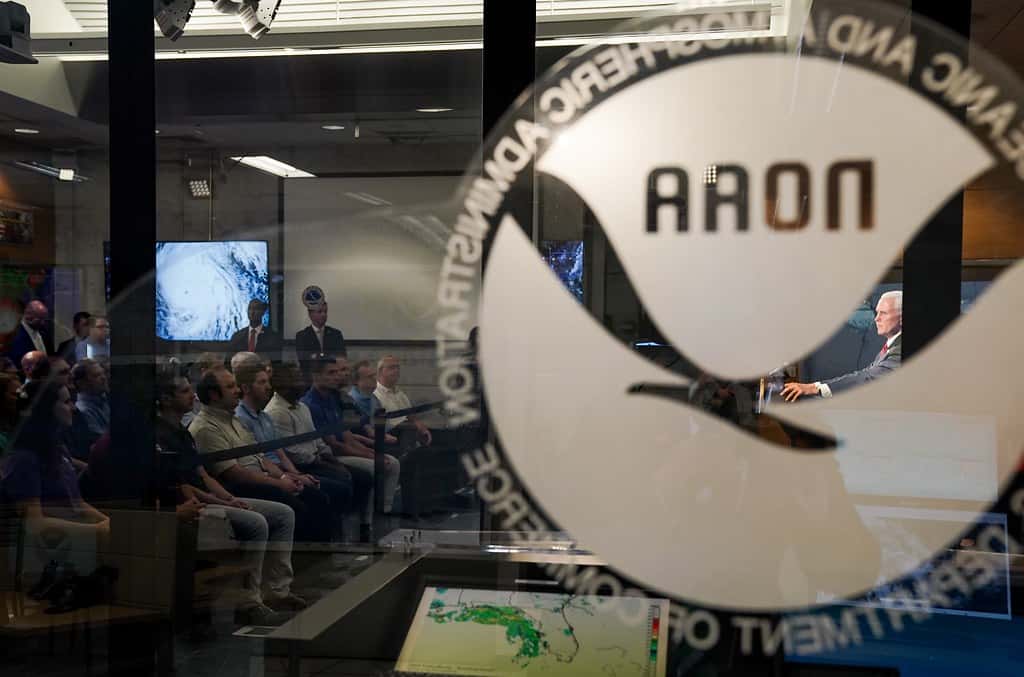
Florida is approaching the climatological peak of the Atlantic hurricane season with an unusually quiet basin. The National Hurricane Center's tropical weather outlook shows no organized systems threatening the United States, and the remnants of Tropical Storm Dolly, located several hundred miles east of the Leeward Islands, are moving west to west-northwest near 25 mph without a closed circulation. Forecasters have said redevelopment of that system is unlikely, though the wave could bring locally heavy rain and gusty winds to the Leeward Islands, the Virgin Islands and Puerto Rico over the coming days.
The quiet reflects a forecast that has held all season. NOAA's Climate Prediction Center has maintained its call for a below-normal 2026 Atlantic hurricane season, projecting 7 to 13 named storms, of which 2 to 6 could become hurricanes, including 0 to 2 major hurricanes of Category 3 strength or higher. The agency puts the probability of a below-normal season at 75 percent, a near-normal season at 20 percent and an above-normal season at just 5 percent.
None of that means Florida is out of the woods. September 10 is the statistical peak of the Atlantic season, and the period from late August through early October has historically produced the storms that have done the most damage in Florida. A below-normal season is a statement about total activity, not about whether any individual storm reaches the state.
What the season has produced so far
NOAA's mid-season update noted that as of its issuance, the season had produced two named tropical storms, Arthur and Bertha, and no hurricanes. Dolly has since formed and degenerated to a remnant low without becoming a hurricane, leaving the basin without a hurricane at a point in the calendar when an average season would typically have recorded at least one.
An average Atlantic season, measured over the 1991 to 2020 climatological period, produces 14 named storms, 7 hurricanes and 3 major hurricanes. Reaching late August with no hurricanes places 2026 well behind that pace, and the shortfall is consistent with what forecasters projected before the season began.
Seasonal totals, though, are a poor predictor of individual impact. Hurricane Andrew struck South Florida in 1992 during a season that produced only seven named storms, one of the quietest on record in terms of storm count. Andrew was a Category 5 at landfall in Homestead and remains among the most destructive hurricanes in American history.
The reverse also holds. Some highly active seasons have produced few or no United States landfalls, with storms recurving into the open Atlantic. Activity in the basin and impact on land are related but distinct, and the relationship between them is weak enough that emergency managers treat seasonal forecasts as background information rather than as planning inputs.
Why forecasters expect a quiet season
Seasonal hurricane forecasts rest primarily on sea surface temperatures in the tropical Atlantic and on the state of the El Nino Southern Oscillation in the Pacific. Warm Atlantic water provides the energy that fuels tropical cyclones. El Nino conditions in the Pacific increase wind shear over the Atlantic, which disrupts developing storms by tearing apart their vertical structure.
Other factors that forecasters weigh include the strength of the West African monsoon, which generates the tropical waves that seed most major Atlantic hurricanes, and the presence of Saharan dust, which introduces dry, stable air that suppresses convection. Saharan Air Layer outbreaks are common in June and July and typically diminish by late August.
Forecast skill for seasonal outlooks is real but limited. NOAA's outlooks have generally captured the broad direction of a season, and the agency expresses its forecasts as probability ranges rather than point estimates precisely because the underlying uncertainty is substantial. Maintaining a below-normal call into August, as NOAA has done, indicates the conditions supporting that forecast have persisted.
What seasonal forecasting cannot do is predict landfall. Whether a storm strikes Florida depends on steering patterns that exist for a few days at a time and that are unpredictable more than roughly a week out. No seasonal outlook has ever forecast a specific landfall location, and none claims to.
Understanding watches, warnings and cones
Because a quiet season lulls attention, it is worth reviewing the terminology that will matter if a system does develop. A tropical storm or hurricane watch means those conditions are possible within the specified area, generally issued 48 hours before the anticipated onset of tropical-storm-force winds. A warning means those conditions are expected, generally issued 36 hours ahead.
The distinction is not academic. A watch is the signal to complete preparations, secure property and review evacuation plans. A warning means the window for those activities is closing. Residents who wait for a warning to begin preparing frequently find that stores are stripped, gas lines are long and roads are congested.
The forecast cone, formally the track forecast cone, depicts the probable track of the storm's center, not the extent of its effects. Historically, the center stays within the cone about two-thirds of the time, which means it falls outside roughly one time in three. Hazards including storm surge, wind and rainfall regularly extend far beyond the cone's edges.
Storm surge is forecast separately, through the National Hurricane Center's storm surge watch and warning products and its potential storm surge flooding map. Surge is the leading cause of death in United States hurricanes, and Florida's low-lying Gulf coast, its barrier islands and the Big Bend region are particularly exposed.
Evacuation zones are not counties
Florida evacuation orders are issued by county emergency management and are zone-specific. An evacuation order covering Zone A in Pinellas County does not mean every Pinellas resident must leave, and treating it that way produces unnecessary road congestion that impedes the people who genuinely need to move.
Every coastal Florida county publishes evacuation zone maps, generally labeled A through E, based on storm surge modeling rather than on wind risk. Residents can look up their own address on their county emergency management website, and the state maintains the Florida Division of Emergency Management site as a central portal to county resources.
Mobile and manufactured homes are a separate category. Those structures are typically ordered evacuated regardless of zone during hurricane conditions because they are vulnerable to wind rather than only to surge, and that instruction applies inland as well as on the coast.
Special needs registries exist in every Florida county for residents who require assistance evacuating or who depend on electrically powered medical equipment. Registration takes place in advance, not during a storm, and county emergency management offices accept registrations year-round.
What Floridians should do during the quiet
A quiet basin is the right time to handle preparations that become impossible once a storm is named. Supply kits assembled in late August are cheaper and easier to build than the same kits assembled during a warning, and Florida's disaster preparedness sales tax holidays have historically applied during periods like this one.
Documentation is the item most often neglected. Photographing or videoing the interior and exterior of a home, along with major possessions, creates a record that substantially simplifies an insurance claim. Storing that record in cloud storage rather than only on a phone protects it if the device is lost.
Insurance policies should be reviewed before rather than after. Flood damage is not covered by standard homeowners policies and requires separate coverage through the National Flood Insurance Program or a private flood carrier, and new NFIP policies generally carry a 30-day waiting period before taking effect. A policy purchased when a storm is approaching will not cover that storm.
Roof condition, tree trimming and gutter clearing are the physical preparations with the highest return. Florida's wind mitigation discount framework also means that documented improvements to roof attachment and opening protection lower insurance premiums, which makes those investments pay back independently of whether a storm arrives.
Power, fuel and the practical aftermath
Extended power outages are the most common hurricane consequence Floridians actually experience, more common than structural damage and more disruptive than most people anticipate. Florida's utilities have invested substantially in grid hardening, including concrete poles, underground conversion in some areas and vegetation management, and restoration times have shortened compared with storms of a decade ago.
Restoration follows a sequence rather than a first-come basis. Utilities restore transmission infrastructure and critical facilities including hospitals, water treatment plants and emergency operations centers before working outward through substations and distribution circuits, which is why neighboring streets are sometimes restored days apart.
Generator safety causes preventable deaths after every major storm. Carbon monoxide from generators operated in garages, on porches or near windows kills people every hurricane season, and the guidance is unambiguous: generators belong outdoors, well away from windows and doors, never in any enclosed or partially enclosed space.
Fuel availability becomes constrained both before and after a storm. Florida law requires certain gas stations along evacuation routes to have transfer switches allowing generator connection, and the state maintains fuel distribution plans, but stations without power cannot pump regardless of whether their tanks hold fuel.
What's next
The National Hurricane Center issues tropical weather outlooks every six hours during hurricane season, covering the Atlantic basin and identifying areas with development potential over the next two and seven days. Those outlooks are the authoritative first signal that something may be developing.
September and early October remain the highest-risk window for Florida. The Cape Verde season, in which waves emerging off West Africa develop into long-track hurricanes, typically peaks during this period, and those systems have historically produced some of Florida's most significant landfalls.
The season officially ends November 30. Late-season storms tend to form in the western Caribbean and Gulf rather than the deep tropics, and those systems can develop close to land with less lead time, which makes October and November storms operationally challenging even when they are weaker.
Floridians should monitor the National Hurricane Center directly, along with National Weather Service forecast offices in Miami, Tampa Bay, Jacksonville, Melbourne, Tallahassee and Key West, and their own county emergency management office for zone-specific guidance if a system develops.
Spotted an issue with this article?
Have something to say about this story?
Write a letter to the editorComments
No comments yet. Be the first to weigh in.
Related Coverage

King Tides Set Record at Port Everglades Gauge, Flooding Streets From Fort Lauderdale to Miami Beach
2d ago
Florida's First Fall Cold Front Delivers Cooler Air and Strong Coastal Winds as a Nor'easter Develops Offshore
6d ago
Atlantic enters October without a hurricane, a satellite-era first
Sep 25
Hurricane Season Enters Its Final Weeks With Six Named Storms and No Atlantic Hurricanes
Sep 23