Atlantic Hurricane Season Opens June 1 With NOAA Forecasting a Below-Normal Year for Florida

The 2026 Atlantic hurricane season officially opens June 1, and federal forecasters are entering it with a comparatively reassuring outlook: NOAA expects a below-normal year for tropical activity. For Floridians, who live with the threat of landfalling storms more than residents of any other state, the forecast is welcome news. But emergency managers are quick to add the line they repeat every June, that a quiet season can still produce the one storm that changes everything for a community.
What NOAA is predicting
NOAA's seasonal outlook assigns the highest probability to a below-normal season, with a smaller chance of a near-normal year and only a slim chance of above-normal activity. In terms of named storms, the agency's range calls for fewer storms than the long-term average, with a correspondingly smaller number expected to reach hurricane strength and only a handful, if any, projected to become major hurricanes of Category 3 or stronger.
For comparison, an average Atlantic season produces roughly 14 named storms, about seven hurricanes, and three major hurricanes. The 2026 forecast sits beneath those benchmarks, which is why the agency characterizes the season as likely below normal. The numbers are a forecast of overall basin activity, not a prediction of where or when any storm will form or strike.
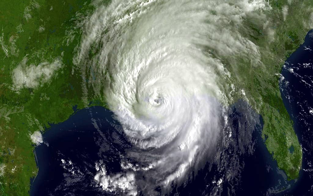
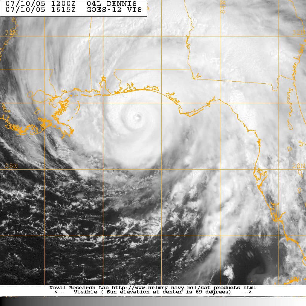
That distinction is the single most important thing for Floridians to understand. A seasonal outlook describes how busy the basin is expected to be; it says nothing about landfall. Florida has been struck by destructive hurricanes during seasons forecast to be quiet, and a single well-placed storm can cause catastrophic damage regardless of the season's total count.
History reinforces the point. Some of the most damaging storms to hit the United States have arrived in seasons that produced relatively few named systems overall, while busier seasons have at times passed with little impact on any particular stretch of coastline. The total count is a measure of basin activity, not a measure of risk to any one community. For a state with more than a thousand miles of coastline and millions of residents living within reach of storm surge, the relevant question is never how many storms form but whether any of them turns toward Florida.
Forecasters also stress that seasonal outlooks carry inherent uncertainty. They are built from climate signals that are understood well enough to shift the odds but not well enough to pinpoint outcomes months in advance. A forecast favoring a below-normal season means the conditions tilt toward fewer storms, not that an active or destructive year is impossible. Residents who treat the outlook as a forecast of their personal risk, rather than as a description of basin-wide tendencies, can be lulled into a false sense of security that the data was never meant to provide.
Why forecasters expect a calmer season
The primary driver behind the below-normal outlook is the expected development and strengthening of El Nino, the climate pattern marked by warmer waters in the tropical Pacific. El Nino tends to increase wind shear over the Atlantic, and strong upper-level winds can tear apart developing storms before they organize, suppressing tropical development across the basin.
Other factors are more mixed. Atlantic ocean temperatures are expected to run slightly warmer than normal, which on its own would tend to fuel storms, and trade winds may be weaker than average. The net effect, in NOAA's analysis, is that the suppressive influence of El Nino is likely to outweigh the factors that favor development, tipping the season toward below-normal activity.
Forecasters caution that these are probabilistic judgments. El Nino's strength and timing can shift, and the outlook will be updated in early August, ahead of the historical peak of the season that typically runs from mid-September through October. The early-season forecast is a starting point, not a guarantee.
The interplay between competing influences is what makes seasonal forecasting difficult. Warm ocean water supplies the energy that fuels tropical systems, so an Atlantic running warmer than normal would, in isolation, argue for a more active year. Wind shear works in the opposite direction, disrupting the vertical structure a storm needs to organize and intensify. When El Nino strengthens shear across the basin while ocean temperatures remain elevated, the season's character depends on which factor dominates, and this year forecasters judge the suppressive effect of shear to be the stronger hand. Small shifts in that balance, however, can move a season from quiet to busy.
The August update will carry particular weight because it lands just before the climatological peak. By late summer, forecasters have a clearer read on how El Nino has actually evolved and how Atlantic conditions are shaping up, which sharpens the outlook for the most dangerous stretch of the season. Floridians should treat the June forecast as preliminary and watch for that revision, since the months of September and October historically account for a large share of the storms that threaten the state.
What it means for Floridians
A below-normal forecast should not translate into complacency, and Florida officials have made that their central message as the season opens. The state's emergency management apparatus urges residents to use the early part of the season, when the tropics are usually quiet, to prepare rather than to relax. That means building a disaster supply kit, reviewing insurance coverage, knowing your evacuation zone, and having a family communication plan in place before a storm is on the horizon.
Insurance is a particular point of focus this year. Florida's property insurance market has shown signs of stabilizing, with rate cuts and new carriers entering the state, but a major landfall could test that recovery quickly. Homeowners are encouraged to confirm what their policies cover, including the separate question of flood insurance, which standard homeowners policies typically exclude and which is critical given Florida's vulnerability to storm surge and inland flooding.
Preparation also extends to the basics of personal safety. Knowing the difference between a watch and a warning matters: a hurricane watch means storm conditions are possible within roughly 48 hours, while a warning means conditions are expected, generally within 36 hours. Evacuation orders, when they come, are typically tied to specific zones rather than entire counties, so residents should learn their zone in advance.
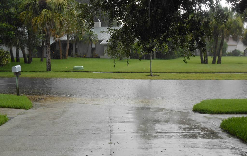
Storm surge deserves special emphasis because it is consistently among the deadliest hazards a hurricane brings. Surge is the wall of seawater pushed ashore by a storm's winds, and it can inundate low-lying neighborhoods well away from the immediate point of landfall. Much of Florida's developed coastline sits at low elevation, which means that the decision to evacuate is frequently driven by surge risk rather than wind alone. Officials urge residents in surge-prone zones to leave when told to, since waiting until conditions deteriorate can cut off escape routes and trap people in rising water.
A practical preparedness kit goes beyond bottled water and flashlights. Emergency managers recommend keeping enough supplies to be self-sufficient for several days, including nonperishable food, medications, cash in small bills in case card systems are down, copies of important documents, chargers and backup power for phones, and supplies for infants and pets. Assembling those items before a storm threatens avoids the crowded stores and empty shelves that accompany a watch or warning, and it frees residents to focus on protecting their property and deciding whether to evacuate when a system is bearing down.
Lessons from recent seasons
Florida's recent history is a reminder of why officials refuse to let a calm forecast lower their guard. The state has endured devastating storms in recent years, with surge, wind, and freshwater flooding inflicting damage across multiple regions. Those events reshaped communities, strained the insurance market, and tested evacuation and recovery systems.
Each storm has also produced lessons that feed into the next season's preparations, from improved surge modeling to refined evacuation planning and hardened infrastructure. Utilities pre-stage crews, counties update shelter plans, and the state coordinates with federal partners on response logistics. Much of this work happens quietly in the spring so that it is in place when a system threatens.
The recent run of damaging seasons left a financial and emotional imprint that extends far beyond the immediate cleanup. Insurance claims from major storms rippled through Florida's property insurance market, contributing to the cost pressures that homeowners have felt in their premiums. Recovery from a significant hurricane can take years, as communities rebuild homes, repair public infrastructure, and restore the local economies that depend on tourism and seasonal residents. That long tail is one reason officials frame preparedness not just as a matter of surviving the storm but of protecting the financial stability of households and the state alike.
Building codes are another piece of the resilience picture. Florida strengthened its construction standards after past catastrophes, and homes built or retrofitted to modern wind and roofing standards tend to fare better in high winds. Those same features can also reduce insurance costs, linking the physical protection of a property to its affordability. The state's emphasis on stronger construction reflects a recognition that the most effective response to hurricane risk begins long before a storm forms, in the way communities are built and maintained.
How to track the season
The National Hurricane Center in Miami is the authoritative source for tropical forecasts, advisories, watches, and warnings. Floridians are encouraged to rely on official sources, including the hurricane center and local National Weather Service offices, rather than on viral social media posts that can spread outdated or exaggerated forecasts. Local emergency management agencies provide county-specific guidance, including evacuation zone lookups and shelter information.
Residents who depend on electricity for medical equipment, who have mobility limitations, or who live in mobile homes face particular risks and should make plans well ahead of any threat. Registering for special-needs shelters and identifying transportation options in advance can be lifesaving when an order comes down.
What's next
With the season now open, attention turns to the tropics and to NOAA's updated outlook in August. Early-season storms are possible, though the climatological peak remains months away. The practical takeaway for Floridians is unchanged by the favorable forecast: prepare now, know your zone, secure your insurance, and stay tuned to official sources. A below-normal season is good news, but in a state defined by its coastline, readiness is the only reliable defense.
Spotted an issue with this article?
Have something to say about this story?
Write a letter to the editor