Heavy Rain and Flooding Threat Spreads Across Florida as Bertha Organizes
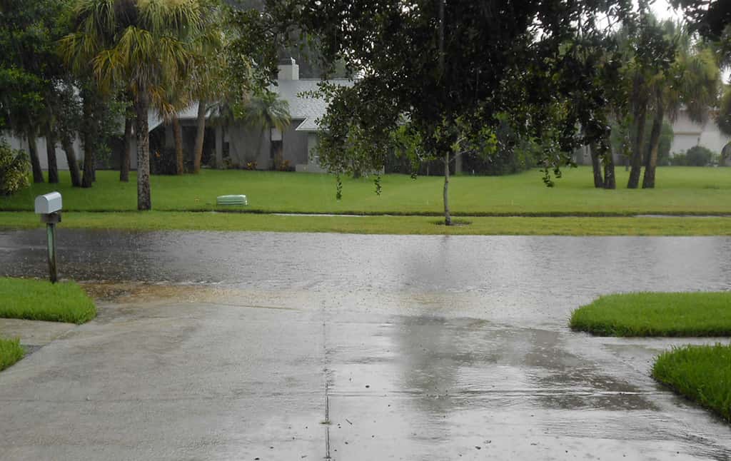
Even as forecasters track the center of soon-to-be Tropical Storm Bertha off the northern Gulf coast, the more widespread danger for Florida this week is water falling from the sky. A slow-moving, moisture-rich tropical system is drawing tropical downpours over much of the state, and the National Weather Service warns that repeated rounds of heavy rain could produce flash flooding well beyond the Panhandle, reaching the Big Bend, Northeast Florida, and Central Florida.
Rainfall, not wind, is the headline threat with this storm. Because the system is crawling along at only a few miles per hour, bands of heavy rain can stall over the same communities for hours, overwhelming storm drains and turning low spots into hazards. Emergency managers are urging residents to prepare for a soggy, disruptive stretch that could complicate the Monday commute and linger through the middle of the week.
How much rain is expected
Forecasters expect widespread totals of 2 to 4 inches across the eastern and central Gulf coast, with locally higher amounts up to 8 inches possible from western Florida into southern Alabama, Mississippi, and Louisiana. Those isolated higher totals are the ones that produce dangerous flash flooding, particularly in urban corridors where pavement sheds water quickly and drainage systems are already near capacity during a wet summer.
The Florida Division of Emergency Management identified the Big Bend, Northeast Florida, and Central Florida as the areas most likely to see the heaviest rainfall as the system's moisture spreads inland. That places metro areas such as Tallahassee, Jacksonville, and the greater Orlando region in the zone where multiple rounds of downpours could stack up over a short period.
Rain totals in any single neighborhood depend heavily on where the slow-moving bands set up, which is difficult to pinpoint days in advance. That uncertainty is exactly why officials frame the threat as a statewide readiness issue rather than a problem confined to the coast near the storm's center.
Why flash flooding is the main danger
Flash flooding is the deadliest hazard in most tropical systems, and it is especially insidious with weak, slow storms that never generate dramatic winds. The danger builds quietly as rain accumulates, then arrives fast when a drainage ditch, canal, or underpass fills beyond capacity. Urban and low-lying areas are most vulnerable, and water can rise on roads that looked passable minutes earlier.
The National Weather Service's long-standing guidance applies directly this week: turn around, do not drown. Roughly a foot of moving water can float many passenger vehicles, and standing water can conceal a washed-out road, a downed power line, or debris. Most flood deaths involve people driving into water they believed was shallow, which makes avoiding flooded roads the single most effective safety step a Floridian can take.
Beyond the roads, prolonged rain raises the risk of localized river and creek flooding in the days after the heaviest downpours, since it takes time for runoff to move through Florida's flat watersheds. Residents near small rivers and retention systems should watch for rising water even after the rain tapers.
Coastal and beach hazards
Along the Gulf, the storm is expected to push water 1 to 3 feet above normally dry ground in the Big Bend from Indian Pass to Chassahowitzka, enough to flood vulnerable coastal roads and low structures near the shoreline if the peak coincides with high tide. Minor coastal flooding is possible elsewhere along the northeastern Gulf coast depending on the storm's exact track and timing.
Beachgoers face a separate and often underestimated threat. Forecasters warn of an increased risk of dangerous rip currents and isolated waterspouts along portions of the northeastern Gulf coast, hazards that can be deadly even on days when the storm feels distant and the sky is only partly cloudy. Swimmers should heed lifeguard flags and local closures, and boaters should expect choppy, hazardous conditions.
A few brief, spin-up tornadoes are also possible in the outer rain bands, a common feature of landfalling and near-shore tropical systems. These tornadoes form quickly and can touch down with little warning, reinforcing the need to keep a reliable way to receive alerts overnight.
How to prepare at home
Officials recommend a straightforward set of preparations that fit a rain-driven event. Clear gutters and storm drains near your property so water can move freely, bring in or secure loose outdoor items that could clog drainage or become airborne in a gust, and move valuables off the floor in flood-prone garages and ground levels. Drivers should map alternate routes that avoid known low spots and underpasses.
Residents should also make sure phones are charged, keep flashlights and batteries handy in case of scattered power outages, and have a plan for pets and medications if flooding forces a temporary move to higher ground. Because this system is not forecast to bring destructive wind statewide, the focus is on managing water safely rather than on major structural protection, though Gulf coast residents in the watch area should complete storm preparations now.
What it means for Floridians
For most of the state, the week ahead means an unsettled, stormy pattern rather than a catastrophe: heavy rain, localized street flooding, travel delays, and hazardous surf. The practical impact will be felt in slowed commutes, saturated yards, and the need to give flooded roads a wide berth. For low-lying and coastal communities in the Big Bend and Panhandle, the risk is more direct and warrants close attention to local guidance.
The event is also a reminder that flood damage and wind damage are handled by separate insurance policies, and that standard homeowners coverage generally excludes rising water. Homeowners in flood-prone areas are often urged to review their flood coverage before storms arrive, since new policies typically carry a waiting period and cannot be added at the last minute.
Why slow storms flood the worst
The defining feature of this system, and the reason its flooding threat is elevated, is its sluggish forward speed. A storm that races inland dumps its rain over a wide swath and moves on quickly, but a storm that crawls can park bands of heavy rain over the same communities for hours. That is how a system with modest winds can produce the kind of totals that overwhelm drainage and flood neighborhoods.
Florida's flat terrain compounds the problem. With little natural slope to carry water away, runoff moves slowly through canals, retention ponds, and drainage systems that can quickly reach capacity during sustained rain. Once those systems fill, additional rain has nowhere to go, and water backs up onto roads, into yards, and toward low-lying structures.
The result is that rainfall, not wind, is the deadliest and most widespread hazard from systems like this one. Officials emphasize that residents should judge the threat by the forecast rain totals and flood watches for their area, not by the category or intensity of the storm, which can badly understate the danger a slow, wet system poses.
Preparing businesses and vehicles
The flooding threat extends beyond homes to businesses and vehicles, which often bear the brunt of urban flooding. Business owners in flood-prone areas are advised to move inventory and equipment off the floor, check that drainage around their property is clear, and have a plan for protecting or relocating vehicles that could be damaged by rising water in parking lots and low-lying streets.
Vehicles are especially vulnerable, and not only when they are being driven. Cars parked in low spots, underpasses, or flood-prone garages can be inundated and totaled by water that rises overnight. Moving vehicles to higher ground before the heaviest rain arrives is a simple precaution that can prevent a costly loss.
For drivers, the guidance bears repeating because it saves lives: never drive through a flooded roadway. Water depth is deceptive, moving water exerts tremendous force, and standing water can hide hazards from downed lines to washed-out pavement. Turning around and finding another route is always the safer choice, even when it means a longer trip.
The days after the rain
The flooding threat from a slow tropical system does not end when the rain stops. In Florida's flat terrain, runoff moves slowly through canals, creeks, and small rivers, and water levels can continue rising for a day or more after the heaviest downpours have passed. Residents near waterways should remain alert to that delayed flooding even once the skies clear.
Saturated ground also brings secondary hazards. Waterlogged soil weakens the hold on trees, raising the risk of limbs or whole trees falling in subsequent wind gusts, which can damage property and knock out power. Standing water left behind by flooding can create mosquito-breeding conditions and, in some cases, contamination concerns, adding to the cleanup and health considerations after a storm.
For these reasons, officials urge residents not to let their guard down the moment the rain eases. The recovery period carries its own risks, and continuing to monitor local advisories, avoid lingering floodwater, and exercise caution around weakened trees and damaged infrastructure is an important part of weathering a rain-driven event safely.
What is next
The National Weather Service and National Hurricane Center will continue to refine rainfall forecasts and issue flood watches and warnings as the system's bands develop. Watches for flash flooding could be posted for parts of the peninsula if guidance points to the heaviest totals setting up over populated areas.
Floridians should monitor local forecasts, sign up for county emergency alerts, and be prepared to change travel plans on short notice through the middle of the week. The Florida Press will continue to track rainfall totals, flood advisories, and any coastal impacts as Bertha moves through the northern Gulf.
Spotted an issue with this article?
Have something to say about this story?
Write us a letterComments
No comments yet. Be the first to weigh in.
Related Coverage

Storm-Force Low Off Southeast Coast Brings Gales, 12-Foot Surf and Rip Currents to Florida's Atlantic Beaches
7h ago
Strong fall cold front brings Florida Saturday rain, cooler air and dangerous surf this weekend
3d ago

Hurricane Center Gives Atlantic Low Near Cabo Verde a 20% Chance as Florida Gets a Break After Isaias
6d ago

Tallahassee and the Big Bend Escape Isaias' Worst, With Downed Trees, Brief Outages and Rising Rivers to Watch
Oct 9