Florida Enters Peak Hurricane Season With a Quiet Atlantic and a New Preparedness Push
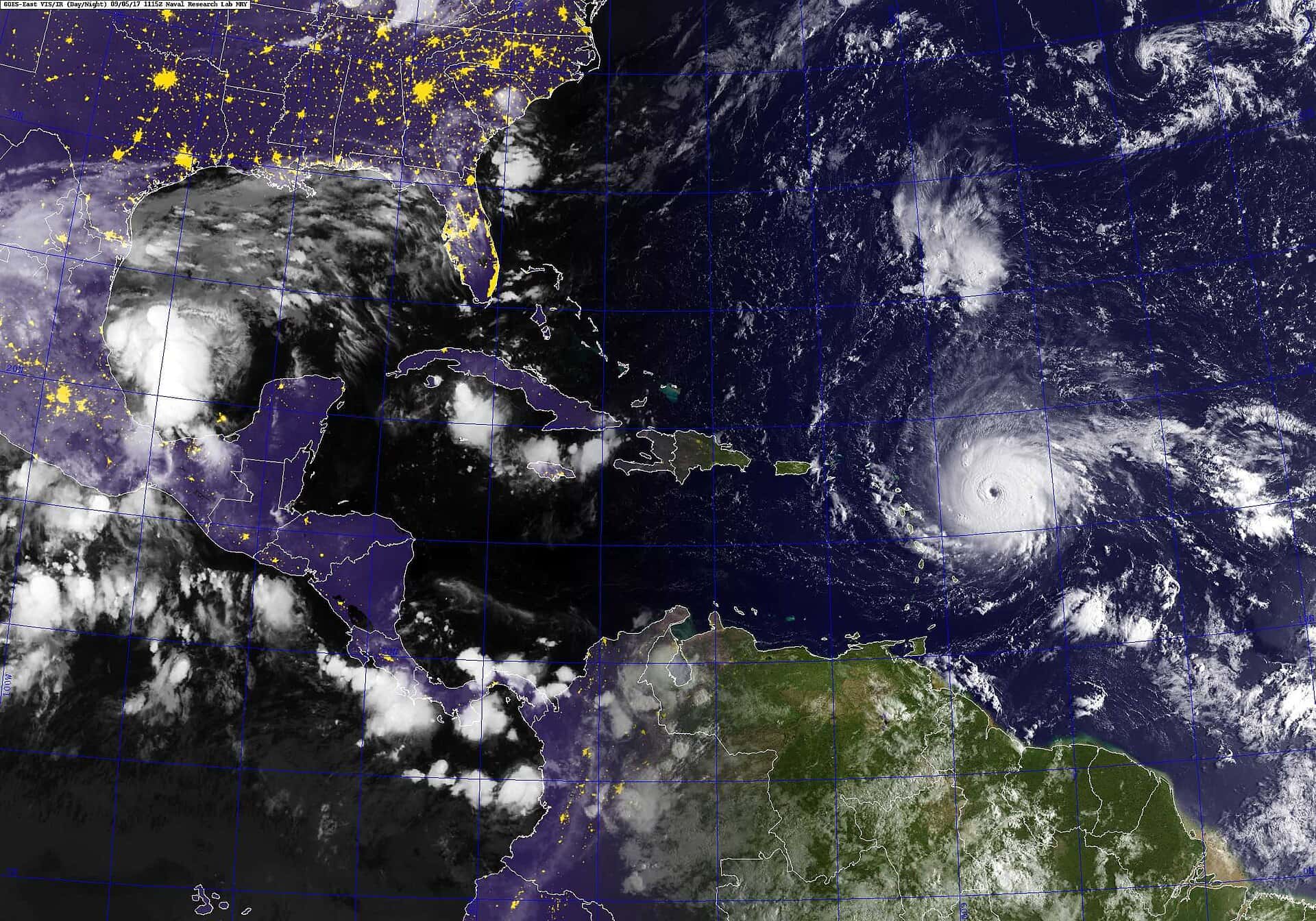
Florida has arrived at the statistical peak of the Atlantic hurricane season with an unusually empty map in front of it. The National Hurricane Center's tropical weather outlook issued on September 3 found no tropical cyclone formation expected across the Atlantic basin, the Caribbean Sea or the Gulf over the following seven days. The basin has produced just two named storms so far in 2026, Tropical Storm Arthur and Tropical Storm Bertha, and no hurricanes at all.
That quiet is arriving at the exact moment forecasters normally brace for the busiest stretch of the year. September 10 is the climatological peak of the Atlantic season, the single date on which tropical activity has historically been most likely. For Florida, which sits at the receiving end of most Gulf and Atlantic tracks, the combination of a calm basin and a peak-season calendar creates an awkward message: the risk window is open, even if the radar is empty.
Governor Ron DeSantis declared September as Florida Preparedness Month on September 2, an announcement handled through the Florida Division of Emergency Management. The declaration asks residents to use the month to confirm their evacuation zone, build a disaster supply kit and settle on a family plan before a storm forces those decisions under pressure. State officials pointed to the recent record as justification, noting that Hurricanes Ian, Helene and Milton all struck Florida during or after September.
What the forecast actually says
NOAA's updated seasonal outlook, issued in August, raised the odds of a below-normal season to 75 percent, up from the 55 percent the agency assigned in its preseason forecast. A near-normal season now carries roughly a 20 percent chance and an above-normal season about 5 percent. The agency's revised numbers call for 7 to 13 named storms, 2 to 6 hurricanes and 0 to 2 major hurricanes through the end of November, ranges that include Arthur and Bertha.
The driver behind the downgrade is El Nino. NOAA has placed the odds of a strong or very strong El Nino during August, September and October at roughly 90 percent. Strong El Nino events reliably increase upper-level winds over the tropical Atlantic, and that wind shear tends to tear apart developing systems before they can organize into a closed circulation, much less strengthen into a hurricane.
None of that is the same as a guarantee. A below-normal season describes the total count of storms across an entire basin over six months, not the probability that any one of them finds Florida. The state has been struck in seasons that finished well below average, and a single landfall in the wrong place produces the same damage totals whether the season ended with eight named storms or twenty.
It is also worth being precise about the terminology, because the difference matters when orders start moving. A hurricane watch means hurricane conditions are possible in a specified area, generally within 48 hours. A hurricane warning means those conditions are expected, generally within 36 hours. A watch is the signal to finish preparations. A warning is the signal that the window has closed.
Why a slow season creates its own risk
Emergency managers have a name for the pattern Florida is living through right now, and it is not a comfortable one. A quiet start tends to erode the readiness habits that a busy start reinforces. Households that have not needed a generator, a stocked pantry or a plan for pets in two months are measurably less prepared than households that watched a storm approach in July and rehearsed the drill.
The state's message this month leans directly against that drift. Knowing an evacuation zone is the single most consequential piece of information a coastal Florida household can hold, because evacuation orders in Florida are issued by zone rather than by county. A county-level headline saying that evacuations have been ordered in Pinellas County does not mean every resident of Pinellas County is being told to leave. It means specific lettered zones, usually the lowest-lying and most surge-exposed, are under orders.
Storm surge, not wind, remains the leading cause of hurricane deaths in the United States, and Florida's shallow continental shelf on the Gulf side makes the state particularly efficient at converting a moderate storm into a serious surge event. That physical reality does not change with the seasonal forecast. A Category 1 hurricane arriving at high tide over the Big Bend can push water further inland than a stronger storm hitting a steeper coastline.
What preparedness month is asking for
The state's guidance follows a familiar structure, and it is deliberately unglamorous. Residents are asked to assemble supplies sufficient for several days without power or resupply, including water, non-perishable food, medications, batteries and a way to receive official information when cellular service degrades. Documents, insurance policies and identification should be photographed or stored where they survive a flooded house.
Florida also changed the economics of this exercise earlier in 2026. The state made its disaster supply sales-tax exemption permanent rather than confining it to the traditional short holiday windows, which means the eligible items stay tax-free through the season rather than only during a designated stretch in late spring. Households that put off buying supplies during the quiet summer are not facing a closed pricing window.
Pet planning and medical planning are the two areas emergency managers most consistently flag as underdone. Not every public shelter accepts animals, and the shelters that do generally require proof of vaccination and a carrier. Residents who depend on electricity for oxygen concentrators, refrigerated medication or powered mobility equipment are urged to register with their county special needs program before a storm rather than during one.
The insurance and federal backdrop
The preparedness message lands against a shifting policy backdrop. The National Flood Insurance Program's authorization had been set to lapse at the end of September, a deadline that would have interrupted the ability to write and renew new flood policies at the precise moment Florida closings depend on them. Congressional action on a short-term funding measure has pushed that authorization further into the calendar, but the program still lacks a long-term reauthorization.
Florida holds more NFIP policies than any other state by a wide margin, which makes every short-term extension a Florida story. Standard homeowners policies in Florida do not cover flood damage, and mortgage lenders in designated flood zones require separate flood coverage as a condition of the loan. A lapse in the program's authority to write new contracts stalls real estate transactions across the state.
On the property insurance side, the market has been comparatively calmer this year than in the recent past. Citizens Property Insurance Corporation, the state-backed insurer of last resort, implemented rate reductions for its personal lines policyholders in 2026, and its policy count has fallen sharply from its 2023 peak as private carriers absorbed policies. A destructive September would test how durable that improvement is.
Power, fuel and the first 72 hours
The most predictable consequence of a Florida landfall is not structural damage but electricity loss, and the scale is routinely underestimated by residents outside the immediate impact zone. Utility restoration proceeds in a fixed order that prioritizes transmission infrastructure, then hospitals and water treatment plants, then the circuits serving the largest numbers of customers. A house at the end of a rural distribution line is at the end of the queue by design.
Florida Power and Light and the state's other major utilities pre-stage crews and materials before landfall, and mutual aid agreements bring line workers in from out of state. Even with that machinery, restoration after a significant storm is measured in days across most of the affected area and in weeks in the hardest-hit counties. Household planning should assume the longer number rather than the shorter one.
Fuel is the other predictable pinch point. Gas stations lose the ability to pump without power, and the pre-storm rush routinely empties stations along evacuation routes days before a storm arrives. Emergency managers advise keeping vehicle tanks above half through the season rather than filling up when a storm enters the forecast cone, which is precisely when lines form.
Cash matters for the same reason. Card readers and ATMs depend on power and connectivity, and the first days after a storm are frequently a cash economy in the affected counties. Households that plan around this detail avoid a specific and common form of post-storm frustration.
What forecasters are watching
Even in a suppressed season, the second half of September and October carry meaningful risk for Florida specifically. Late-season activity tends to shift toward the western Caribbean and the Gulf, which is the geography that produces short-fuse threats to the Florida peninsula and the Panhandle. Systems that form close to home give residents days rather than a week to react.
Meteorologists will be tracking whether El Nino's suppression holds through October or relaxes enough to allow a Caribbean system to organize. Sea surface temperatures across the Atlantic basin remain warm enough to support development if the wind shear pattern breaks down, which is why forecasters have declined to call the season over despite the quiet stretch.
The practical guidance from state and federal forecasters has not changed with the downgraded outlook. Residents are advised to monitor the National Hurricane Center's outlooks directly rather than relying on long-range model images circulated on social media, which routinely show storms that never form. Official advisories, watches and warnings come from the Hurricane Center, and evacuation orders come from county emergency management.
What's next
The peak date passes on September 10, but the season runs through November 30. Florida's own history is the reason state officials keep repeating that the calendar does not close early. Hurricane Michael struck the Panhandle in October. Hurricane Wilma crossed South Florida in late October. A below-normal season with a single Florida landfall is, for the households in the cone, a catastrophic season.
County emergency management offices across the state will spend the month running preparedness events, updating evacuation zone lookup tools and pushing residents toward their local alert systems. Those tools are the most useful thing a Florida household can engage with while the tropics are quiet, because they are difficult to navigate once a storm is three days out and traffic is building on the interstates.
For now, the forecast offices are in a rare and welcome position: nothing to track, and a month of runway to convince people to get ready anyway.
Spotted an issue with this article?
Have something to say about this story?
Write us a letterComments
No comments yet. Be the first to weigh in.
Related Coverage

Storm-Force Low Off Southeast Coast Has 40% Chance to Turn Subtropical as Florida Coast Faces Tidal Flooding, Rough Surf
20h ago
Strong fall cold front brings Florida Saturday rain, cooler air and dangerous surf this weekend
3d ago

Hurricane Center Gives Atlantic Low Near Cabo Verde a 20% Chance as Florida Gets a Break After Isaias
Oct 12

Tallahassee and the Big Bend Escape Isaias' Worst, With Downed Trees, Brief Outages and Rising Rivers to Watch
Oct 9