Forecasters Watch Gulf for Early-Season Tropical Development as Florida Braces for Heavy Rain
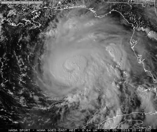
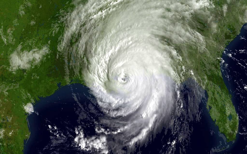
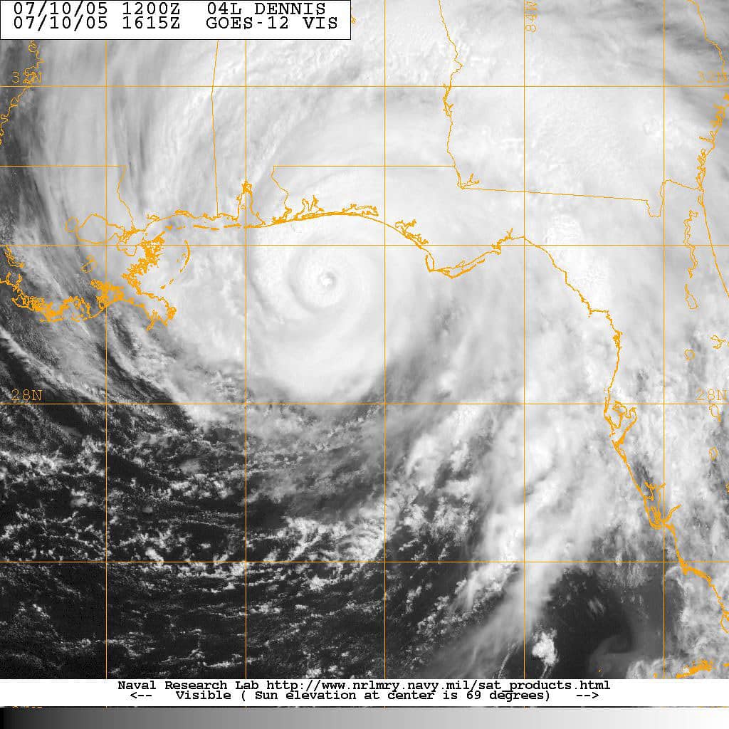
Just days into the 2026 Atlantic hurricane season, forecasters are keeping a close watch on the Gulf for signs of early tropical development that could funnel heavy rain into Florida. Warm waters and a shifting weather pattern have raised the odds of a tropical depression or storm forming in waters stretching from Mexico toward the Florida peninsula in the coming days, an early reminder that the tropics demand attention from the very start of the season.
The National Hurricane Center began issuing its routine daily tropical outlooks at the start of the season on June 1, with updates released at 2 a.m., 8 a.m., 2 p.m., and 8 p.m. Eastern. While the center has not flagged an imminent named storm in its initial outlooks, private and public forecasters note that conditions over the central and eastern Gulf are gradually becoming more favorable for organization, and they are watching a broad zone for any sign that a disturbance is consolidating.
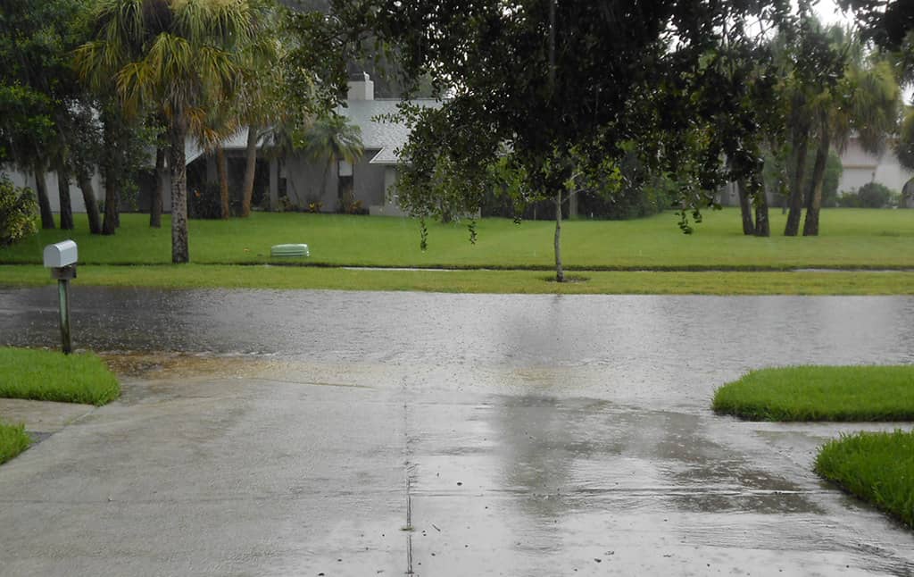
For Floridians, the headline is less about wind and more about water. Even if a system never reaches tropical storm strength, a moisture-laden disturbance drifting toward the state could dump several inches of rain over a short period, raising the risk of localized flooding in low-lying and urban areas. The early-season setup is a textbook example of why coastal residents are urged to treat the tropics seriously well before the peak months of August and September arrive.
What forecasters are seeing
Sea surface temperatures across the region are running above average for early June, generally in the 80-degree range, which is around the threshold needed to support tropical development. Forecasters have pointed to a broad zone extending from the Yucatan Peninsula across the Gulf toward Florida as the area worth monitoring, where warm water and lighter wind shear could allow a disturbance to gather strength if other conditions cooperate.
Steering currents matter as much as the warm water. A system that develops over the central or eastern Gulf would be more likely to track northeastward toward Florida, while one forming over the southwestern Gulf, near the Bay of Campeche, would tend to move west into Mexico. That distinction will shape who feels the heaviest impacts, and it is one of the key uncertainties forecasters are working to resolve as computer models come into better agreement.
It is worth emphasizing the difference between a watch and a warning, terms that often get blurred in casual conversation. A tropical storm or hurricane watch means conditions are possible within roughly 48 hours, while a warning means those conditions are expected within about 36 hours. As of this report, the situation remains firmly in the monitoring stage rather than the warning stage, meaning no part of Florida is under an active tropical alert.
The rain threat for Florida
Regardless of whether a named system materializes, the broader pattern points to a wetter stretch across Florida through mid-June. Forecasters say that increased moisture should help ease lingering drought conditions in parts of the state, a genuine benefit after dry spells stressed lawns, agriculture, and water supplies and raised wildfire risk in some interior areas during the spring.
The flip side is flooding. If a tropical depression or storm tracks close enough to the peninsula, several inches of rain could fall in a short window, overwhelming storm drains and creating ponding on roadways. South Florida's flat terrain and dense development make urban street flooding a recurring hazard during heavy rain events, and even routine summer downpours can snarl traffic and inundate intersections in the region's largest cities.
Residents in flood-prone neighborhoods should be prepared to move vehicles to higher ground, clear gutters and storm drains near their homes, and avoid driving through standing water. Just a few inches of moving water can stall a vehicle, and deeper water can sweep a car off the road entirely, which is why emergency officials repeat the well-worn warning to turn around rather than drive through flooded streets.
Why early-season systems matter
Early-season tropical activity tends to be driven by warm local waters rather than the long-track systems that emerge off Africa and dominate the peak months. These homegrown Gulf and Caribbean systems can form quickly and close to land, leaving less lead time for preparation and sometimes catching residents off guard who assume the real danger lies months ahead.
That proximity is precisely why emergency managers urge residents not to wait for a named storm to get ready. A disturbance that organizes just offshore can produce dangerous rainfall, gusty winds, and rip currents along the coast well before it earns a name from the hurricane center, and the compressed timeline can make last-minute preparations difficult once a system is bearing down.
Boaters and beachgoers should pay particular attention to marine forecasts and rip current statements in the days ahead. Elevated surf and dangerous currents often accompany even weak tropical systems, posing a serious threat to swimmers along both the Gulf and Atlantic coasts, where rip currents are already among the leading weather-related causes of death in Florida during a typical year.
The bigger picture for the season
This early Gulf watch arrives against the backdrop of a seasonal forecast that calls for a less active year than Florida has endured recently. Federal forecasters have projected a below-normal 2026 Atlantic season, citing the expected development of El Nino conditions that tend to suppress tropical activity, even as Atlantic waters run slightly warmer than average.
But a quieter season overall offers little comfort if a single storm strikes a populated stretch of coast. Florida's recent history is full of reminders that it only takes one landfall to cause catastrophic damage, and forecasters caution residents against letting a below-normal outlook breed complacency about their personal preparations.
The current disturbance, whether or not it develops into a named storm, functions as an early test of that readiness. It gives emergency managers a chance to exercise their systems and gives residents a timely nudge to review their plans while the stakes remain relatively low compared with a major hurricane threat.
Understanding the hazards beyond wind
When people think of hurricanes and tropical storms, they often picture damaging wind, but the greatest dangers frequently come from water. Storm surge, the wall of seawater pushed ashore by a storm, is historically the deadliest hazard, capable of inundating coastal neighborhoods within minutes. Even a weak system can produce dangerous surge along vulnerable stretches of Florida's low-lying coast, which is why evacuation zones are based on surge risk rather than wind alone.
Inland flooding from heavy rain is another major threat that can occur far from where a storm comes ashore. Slow-moving systems can stall over an area and drop enormous amounts of rain, overwhelming rivers, canals, and drainage systems. Florida's flat terrain and high water table make it especially prone to this kind of flooding, which can damage homes and strand residents well after the winds have died down.
Tornadoes spun up by the outer bands of tropical systems add yet another layer of risk, often with little warning. These tornadoes can form quickly and strike areas that are otherwise experiencing only moderate weather, underscoring the importance of staying alert to warnings throughout a storm's passage rather than relaxing once the worst winds appear to have passed.
Rip currents and coastal safety
Even before a tropical system arrives, its distant influence can make Florida's beaches dangerous. Tropical disturbances churning offshore generate swells that produce powerful rip currents, the fast-moving channels of water that pull swimmers away from shore. Rip currents are among the leading causes of weather-related deaths in Florida during a typical year, and they can be deadly even on days that otherwise look sunny and calm.
Beachgoers should heed warning flags and lifeguard guidance, swim only at guarded beaches when possible, and understand how to escape a rip current by swimming parallel to shore rather than fighting directly against the pull. Officials urge particular caution when a tropical system is anywhere in the region, since dangerous surf can persist for days even when skies overhead appear clear.
Boaters face their own elevated risks from rough seas and sudden changes in conditions associated with tropical systems. Checking marine forecasts, avoiding the water when small craft advisories are in effect, and carrying proper safety equipment are basic precautions that become especially important during the unsettled stretches that often accompany early-season Gulf activity.
The names on this year's list
Each Atlantic hurricane season draws its storm names from a predetermined list maintained by international meteorological authorities, with the names rotating on a six-year cycle. The first named system of 2026 will take the first name on this year's list, and subsequent storms will follow alphabetically as they form, a system designed to make communication clear and to avoid confusion when multiple systems are active at once.
Names of especially deadly or destructive storms are retired and replaced, which is why the lists evolve over the years. For Floridians, the specific name matters less than the underlying threat, but the naming of a system often marks the moment public attention sharpens. The current Gulf disturbance, named or not, serves as a useful prompt to treat every season seriously from its earliest days.
How to stay informed
The most reliable sources for tropical updates are the National Hurricane Center and local National Weather Service offices, which issue Florida-specific forecasts for Miami, Tampa Bay, Jacksonville, and other regions. Their products cut through social media speculation with official watches, warnings, and rainfall outlooks, and they should be the first stop for any resident trying to separate genuine threats from viral but unverified forecasts.
State officials encourage Floridians to sign up for county emergency alerts, keep phones charged, and review evacuation zone information now rather than during a crisis. County emergency management websites provide zone lookups so residents know in advance whether and when they might be asked to leave, information that is far easier to gather calmly today than in the rush before a storm.
With the season barely underway, the current Gulf activity is a useful reminder that preparation cannot wait until a storm has a name on the map. Forecasters will refine their thinking over the next several days as models converge, and the hurricane center's outlooks will assign formation probabilities over the next two and seven days, giving residents a clear sense of whether the odds are rising or fading as the situation evolves.
Spotted an issue with this article?
Have something to say about this story?
Write a letter to the editor