Heavy Rain Triggers Flood Advisories Across South Florida
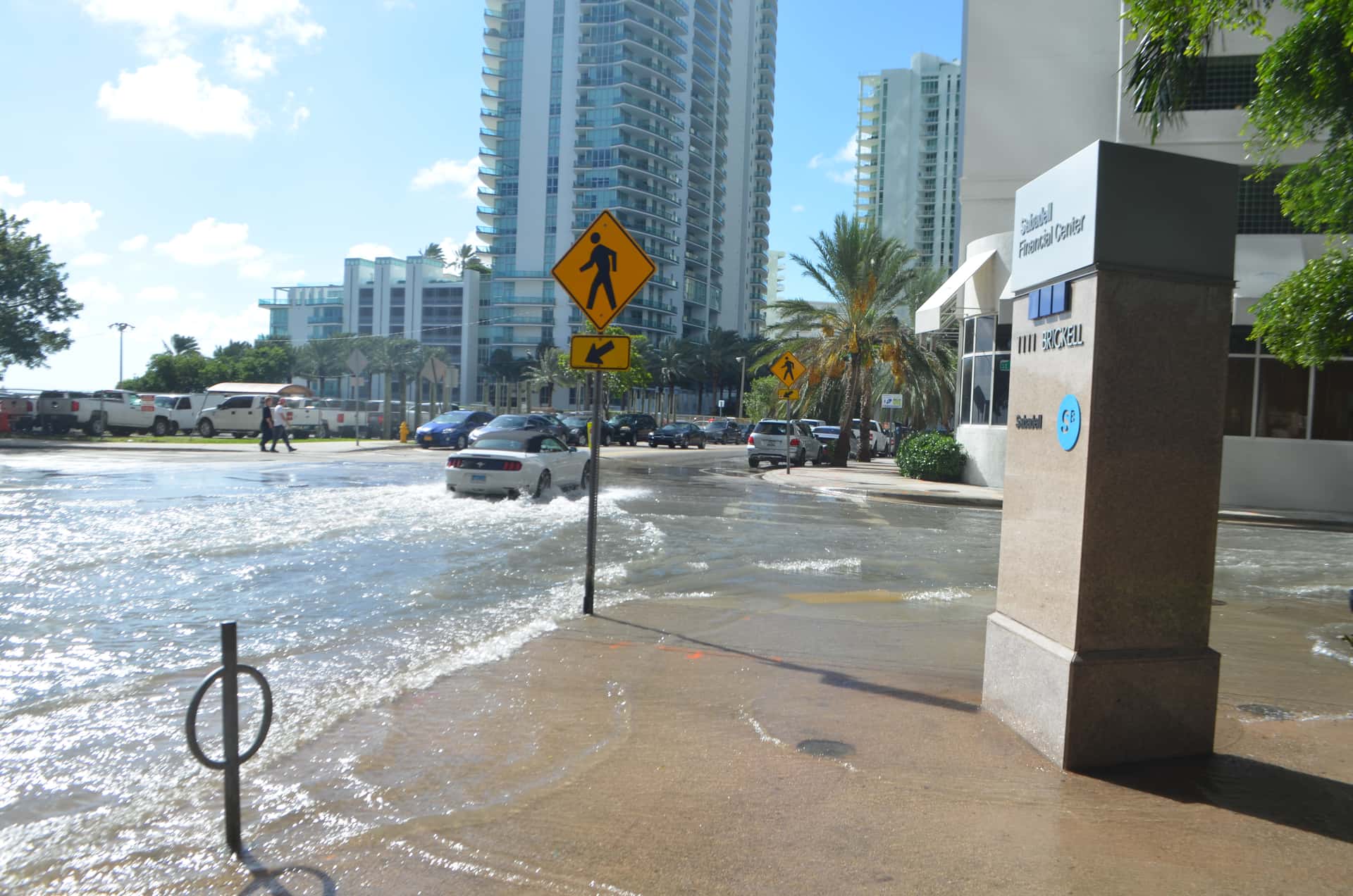
Slow-moving thunderstorms pushed several inches of rain across South Florida on Saturday, prompting National Weather Service offices to issue a rolling series of flood advisories and special weather statements through the afternoon. Miami-Dade, Palm Beach, Lee and Highlands counties all fell under advisories at various points, with the heaviest totals reported in central Miami-Dade and in Highlands County.
Forecasters reported that between 1 and 2 inches of rain had already fallen across parts of central Miami-Dade County by midday, with an additional 1 to 2 inches expected. In Highlands County, gauges showed between 2.5 and 3.5 inches of accumulation by mid-afternoon.
The activity came without any tropical system in the basin. The 2026 Atlantic hurricane season has been unusually quiet, and Saturday's rainfall was the product of ordinary late-summer convection rather than an organized storm, a reminder that Florida's flood risk is not confined to named systems.
Where the advisories were issued
The Miami forecast office issued flood advisories covering communities in southern and central Miami-Dade County, including Homestead, Princeton, Goulds and Cutler Bay, along with the area around Homestead Miami Speedway. Those advisories cited minor flooding in low-lying areas and locations with poor drainage.
Palm Beach County saw its own advisories, with forecasters noting excessive rainfall in the eastern and central portions of the county. Rainfall totals there ran in the 1 to 2 inch range with additional accumulation expected over already saturated ground.
Separately, a strong thunderstorm moved north through Broward County at roughly 20 miles per hour with wind gusts estimated at 45 to 50 miles per hour. That cell affected Fort Lauderdale, Coral Springs, Pompano Beach, Sunrise, Deerfield Beach and Boca Raton, prompting a special weather statement warning of gusty winds and brief heavy downpours.
A flash flood warning had been issued in Florida the previous day, indicating that conditions across parts of the state had been primed for runoff problems before Saturday's round of storms arrived.
Advisory, watch, warning: what the terms mean
The National Weather Service uses a graduated set of products, and the distinctions carry practical meaning for residents deciding how to respond.
A flood advisory, which covered most of South Florida on Saturday, indicates that flooding is occurring or is imminent but is not expected to be severe enough to threaten life or cause significant property damage. Advisories typically describe nuisance flooding on roadways, in parking lots and in poor drainage areas.
A flood watch means conditions are favorable for flooding to develop. A flood warning or flash flood warning means flooding is occurring or is imminent and poses a genuine hazard. Flash flood warnings in particular call for immediate action, including avoiding travel and moving away from low-lying areas.
Forecasters consistently emphasize that most flood fatalities in the United States involve vehicles. Water depth on a roadway is difficult to judge, moving water exerts far more force than drivers expect, and roadbeds can be undermined beneath standing water.
Why South Florida floods the way it does
South Florida's drainage challenges are structural. The region sits on porous limestone at very low elevation, and its water management system was engineered decades ago for a smaller population and a different rainfall regime.
The South Florida Water Management District operates an extensive network of canals, pumps and control structures that move water toward the coast and toward conservation areas. That system performs well under design conditions but has finite capacity, and intense short-duration rainfall can exceed the rate at which water can be moved.
Tidal conditions complicate the picture further. When high tide coincides with heavy rainfall, gravity drainage to the ocean slows or reverses, which backs water up in the canal system. Coastal communities in Miami-Dade and Broward counties experience this interaction regularly during the wet season.
Development patterns add another layer. Impervious surfaces from roads, parking lots and rooftops generate runoff that would otherwise infiltrate the ground, concentrating water in drainage systems designed for earlier conditions.
What it means for Floridians
The immediate practical guidance from forecasters during advisories is straightforward. Drivers should avoid flooded roadways, allow extra travel time, and treat standing water as deeper than it appears. Residents in areas prone to repeat flooding should move vehicles to higher ground when advisories are issued.
There is also an insurance dimension that Florida homeowners routinely misunderstand. Standard homeowners policies in Florida exclude flood damage. Flood coverage must be purchased separately, either through the National Flood Insurance Program or from a private carrier, and new policies generally carry a waiting period before coverage takes effect.
That waiting period means flood insurance cannot be purchased in response to an approaching storm. Households considering coverage are advised to evaluate it well ahead of any specific weather threat.
Local impact across the state
In Miami-Dade County, the advisories affected agricultural areas in the southern portion of the county along with residential communities in Homestead and Cutler Bay. The Homestead area's low elevation and agricultural drainage make it particularly sensitive to heavy rainfall events.
In Highlands County, where totals ran highest, the terrain and lake system in the interior of the state produce a different flooding profile than the coastal counties. Runoff there moves through a chain of lakes rather than a coastal canal network.
Palm Beach County's advisories covered the eastern developed corridor, where drainage infrastructure serves dense residential and commercial development, along with areas farther west where agricultural land and water management structures dominate.
Wet season arithmetic
South Florida's climate divides into a wet season running roughly from May through October and a dry season covering the remaining months. The wet season delivers the majority of the region's annual rainfall, typically in the form of afternoon and evening convective storms driven by daytime heating and sea breeze convergence.
That pattern means flooding in September is a routine feature of the calendar rather than an anomaly. Drainage systems are designed around it, and residents in flood-prone neighborhoods generally know which streets go under during heavy rain.
What varies is intensity. A storm that moves through quickly drops manageable rainfall. A storm that stalls, or a sequence of storms that repeatedly track over the same area, can deliver several inches in a few hours, which exceeds what drainage systems can handle regardless of their condition.
Saturated antecedent conditions compound the problem. Ground that has already absorbed heavy rainfall in preceding days has reduced capacity, which means a subsequent storm produces more runoff from the same rainfall total.
What the sea breeze does
The Florida peninsula generates its own weather through a mechanism that operates almost daily during the warm season. Land heats faster than water, creating a pressure difference that draws air inland from both coasts.
Those two sea breeze fronts, one moving west from the Atlantic and one moving east from the Gulf, converge somewhere over the interior of the peninsula. Where they meet, air is forced upward, and that lift initiates thunderstorm development.
The convergence line's position shifts based on the prevailing wind. When larger-scale flow is from the east, the collision point moves toward the Gulf coast. When flow is from the west, storms fire closer to the Atlantic side. This is why some days bring heavy storms to Tampa Bay while Miami stays dry, and other days reverse it.
Saturday's activity across Miami-Dade, Broward, Palm Beach and Highlands counties reflected a pattern that kept convection over the southeastern portion of the peninsula through the afternoon.
Sea level rise and the drainage question
South Florida's flood management faces a constraint that grows more binding over time. Much of the regional drainage system relies on gravity, moving water toward the coast through canals and out through control structures that open when inland water levels exceed coastal levels.
As sea level rises, the head difference driving that flow narrows. Structures that once operated by gravity for most of the tidal cycle now spend more hours unable to discharge, which means water backs up inland during precisely the conditions when drainage is most needed.
Water management agencies have responded by installing forward pumps at key structures, converting gravity discharge to mechanical pumping. That works but costs substantially more to build and operate, and each installation addresses only the basin it serves.
Local governments across Miami-Dade and Broward counties have been raising road elevations, upgrading stormwater systems and installing tidal valves in response. Those projects carry significant costs, and how they are funded intersects with the property tax debate on the November ballot.
Preparing before the next round
Emergency managers offer consistent guidance ahead of heavy rain events, and most of it costs nothing. Clearing storm drains near a property of leaves and debris improves local drainage measurably. Knowing whether a residence sits in a designated flood zone determines both insurance obligations and evacuation planning.
Residents can look up their flood zone through FEMA's mapping tools or through county property appraiser websites, many of which display flood zone designations alongside property records.
County emergency management offices operate alert systems that deliver targeted notifications by text or phone, and enrollment is free. Those systems provide more localized information than statewide broadcasts and reach residents faster during rapidly developing situations.
What's next
Late-summer convective patterns typically persist into October across South Florida before the dry season begins to assert itself. Daily afternoon storm chances remain part of the routine forecast, and additional advisories should be expected on days when storms move slowly or train over the same area.
Residents can monitor conditions through the National Weather Service forecast offices serving their area, and through county emergency management channels that issue local alerts. Signing up for county alert systems remains the most direct way to receive targeted notifications.
Meanwhile, the tropics remain unusually inactive. Forecasters at the National Hurricane Center have been monitoring a disorganized system in the central subtropical Atlantic, but development chances have been rated low, and no organized tropical system currently threatens Florida.
Spotted an issue with this article?
Have something to say about this story?
Write a letter to the editor