Florida's Fastest Growth Is Moving Inland as Climate Risk and Insurance Costs Reshape Where People Settle
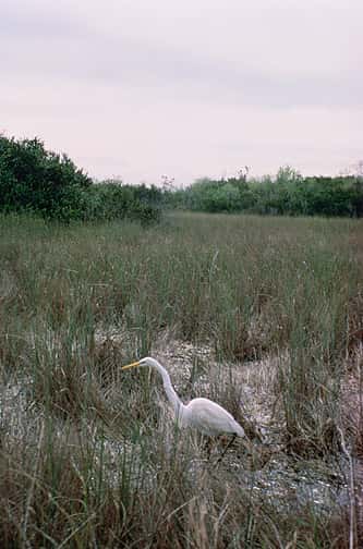
Florida's population growth is moving away from the coastline. Fifteen of the state's 20 fastest growing cities this decade are located in noncoastal counties, a reversal of the pattern that defined Florida development for most of the past century. Former citrus groves and cattle pastures in the state's interior are now absorbing residents who once would have settled within sight of the water.
The drivers are a combination of climate risk and cost. Repeated hurricane landfalls have raised the perceived and actual risk of coastal living, while property insurance premiums, flood coverage requirements, and construction costs have made coastal housing unaffordable for a widening share of buyers. Inland counties offer lower premiums, lower land costs, and elevations that reduce flood exposure.
For Floridians, the shift matters because it redistributes demand on schools, roads, water supply, and emergency services toward counties whose infrastructure was built for far smaller populations. It also changes the political geography of a state where coastal metropolitan areas have long dominated.
Where the growth is going
Highlands County, in the state's south central interior, has added roughly 10,000 residents through migration in the first half of the 2020s. That compares with about 2,500 across the entire preceding decade, a fourfold increase in a county whose economy was built on citrus and cattle.
Hendry County, an agricultural hub of roughly 47,000 residents, grew by fewer than 500 people during the 2010s. Since 2020 it has added about 7,500, an increase of nearly 20 percent in a few years. That is a rate of change most rural county governments are not staffed to manage.
Marion and Sumter counties, historically horse farm and cattle country in North Central Florida, rank among the state's fastest growing this decade. Sumter's growth has been shaped substantially by large scale age restricted development, while Marion has drawn a broader mix of households.
The common thread is elevation and distance from storm surge. These counties sit well inland, on higher ground, in insurance rating territories that price wind risk very differently than coastal ZIP codes.
The insurance arithmetic
Property insurance is the mechanism that translates climate risk into a monthly household cost, and in Florida that translation has been sharp. Wind exposure is the dominant rating factor along the coast, and premiums in coastal counties can run several times what comparable homes pay inland.
Flood insurance operates separately through the National Flood Insurance Program and a growing private market, and its pricing has moved toward risk based rates that reflect individual property elevation and proximity to water. For homes in mapped flood zones, the combined cost of wind and flood coverage can rival a mortgage payment.
Buyers respond to total monthly cost, not to purchase price alone. A home priced identically in Sarasota and in Sebring can carry meaningfully different carrying costs once insurance is included, and that difference has grown large enough to redirect purchase decisions.
Statewide, Florida's insurance market has stabilized somewhat relative to its most acute period, with rate decreases filed by a number of carriers for 2026. But stabilization at a high level is not the same as affordability, and the geographic spread between coastal and inland premiums has not closed.
What inland counties face
Rapid growth in counties with small administrative capacity produces predictable strains. Water supply is the most binding constraint in much of interior Florida, where withdrawals are regulated by water management districts and where existing permits were sized for agricultural rather than residential use.
Wastewater is a parallel problem. Many interior communities rely heavily on septic systems, which function poorly at suburban densities and which contribute nutrients to springs and surface waters. Converting to central sewer requires capital that small counties struggle to raise.
Roads and schools follow the same pattern. State road capacity in interior Florida was designed around agricultural traffic and long distance travel rather than daily commuting, and school districts in these counties are adding students faster than they can build classrooms.
Emergency services face a specific version of the challenge. Inland counties are not exempt from hurricanes, and the interior of Florida experiences serious wind and freshwater flooding during storms even without surge. Larger inland populations mean more households needing shelter, power restoration, and post storm services in places with fewer resources.
What it means for Floridians
For buyers, the practical takeaway is that the calculation has changed. Total housing cost in Florida is now shaped as much by insurance geography as by purchase price, and the interior offers a genuinely different cost structure.
For current inland residents, growth brings both opportunity and pressure. Property values have risen, which benefits existing owners, while rents have risen faster than local wages in several interior counties, which strains renters and workers in agriculture and services.
For coastal communities, sustained out migration of middle income households raises questions about workforce availability. Coastal economies depend on service, hospitality, health care, and construction workers who increasingly cannot afford to live near their jobs, producing longer commutes from inland counties.
Statewide, the redistribution affects legislative representation over time, since seats follow population. Interior counties that have historically had limited influence in Tallahassee will gain it as growth continues.
Environmental consequences
Interior Florida contains much of the state's remaining agricultural land, ranchland, and recharge area for the Floridan aquifer. Converting pasture and grove to subdivisions changes both the hydrology and the ecology of those landscapes.
Ranchland in particular has functioned as de facto conservation land, supporting wildlife corridors that connect protected areas across the peninsula. The Florida Wildlife Corridor initiative has focused specifically on keeping these working lands intact, and development pressure runs directly against that objective.
Aquifer recharge is the other central concern. Interior Florida's sandy uplands are where rainfall enters the aquifer that supplies drinking water across much of the state. Impervious surface reduces recharge while simultaneously increasing withdrawal, a combination that stresses springs and municipal supplies.
Conservation easements and rural land protection programs exist to address this, but they compete against development values that have risen sharply as demand shifted inland.
What inland does not solve
Moving inland reduces exposure to storm surge, which is the deadliest hurricane hazard and the one most tightly correlated with coastal proximity. It does not eliminate hurricane risk, and treating it as though it does produces a dangerous complacency.
Wind fields of major hurricanes extend far inland. Hurricane Charley in 2004 crossed the peninsula and produced destructive winds through Central Florida, and Hurricane Irma in 2017 caused damage in interior counties well removed from either coast. Inland structures are built to wind standards under the Florida Building Code, but the exposure is real.
Freshwater flooding is the hazard that most often surprises inland residents. Interior Florida drains slowly, and prolonged rainfall can produce lake and river flooding that persists for weeks after a storm passes. Communities around the Kissimmee chain of lakes and along the St. Johns River have experienced extended inundation following heavy rainfall events.
Flood insurance is therefore relevant inland, and many interior properties sit outside mapped high risk flood zones where lenders do not require coverage. Properties outside those zones still flood, and a substantial share of national flood claims come from areas not designated high risk.
Infrastructure and the cost of catching up
The financial mechanics of rapid growth in small counties deserve attention because they determine whether new residents get the services they expect.
Impact fees, charged to new development to fund the capital cost of expanded capacity, are the primary tool available. Florida law constrains how quickly local governments may raise them and requires that the fees bear a rational relationship to the cost the new development imposes. Counties that had low fees before growth arrived cannot raise them abruptly to catch up.
Property tax revenue from new development arrives after construction and assessment, which means the infrastructure must generally be built before the revenue supporting it appears. That timing gap is bridged with debt, and small counties borrow at less favorable terms than large ones.
Schools face a parallel problem through school concurrency, the requirement that adequate classroom capacity exist to serve new residential development. Districts can enter agreements with developers, but the practical result in fast growing counties has often been portable classrooms while permanent construction proceeds.
Staffing is the constraint that money solves most slowly. Hiring deputies, firefighters, paramedics, teachers, and utility operators in counties with limited local labor pools takes time regardless of budget, and competition with better funded coastal jurisdictions is direct.
Heat as the interior's own hazard
The risk profile of inland Florida differs from the coast in one respect that receives less attention than flooding: heat.
Coastal communities benefit from sea breezes that moderate afternoon temperatures. Interior locations lack that ventilation, and daytime highs in inland counties routinely exceed coastal readings by several degrees during summer months.
That difference matters for outdoor workers in agriculture and construction, sectors that employ significant shares of the workforce in the interior counties absorbing growth. It also matters for households where air conditioning costs represent a large share of income, since higher temperatures mean higher electricity bills.
Tree canopy influences the outcome substantially. Converting pasture and grove to subdivisions typically reduces shade and increases paved surface, which raises local temperatures through the urban heat island effect even in communities that are not urban by population standards.
Development standards that preserve canopy, require shade in parking areas, and use reflective materials can moderate the effect. Those provisions sit in local land development codes, which is another reason county comprehensive plan decisions in interior Florida carry consequences that extend well past the immediate question of how many homes get built.
What's next
County comprehensive plan amendments will be the venue where most of this plays out. Interior counties are processing large scale land use changes that convert agricultural designations to residential, and those decisions are made at local commission meetings with limited public attention.
Water management districts will face increasing pressure over consumptive use permits as residential demand grows in areas where agricultural allocations already exist. How those permits are reallocated will shape the pace of development.
State transportation planning will need to catch up. Corridors connecting interior Florida to coastal employment centers were not designed for commuter volumes, and capacity projects take years from planning to construction.
The underlying driver, the cost differential created by climate risk pricing, is unlikely to reverse. Barring a fundamental change in how coastal risk is priced, the inland shift is likely to continue through the rest of the decade.
Spotted an issue with this article?
Have something to say about this story?
Write us a letterComments
No comments yet. Be the first to weigh in.
Related Coverage

Record Sargassum Season Fades as Key West and UM Researchers Prepare for the Next Wave
1d ago
Florida's New Stormwater Pollution Credit Rules Draw Fire From Environmentalists and Industry Alike
2d ago
Lead pellets from shot iguanas linked to first known crocodile poisoning death in Florida
5d ago

DeSantis and Cabinet protect more than 10,770 acres, from Putnam County woods to Martin County ranches
Oct 4