Atlantic Season Passes Its Peak Without a Hurricane as Tropical Storm Fay Fades
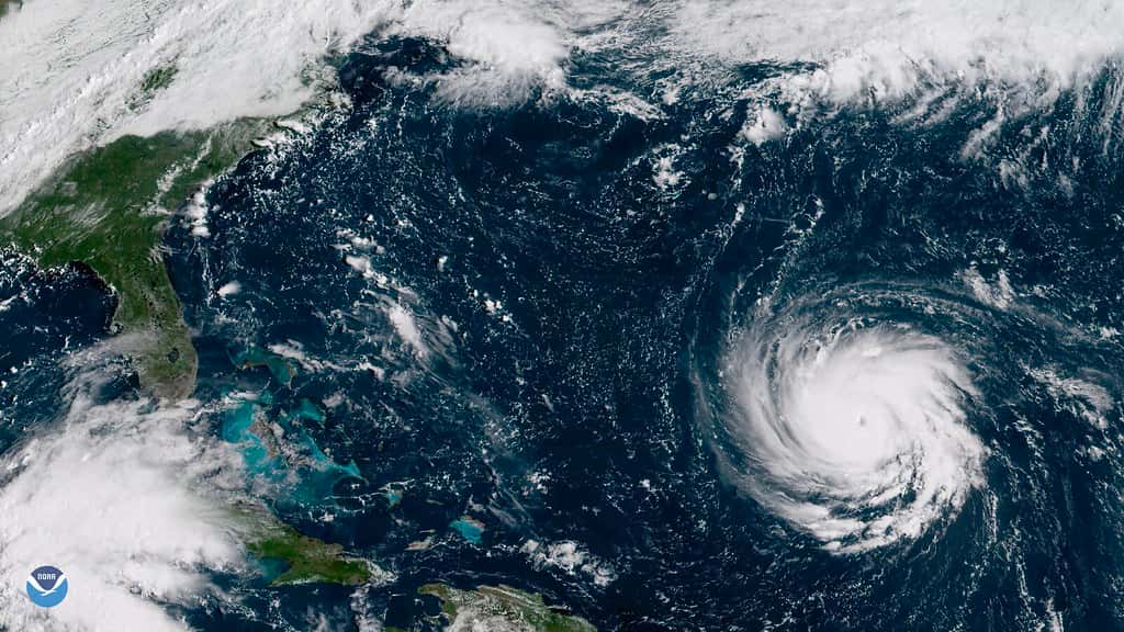
The Atlantic basin has passed the climatological peak of the 2026 hurricane season without producing a single hurricane, an outcome that has no modern parallel for a Florida that normally spends September watching the tropics. Tropical Storm Fay, which formed early Sunday and briefly looked like the season's best candidate for hurricane status, weakened instead. As of the National Hurricane Center's Monday morning position, Fay was drifting over the far eastern Atlantic with maximum sustained winds near 65 mph and was forecast to degenerate into a post-tropical remnant low within a day or two. Forecasters say Fay poses no threat to any land.
Where Fay stands now
The National Hurricane Center placed Fay's center near latitude 33.8 north, longitude 32.1 west in its 5 a.m. Monday advisory, roughly a third of the way across the ocean from Florida and well east of Bermuda. The storm was moving south-southeast at about 2 mph, an unusually slow crawl that reflects weak steering currents rather than any organized track toward the Americas.
Fay's maximum sustained winds had decreased to near 65 mph by Monday morning, down from the level reached Sunday evening when the storm appeared to have a narrow window to reach Category 1 strength. Reaching 74 mph would have made Fay the first hurricane of the 2026 Atlantic season. That window closed as wind shear increased and the storm's circulation began to lose organization.
Forecasters expect continued weakening through the week. The official forecast shows Fay becoming a post-tropical remnant low, and hurricane specialists noted that the transition could happen sooner than the advisory schedule suggests. A faster motion to the southwest is anticipated over the next few days, but the storm is expected to dissipate over open water rather than approach any coastline.
For Florida, the practical significance of Fay is close to zero in terms of direct impact. The storm's importance is statistical. It is the sixth named storm of a season that has not yet produced a hurricane, and its failure to strengthen extends a streak that is now genuinely unusual for late September.
A season that has defied the calendar
September 10 is generally treated as the climatological peak of Atlantic hurricane season, the point at which the long-term average number of active systems reaches its annual maximum. Florida is now nearly two weeks past that date with no hurricane anywhere in the basin. In most seasons, the state has already tracked at least one hurricane by this point, and often several.
The primary driver appears to be a strengthening El Nino pattern in the Pacific, which typically increases vertical wind shear over the tropical Atlantic. Shear tears apart the vertical structure that developing storms need to organize, and it has repeatedly disrupted systems this season before they could consolidate. Fay's stall and weakening fit that pattern closely.
The quiet outcome is broadly consistent with what federal forecasters projected. NOAA had predicted a below-normal 2026 Atlantic season, forecasting 7 to 13 named storms, of which 2 to 6 could become hurricanes, including 0 to 2 major hurricanes. Agency forecasters put the chance of below-normal activity at 75 percent, with a 20 percent chance of a near-normal season and a 5 percent chance of above-normal activity. NOAA maintained that outlook in its midseason update.
What the outlook did not anticipate was a peak season that produced no hurricanes at all. The lower end of NOAA's range still called for two. Reaching late September with none is at the extreme edge of the forecast envelope, and it reflects how much a single atmospheric driver can suppress an entire basin.
What a quiet peak does not mean
Florida emergency managers have spent the season repeating a point that the state's own history supports: a quiet peak is not a guarantee of a quiet finish. The Atlantic hurricane season runs through November 30, and more than two months remain on the calendar.
Late-season storms behave differently from peak-season ones. August and early September systems typically form off the coast of Africa and track west across the open Atlantic, giving forecasters a week or more of lead time. October storms are more likely to develop close to home, in the western Caribbean or the Gulf, where warm water sits under a weakening shear environment. Those systems can intensify quickly and reach Florida with far less warning.
That geography matters for the state's most vulnerable regions. A homegrown Gulf system can move from a disorganized area of low pressure to a landfalling hurricane in the space of a few days, which compresses the window for evacuation decisions, fuel distribution, and shelter activation. Florida's most damaging late-season storms have historically followed that pattern.
Emergency management officials have also cautioned about a behavioral risk. A season without a scare tends to erode readiness. Households that stocked supplies in June may have drawn them down by September, and residents who moved to Florida within the past year may never have experienced a storm warning at all.
Preparedness Month arrives in an unusually calm year
Governor Ron DeSantis declared September as Florida Preparedness Month earlier this month, a designation that lands with odd timing in a year when the tropics have stayed quiet. The state's emphasis has been on getting households to build and maintain supply kits regardless of what the current forecast shows.
Florida's approach to preparedness costs has changed in recent years. Rather than concentrating relief into a handful of sales tax holidays timed to the start of the season, the state has shifted toward year-round exemptions on disaster preparedness staples. The intent is to remove the deadline pressure that pushed families to buy everything in a single week, and to make restocking in October as affordable as stocking up in June.
State guidance continues to recommend that households maintain at least seven days of water and non-perishable food per person, along with medications, battery-powered radios, phone chargers, and copies of insurance documents. Officials also encourage residents to confirm their evacuation zone before a storm threatens rather than during an advisory.
Evacuation zones are a point of recurring confusion. Florida counties issue evacuation orders by zone, not countywide, and the zones are keyed to storm surge risk rather than distance from the coast. A resident several miles inland in a low-lying area may be in an earlier evacuation zone than someone closer to the water on higher ground.
What the quiet season means for insurance and recovery
A year without a Florida hurricane landfall has financial consequences that extend well beyond emergency management. The state's property insurance market has spent several years absorbing losses from major storms, and a loss-free season affects how carriers price risk and how much capital reinsurers are willing to commit.
A quiet year does not automatically translate into lower premiums for homeowners. Rate filings reflect multi-year loss modeling, reinsurance costs set in the global market, and litigation trends, not simply the previous season's claims. But consecutive quiet years tend to relieve pressure on the system, and a single quiet year removes the acute shock that follows a major landfall.
The state is still working through recovery from earlier storms. Federal disaster assistance continues to flow to Florida communities for projects tied to prior hurricanes, covering debris removal, infrastructure repair, and emergency protective measures. A quiet 2026 season gives those recovery programs room to finish work without new damage competing for the same contractors and crews.
For homeowners, the practical guidance has not changed. Flood damage is not covered by standard homeowners policies, and a new flood policy generally carries a 30-day waiting period before it takes effect. A resident who waits until a storm enters the Gulf to buy flood coverage will not be covered for that storm.
Two more months on the calendar
Forecasters continue to monitor several areas of the Atlantic beyond Fay. The basin has not shut down, and the atmosphere can change character quickly when shear relaxes even temporarily. October systems in the western Caribbean are a standard feature of the climatology, El Nino or not.
Residents planning around the remainder of the season should keep the distinction between a watch and a warning in mind. A tropical storm or hurricane watch means those conditions are possible within the specified area, generally within 48 hours. A warning means the conditions are expected, generally within 36 hours. The two words carry different action thresholds, and county emergency managers key their guidance to them.
The National Hurricane Center issues regular tropical weather outlooks covering the next seven days, and those outlooks are the most reliable early signal of whether a system is likely to develop. Florida residents can track them directly rather than relying on secondhand summaries of model output, which often circulate widely on social platforms without context about reliability.
What's next
Fay is expected to dissipate over open water within days, closing the book on the 2026 season's closest approach to a hurricane so far. Whether the basin produces one before November 30 remains an open question, and forecasters are not prepared to call the season finished.
Florida's immediate weather concerns are closer to home. A moist and unsettled pattern has settled over much of the peninsula, bringing scattered to numerous showers and thunderstorms through the week. That is ordinary September weather for the state, but heavy rainfall can still produce localized flooding in areas with poor drainage.
The practical advice from emergency managers has not shifted with the quiet tropics. Confirm your evacuation zone, maintain a supply kit, review your insurance coverage including flood, and treat the remaining ten weeks of the season as live. The 2026 Atlantic has been unusually forgiving so far, and that record says nothing about what October holds.
Spotted an issue with this article?
Have something to say about this story?
Write us a letterComments
No comments yet. Be the first to weigh in.
Related Coverage
NOAA Winter Outlook Favors a Wet Florida Winter as a Very Strong El Niño Builds
1d ago

Josephine Heads Out to Sea, but Florida's Atlantic Coast Faces Strong Winds, King Tide Flooding and Dangerous Surf This Weekend
4d ago
Strong fall cold front brings Florida Saturday rain, cooler air and dangerous surf this weekend
Oct 15

Hurricane Center Gives Atlantic Low Near Cabo Verde a 20% Chance as Florida Gets a Break After Isaias
Oct 12