Brutal Heat, Quiet Tropics: Florida Bakes While the 2026 Hurricane Season Stays Calm, For Now

Florida is caught between two very different weather stories this week. The tropics are quiet, with the National Hurricane Center expecting no tropical cyclone formation in the Atlantic, Caribbean, or Gulf of Mexico over the next seven days as of June 24, 2026. At the same time, the state is sweating through an intense early-summer heat spell, with highs in the mid-90s and heat index readings climbing into the low 100s in places, as reported on June 23.
The calm in the tropics is no accident. A large plume of Saharan dust is drifting over the deep tropics, and high wind shear is hanging over the Gulf and Caribbean. Both factors work against tropical development, and together they have put the brakes on storm formation for now. For Floridians, that means the immediate threat this week is not from a hurricane but from the heat itself.
It is a familiar early-season pattern, and it carries a familiar warning. A quiet stretch is welcome, but forecasters and emergency officials stress that the season is just getting started and that the absence of storms today says little about what the coming months may bring.
Why the Tropics Are Quiet
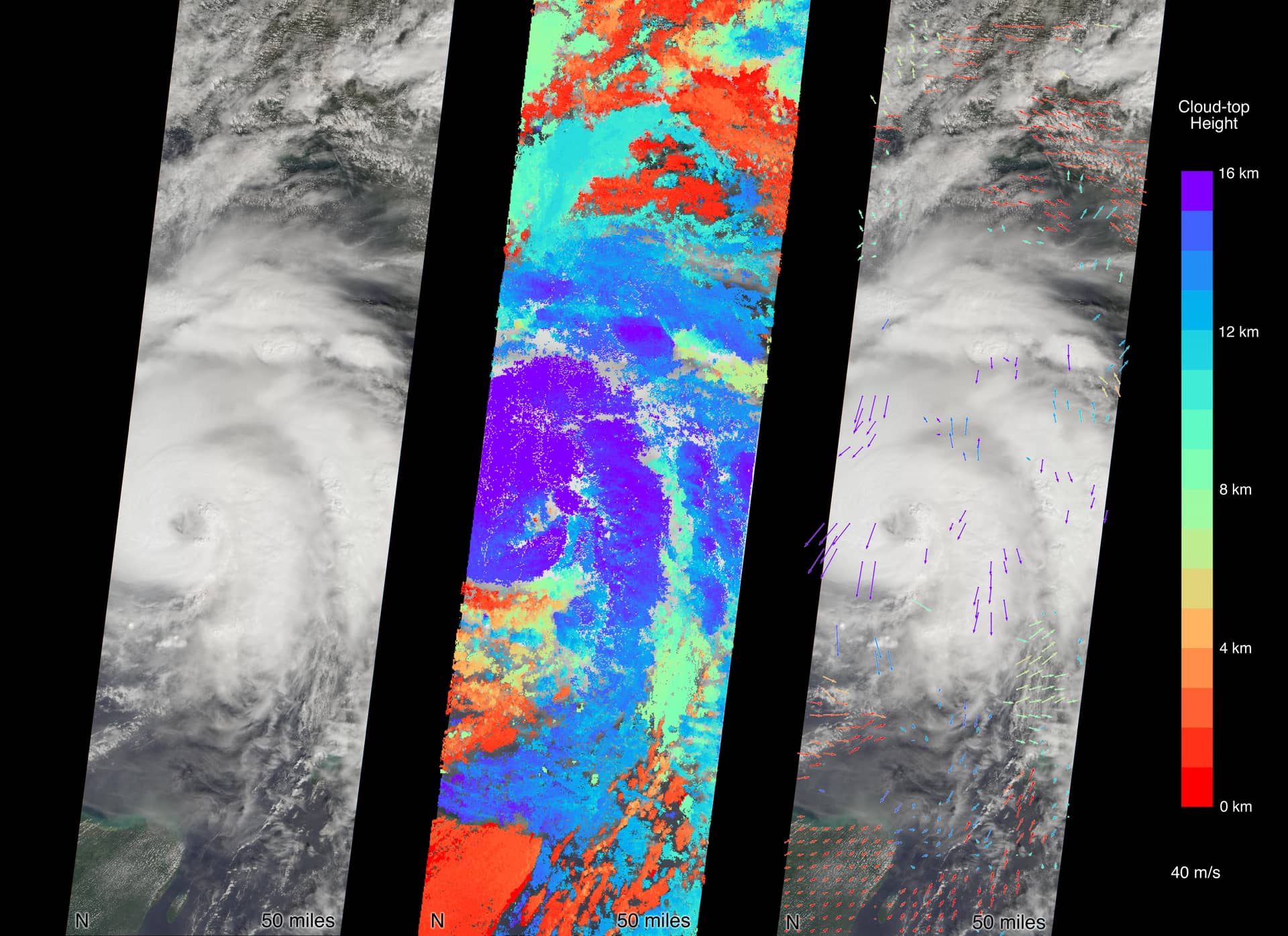
Two ingredients are doing most of the work to suppress storms right now. The first is Saharan dust, a dry, dusty air mass that travels across the Atlantic from Africa each summer. When that dry air sits over the tropics, it starves developing systems of the moisture they need to organize and strengthen. A large plume of it is currently parked over the deep tropics.
The second factor is wind shear, the change in wind speed and direction with height. Strong shear tears at the structure of a developing storm, preventing it from stacking up vertically and building the organized core that a tropical cyclone requires. High wind shear over the Gulf and Caribbean is helping keep those basins quiet.
With both of these forces in play, the National Hurricane Center sees no tropical cyclone formation expected over the next seven days. That is a meaningful stretch of calm for late June, and it gives coastal Florida a breather as the heat dominates the headlines instead.
It is worth noting how these conditions can shift. Saharan dust outbreaks tend to fade as the season progresses into late summer, and wind shear patterns can change. The current quiet reflects the present setup, not a guarantee for the weeks ahead.
The Season's Only Storm So Far
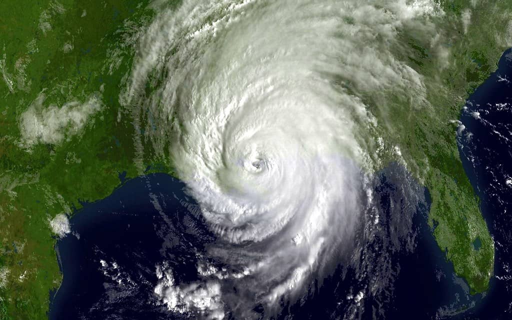
The 2026 Atlantic season is not entirely without a storm to its name. The season's first system, Tropical Storm Arthur, formed on June 17 and made landfall near Galveston, Texas, with peak winds around 40 mph. As a low-end tropical storm, Arthur was a relatively modest system, and it came ashore well to the west of Florida.
Arthur's quick arrival and departure fit the pattern of an early-season storm: it formed, made landfall, and moved on without the kind of prolonged threat that larger, later-season hurricanes can pose. Its track toward Texas also kept the direct impacts away from Florida.
Since Arthur, the basin has gone quiet, which brings the focus back to the suppressing conditions currently in place. One early storm followed by a lull is not unusual, and it underscores why a single data point, whether a storm or a quiet week, should not drive complacency about the season as a whole.
Early-season storms like Arthur also serve as a useful reminder of how the season tends to unfold. June systems often form close to land in the Gulf or off the southeastern coast, rather than tracking across the open Atlantic the way many of the strongest late-season hurricanes do. They can still bring rain, gusty winds, and coastal hazards, even when their peak winds stay modest, which is why even a low-end tropical storm draws attention from forecasters and emergency managers.
What NOAA's Outlook Says
The broader forecast for 2026 leans toward a calmer-than-usual year. NOAA's 2026 outlook calls for a below-normal season, with a 55% chance of a below-normal season, a 35% chance of near-normal, and a 10% chance of above-normal activity. The agency is forecasting 8 to 14 named storms, 3 to 6 hurricanes, and 1 to 3 major hurricanes.
Those numbers describe a season expected to run on the quieter side of average. For a state that has weathered some punishing hurricane years, a below-normal outlook is reassuring news. But a seasonal outlook is exactly that: a forecast of overall activity, not a prediction of where, when, or whether any individual storm will strike.
This is where the distinction between a watch and a warning matters. A seasonal outlook is a long-range expectation, akin to a watch in spirit, signaling conditions and probabilities rather than an imminent threat. It is not a warning about any specific storm. Floridians should read it as context, not as an all-clear.
Crucially, below-normal does not mean no risk. Even in a quiet season, a single landfalling storm can be devastating. History is full of below-average seasons that still produced a damaging hurricane somewhere along the coast. The seasonal count tells you nothing about whether your community will be the one that gets hit.
The Heat Is the Immediate Danger
While the tropics rest, the heat is the clear and present hazard. Highs in the mid-90s combined with heat index values in the low 100s create conditions that can be dangerous, especially for people working outdoors, exercising, or without access to cooling. The heat index reflects how hot it actually feels when humidity is factored in, and Florida's humidity pushes those feels-like numbers well above the air temperature.
Heat-related illness builds gradually and can become serious quickly. The standard public-health guidance is straightforward: drink plenty of water, take breaks in the shade or in air conditioning, avoid strenuous activity during the hottest part of the afternoon, and wear light, loose clothing. Officials routinely urge people to check on elderly neighbors and those who may not have reliable air conditioning.
Children and pets should never be left in parked vehicles, where interior temperatures can rise to lethal levels within minutes even on a day that does not feel extreme outside. This is one of the most consistent and preventable heat dangers each summer, and it bears repeating during a stretch like this one.
For outdoor workers, the combination of heat and humidity is particularly demanding. Frequent water breaks, rest in shade, and awareness of the warning signs of heat exhaustion and heat stroke are the basic protections. The early-summer timing matters too, because the body has not yet fully adjusted to sustained extreme heat.
Recognizing the warning signs of heat illness can prevent a dangerous situation from escalating. Heat exhaustion can bring heavy sweating, weakness, dizziness, nausea, and headache, and it calls for moving to a cooler place, resting, and drinking fluids. Heat stroke is a medical emergency that can involve confusion, a very high body temperature, and a change in consciousness, and it requires calling for emergency help immediately. The standard guidance is to take early symptoms seriously rather than pushing through them.
The Heat and Florida's Vulnerable Residents
Extreme heat does not affect everyone equally, and a spell like this one falls hardest on certain groups. Older adults, young children, people with chronic health conditions, and those without reliable air conditioning face the greatest risk. For these residents, a stretch of mid-90s highs with low-100s heat index values is not merely uncomfortable but potentially dangerous.
Access to cooling is a central concern during hot spells. People who cannot keep their homes cool are more exposed to heat illness, which is why officials often point residents toward air-conditioned public spaces and encourage neighbors and family members to check on those who may be at risk. A brief visit to confirm an elderly relative or neighbor has working air conditioning and is drinking enough water can make a real difference.
Florida's large population of older residents adds weight to this concern. The state is home to many retirees and seasonal residents, and a significant share of the population falls into the age groups most vulnerable to heat. That demographic reality is part of why heat safety messaging is a recurring feature of Florida summers and why officials emphasize community awareness during episodes of extreme heat.
Why Preparedness Still Matters
A quiet week and a below-normal outlook can lull people into putting off hurricane preparations, and that is precisely the trap officials want Floridians to avoid. Gov. Ron DeSantis has encouraged residents to prepare for the 2026 season, reflecting the standard message from emergency managers that the time to get ready is before a storm is on the radar, not after.
Preparation does not require a storm in the forecast. The basics include assembling supplies such as water, nonperishable food, medications, and batteries, knowing evacuation routes and zones, and having a plan for family members and pets. These steps are far easier to take during a calm stretch than during the rush that precedes an approaching storm.
The current lull, in fact, is an ideal window. With no system threatening and the heat keeping everyone indoors anyway, this is a good time to review insurance, secure important documents, and check that emergency kits are stocked. Doing the work now removes the pressure later.
What's Next
For the next seven days, the outlook is for continued quiet in the tropics, with the suppressing influence of Saharan dust and wind shear keeping a lid on development. That gives Florida a stretch without a tropical threat, even as the heat remains the dominant weather concern across the state.
Beyond this week, the season will continue to evolve. Conditions that suppress storms in late June can change as summer deepens, and the heart of the Atlantic season typically arrives later. The below-normal outlook sets expectations for the year, but it does not lock in any single week's weather, and forecasters will keep watching the tropics as the months pass.
The takeaway for Floridians is to manage the heat today and prepare for the season ahead. A calm tropics and a quiet forecast are good news, but they are not a reason to stand down. The Florida Press will continue to monitor both the heat and the tropics as the 2026 season develops.
Spotted an issue with this article?
Have something to say about this story?
Write a letter to the editor