NOAA Forecasts a Below-Normal 2026 Hurricane Season but Florida Is Told to Prepare Anyway
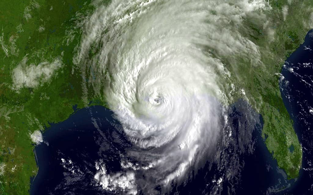
NOAA has released its outlook for the 2026 Atlantic hurricane season, which runs from June 1 to November 30, and the forecast points toward a below-normal year. The agency estimates a 55% chance of below-normal activity, a 35% chance of a near-normal season and just a 10% chance of an above-normal season. In concrete terms, NOAA forecasts 8 to 14 named storms, of which 3 to 6 are expected to become hurricanes and 1 to 3 are projected to reach major hurricane status at Category 3 or higher.
The outlook reflects a set of competing atmospheric and oceanic signals. NOAA expects El Nino to develop and strengthen during the season, a pattern that tends to suppress Atlantic activity by increasing wind shear that can tear apart developing storms. At the same time, Atlantic Ocean temperatures are running slightly warmer than normal, and trade winds may be weaker than average, conditions that can favor storm development. The net forecast tilts below normal, but the presence of conflicting factors is a reminder that seasonal outlooks carry uncertainty.
For Florida, the most important message from forecasters is not the headline number but the caution that accompanies it. A below-normal forecast does not mean the state is safe, because it only takes one storm making landfall to produce a catastrophic season for any given community. State and federal officials have used the release of the outlook to urge residents to prepare regardless of the seasonal projection, emphasizing that preparedness, not probability, determines how a household weathers a hurricane.
What the Numbers Mean
NOAA's forecast of 8 to 14 named storms covers any system that reaches tropical storm strength and earns a name. Of those, the agency expects 3 to 6 to intensify into hurricanes, with sustained winds of at least 74 miles per hour, and 1 to 3 to become major hurricanes at Category 3 or above. The ranges reflect the inherent difficulty of predicting an entire season months in advance, and they describe basin-wide activity rather than where any storm might track.
The probability framing, a 55% chance of below-normal activity against a 35% chance of near-normal and a 10% chance of above-normal, communicates confidence rather than certainty. A below-normal designation indicates that forecasters expect fewer storms than the long-term average, but it explicitly leaves room for a near-normal or even active season. The distribution of probabilities is itself a caution against reading the outlook as a guarantee of a quiet year.
Crucially, the seasonal numbers say nothing about landfall. A season can produce relatively few storms yet still deliver a devastating hurricane to a populated coastline, while an active season can pass with most storms remaining over open water. For Florida residents, the practical takeaway is that the count of named storms matters far less than whether a single one finds the state, a distinction forecasters stress every year.
The Science Behind the Outlook
The expectation that El Nino will develop and strengthen is a central driver of the below-normal forecast. El Nino conditions in the Pacific tend to increase vertical wind shear over the Atlantic, and strong shear disrupts the organized structure that storms need to form and intensify. When that pattern takes hold, it can act as a brake on a season, limiting both the number and the strength of systems that develop.
Countering that suppressing influence are warmer-than-normal Atlantic Ocean temperatures and the prospect of weaker-than-average trade winds. Warm water supplies the energy that fuels tropical systems, and weaker trade winds can reduce the shear and dry air that often inhibit development. These factors pull in the opposite direction from El Nino, which is why the forecast lands below normal rather than sharply suppressed, and why uncertainty remains embedded in the outlook.
The interplay of these signals illustrates why seasonal forecasting is probabilistic rather than precise. Forecasters weigh competing influences and express their best estimate as a range and a set of probabilities, not a definitive prediction. When the drivers conflict, as they do this year, the resulting outlook reflects a balance of forces that could shift as the season unfolds, underscoring the value of monitoring conditions throughout the summer and fall.
These drivers can also evolve over the course of a season. El Nino can develop faster or slower than anticipated, ocean temperatures can rise or moderate, and wind patterns can change in ways that alter the basin's receptiveness to storms. A forecast issued before the season reflects the best available understanding at that moment, which is why agencies revisit and update their outlooks as the year progresses. Residents should treat the preseason number as a starting point rather than a settled conclusion, and follow the updates that arrive closer to the season's peak.
The First System of the Season
The season's tentative beginning arrived on June 10, 2026, when the National Hurricane Center began tracking the first potential system of the year. Forecasters identified a broad area of low pressure that could form over the Bay of Campeche late in the week. The early attention demonstrated that the season is underway, even as the system carried significant caveats about its likely development and impact.
Conditions were not expected to favor significant development of the disturbance, and the system was projected to move inland over eastern Mexico late in the weekend. That track would keep it well away from Florida, suggesting minimal direct impact on the state from this particular feature. The early-season disturbance served more as a marker of the season's start than as an immediate threat to Florida communities.
The episode offered a useful illustration of how the season's first signals often look: a broad, disorganized area of low pressure with limited development potential and a track away from major population centers. Such systems are routine in the early weeks of a season and rarely escalate into significant threats, but they require monitoring nonetheless. The National Hurricane Center's tracking of the disturbance reflected standard practice rather than alarm.
An Outlook Is Not a Forecast of Safety
One of the most important distinctions for residents to understand is the difference between a seasonal outlook and a guarantee. A below-normal outlook describes expected basin-wide activity; it does not promise that Florida will escape unscathed. History is full of below-normal or quiet seasons that nonetheless produced a single, devastating landfall. The phrase forecasters repeat, that it only takes one storm, captures the limit of what a seasonal number can tell any individual community.
Equally important is the distinction between a tropical outlook and a named storm. An area of low pressure under observation, like the disturbance identified on June 10, is not a tropical storm or hurricane. It is a region forecasters are watching for possible development, and most such areas never become named systems. Confusing an outlook with an active storm can lead either to unnecessary alarm or to misplaced complacency, both of which forecasters work to avoid.
The terminology of alerts carries its own critical distinction. A watch means that hazardous conditions are possible within a specified area, typically within 48 hours, while a warning means those conditions are expected, usually within 36 hours. A watch is a signal to prepare; a warning is a signal to act. Understanding the difference can shape how and when residents respond, and emergency officials stress that residents should learn these terms before a storm threatens, not during one.
Why Florida Must Prepare Regardless
Florida's geography makes it uniquely exposed to tropical systems, and that exposure does not diminish in a below-normal season. The state's long coastlines, dense coastal population and low-lying terrain mean that a single landfalling hurricane can produce widespread damage, regardless of how many storms form across the basin. Preparedness, officials emphasize, must be tied to risk and geography rather than to a seasonal probability.
Effective preparation begins well before any storm appears on a forecast map. Emergency managers recommend that households assemble supply kits, review evacuation routes and zones, confirm insurance coverage and develop a family communication plan. These steps cost little when undertaken early but become difficult or impossible once a storm is bearing down and stores empty and roads fill. The below-normal outlook is, if anything, an argument for preparing calmly now rather than scrambling later.
The broader point is that preparedness is an annual obligation for Florida residents, independent of any single year's forecast. A quiet season is not a reason to relax, because the one storm that matters can arrive in an otherwise inactive year. By treating every season as a season that demands readiness, residents insulate themselves from the false comfort that a below-normal outlook can create. The forecast informs expectations; it does not replace planning.
Community-level preparation reinforces individual readiness. Knowing the location of nearby shelters, understanding local evacuation orders and signing up for official alert systems all strengthen a household's ability to respond. Vulnerable residents, including the elderly, those with medical needs and households without reliable transportation, benefit from arranging assistance well in advance rather than during a crisis. Emergency managers consistently note that the communities that fare best are those that prepare collectively, not just individually, long before a threat appears on the horizon.
What's Next
With the season officially underway, forecasters at the National Hurricane Center will continue monitoring the Atlantic, Caribbean and Gulf for developing systems, beginning with the early-season disturbance near the Bay of Campeche. NOAA typically updates its seasonal outlook later in the summer, around the climatological peak of activity, and that update will incorporate how El Nino, ocean temperatures and trade winds have evolved. Residents can expect the picture to sharpen as the season progresses.
For Florida, the path forward is straightforward: prepare now, stay informed and treat each developing system on its own terms. The below-normal forecast offers a measure of statistical reassurance, but it changes nothing about the fundamental advice from emergency officials. As the 2026 season unfolds through November 30, the state's residents are urged to keep their plans current, heed official watches and warnings, and remember that readiness, not the seasonal number, determines how they weather whatever the Atlantic produces.
Spotted an issue with this article?
Have something to say about this story?
Write a letter to the editor