Saharan Dust Keeps Atlantic Quiet as Florida Gets an Early-Season Reprieve

Florida is getting an early-season breather from the tropics. As late June 2026 arrives, the Atlantic basin is unusually quiet, and forecasters expect no tropical development through the end of the month. A continent-sized plume of Saharan dust is blanketing much of the ocean, smothering the thunderstorm activity that storms need to form and giving the state a welcome, if temporary, lull at a point in the calendar that can sometimes deliver early trouble.
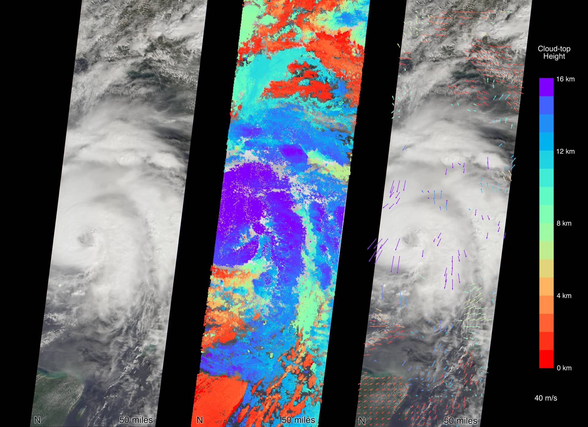
The quiet is the product of several overlapping forces, but the most visible is the Saharan Air Layer, a vast mass of warm, dry, dust-laden air that streams off Africa and spreads westward across the Atlantic. When it dominates the basin, it acts like a lid, choking off the moisture and instability that tropical waves rely on to organize. This year that lid has been thick, and the result is a tropical map that has gone largely blank.
For Florida, the message from forecasters is pointed and familiar: a quiet start is not a season forecast. The Atlantic hurricane season's most dangerous stretch runs from August into October, and a calm June says little about what September will bring. The same forecasters urging residents to enjoy the lull are also urging them to use it, by preparing now, before the peak arrives.
How Saharan dust shuts down storms
The Saharan Air Layer is one of nature's most effective storm suppressants. It carries warm, dry and remarkably stable air across the Atlantic, and each of those qualities works against tropical development. Tropical systems feed on deep, moist, rising air; the Saharan layer delivers the opposite, injecting dryness that starves budding storms and stability that resists the towering thunderstorms a hurricane must build.
The dust itself adds to the effect. A continent-sized plume can stretch across enormous swaths of the basin, and where it sits, tropical waves rolling off Africa struggle to gain traction. Instead of blossoming into organized systems, they fizzle, their thunderstorms suppressed before they can consolidate. The visual signature is a hazy, milky sky, and the meteorological signature is a tropical map devoid of activity.
This is a seasonal phenomenon with a seasonal rhythm. Saharan dust outbreaks are common in early summer and tend to wane as the season progresses, which is one reason the deep tropics often stay quiet in June and early July before becoming far more active later. The dust is not a guarantee of a calm season; it is a temporary suppressant whose grip typically loosens as summer wears on.
That timing is precisely why meteorologists caution against reading too much into a dusty June. The conditions stifling development now are characteristic of the early season and are expected to fade. When they do, the same waves that are fizzling today could find a far more hospitable environment.
More than dust: cool water and wind shear
Saharan dust is the most photogenic part of the story, but it is not acting alone. Cooler-than-average sea-surface temperatures across much of the Main Development Region, the stretch of tropical Atlantic where many of the season's strongest storms are born, are adding to the hostile environment. Warm ocean water is the fuel for hurricanes, and where that fuel runs cool, storms have a harder time igniting and intensifying.
Wind shear is the third ingredient working in Florida's favor. Shear, the change in wind speed or direction with height, can tear apart a developing system before it organizes, in effect decapitating the storm. When shear is elevated across the basin, even systems that begin to gather can be ripped apart, and the current pattern has been adding that disruptive force to the dust and the cool water.
The combination is what makes the present lull so complete. Dry, stable, dusty air aloft; cooler water below; and disruptive winds in between, all stacking the deck against development. Any one of these factors can slow the tropics; together they have effectively shut the basin down for the back half of June.
Some reports tie the unusual calm partly to broader climate patterns operating on a larger scale, though that connection should be treated cautiously and attributed tentatively. What is clearer is the immediate physical picture: multiple suppressing factors are overlapping, and the result is a tropical Atlantic that, for now, is going nowhere.
Arthur came and went
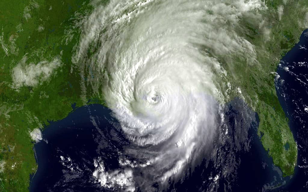
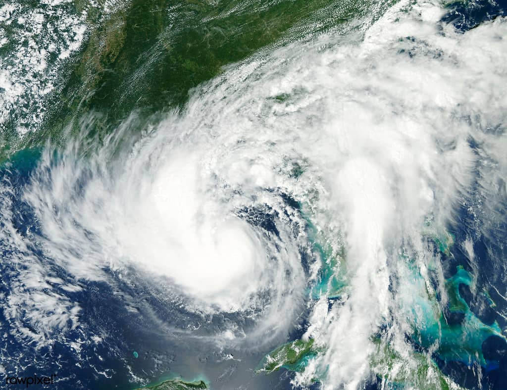
The season has not been entirely silent. Its first named storm, Tropical Storm Arthur, formed on June 17 near the Texas coast and quickly weakened, a brief appearance that illustrates how the early season often works. Storms that do manage to form in June frequently spin up close to land in the Gulf or the western basin rather than in the deep tropics, and they tend to be short-lived rather than long-track threats.
Arthur's rapid weakening fits that pattern. With the deep Atlantic hostile to development, the systems that do organize are more likely to be homegrown affairs near the coast, lacking the warm-water runway and favorable upper-level conditions that allow a storm to grow and endure. Arthur claimed the season's first name and then faded, leaving the basin quiet again.
For Florida, Arthur was a useful reminder rather than a threat. It marked the official start of named activity for 2026 without posing a danger to the state, and its quick demise underscored just how unfavorable conditions have been. One named storm that weakened almost as soon as it formed is not the profile of an aggressive early season.
It also reset the counter. With Arthur in the books, the next named system will carry the season's second name, and forecasters and residents alike now watch to see whether the basin's hostile pattern holds or begins to break down as July approaches.
NOAA's below-normal 2026 outlook
The seasonal context comes from NOAA, whose 2026 outlook calls for a below-normal Atlantic hurricane season. The forecast envisions roughly 8 to 14 named storms, of which about 3 to 6 are expected to become hurricanes, with 1 to 3 of those reaching major-hurricane strength. Those ranges sit beneath the long-term averages and align with the suppressing factors currently on display in the basin.
A below-normal outlook, however, is a statement about quantity, not danger. Even a quiet season can produce a single devastating landfall, and Florida's history is full of years in which one storm defined the season regardless of how many names were used. The number of storms says little about where any of them will go, and it takes only one to make a quiet year catastrophic for the community it strikes.
Forecasters have leaned into that nuance, pairing the optimistic numbers with a steady drumbeat of preparedness messaging. The colorful shorthand making the rounds, that June is going out like a lamb, captures the present calm without promising it will last. The outlook describes the likely shape of the season; it does not predict the absence of risk to any given stretch of coastline.
For Floridians, the practical takeaway is to treat the below-normal forecast as a reason to prepare calmly rather than a reason to relax. The numbers are favorable, but they are probabilities, not guarantees, and the season's most dangerous months still lie ahead.
Watch versus warning: know the difference
As the season progresses and the tropics inevitably stir, residents will start hearing the terms watch and warning, and the distinction between them is one of the most important pieces of hurricane literacy. A watch means hazardous conditions are possible within a specified area, typically issued well ahead of potential impacts to give people time to prepare. A warning means those conditions are expected, signaling that the time for final preparations and any ordered action is now.
The difference is essentially one of certainty and timing. A watch is a heads-up that something could happen and that residents should be getting ready; a warning is a far more urgent message that something is anticipated and that protective steps should be completed. Confusing the two can cost precious hours, which is why officials repeat the distinction every season.
For Florida, where storms can approach quickly and intensify near the coast, understanding these terms in advance is part of being prepared. Knowing that a warning demands immediate attention, while a watch is the cue to finalize a plan, helps families respond without panic when the alerts begin. The current lull is the ideal time to absorb that vocabulary, before it matters.
Preparation is more than terminology. Forecasters consistently urge residents to build or refresh supply kits, confirm evacuation plans and routes, and review insurance coverage during quiet stretches like this one. The calm is not a reason to delay; it is the window in which that work is easiest to do.
What's next
The immediate forecast is reassuring: no tropical development is expected through the end of June, leaving Florida with an early-season reprieve as the Saharan dust, cool waters and wind shear keep the basin in check. June, in the popular phrase, is going out like a lamb, and the state can use the quiet to catch its breath and to ready itself.
The longer view is more sobering. Seasonal suppressants like Saharan dust typically ease as summer deepens, and the heart of the Atlantic hurricane season, August through October, remains ahead. A quiet June tells Florida nothing about September, and forecasters are unanimous that residents should not mistake the present calm for a season that has passed them by.
The throughline is simple: enjoy the lull, but use it. The conditions stifling the tropics today are seasonal and temporary, the NOAA outlook is favorable but not a promise of safety, and the most dangerous months have not yet arrived. For Florida, the smartest response to a quiet late June is to prepare for the loud months that history says are coming.
Spotted an issue with this article?
Have something to say about this story?
Write a letter to the editor