Forecasters Track Invest 96L as Atlantic Season Nears Its Peak
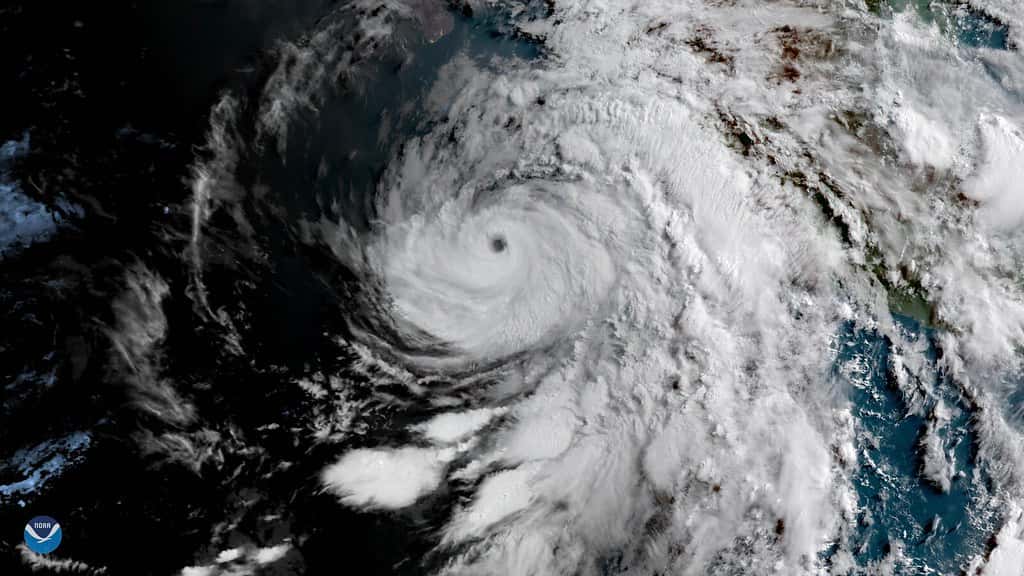
The National Hurricane Center is tracking a tropical disturbance moving westward across the open Atlantic that forecasters give a high probability of developing into a tropical depression or storm in the coming days. Designated Invest 96L, the system is the most organized Cabo Verde disturbance of the 2026 Atlantic hurricane season, and it arrives as the basin approaches its climatological peak in early September.
For Florida residents, the immediate message is that this system is thousands of miles away and carries no current threat to the state. The forecast track beyond the next several days remains genuinely uncertain, and the range of outcomes runs from complete dissipation to a system that reaches the Caribbean. Nothing in the present guidance supports preparation beyond the ordinary readiness that late August warrants.
The system does matter as a marker. A season that has been notably quiet is producing its most credible development candidate at exactly the point on the calendar when Atlantic activity historically becomes most dangerous for the United States coastline.
What forecasters are watching
Invest 96L emerged from a tropical wave that moved off the west coast of Africa and is tracking slowly westward across the eastern and central tropical Atlantic. Forecasters have assigned it a roughly 70 percent chance of tropical development over the coming week.
The designation itself is worth explaining, because the terminology causes confusion every season. An invest is not a storm. It is an area of disturbed weather that forecasters have flagged for closer analysis, which triggers additional model runs and data collection. Most invests never become named systems. The numbering rotates through a fixed sequence and is reused throughout the season, which is why the same numbers appear repeatedly.
Recent satellite imagery has shown dry air interfering with the disturbance's organization, with thunderstorm activity concentrated across its southern half rather than wrapping symmetrically around a center. That asymmetry is a sign of a system still fighting its environment rather than one consolidating. Development remains plausible, but it is not assured.
Where the name question stands
The 2026 Atlantic list runs Arthur, Bertha, Cristobal, Dolly, Edouard, Fay, Gonzalo, Hanna, Isaias, Josephine, Kyle, Leah, Marco, Nana, Omar, Paulette, Rene, Sally, Teddy, Vicky and Wilfred. The list skips Q, U, X, Y and Z, and it repeats the rotation used in 2020 with one substitution: Laura was retired after that season's damage and replaced by Leah.
The season has produced Arthur and Bertha and no hurricanes to this point, which places the basin well behind a typical pace for late August. Which name a developing system receives depends on the order in which systems reach tropical storm strength, and forecasters have flagged more than one area of interest in recent weeks. Residents tracking the tropics should follow official National Hurricane Center advisories rather than name speculation circulating ahead of formal designation.
The absence of hurricanes to date is itself notable. In an average season, the Atlantic has produced multiple hurricanes by the end of August. The 2026 basin has produced none, which is consistent with the below-normal forecast NOAA has maintained.
Why this season has been quiet
NOAA has held to its prediction of a below-normal Atlantic season, forecasting 7 to 13 named storms, 2 to 6 hurricanes and 0 to 2 major hurricanes. The agency has placed the probability of a below-normal season at 75 percent, a near-normal season at 20 percent and an above-normal season at 5 percent.
The primary driver forecasters have cited is El Nino conditions in the Pacific, which suppress Atlantic hurricane activity through a well-documented mechanism. El Nino strengthens upper-level westerly winds over the Atlantic basin, and those winds create vertical wind shear that tears apart the vertical structure developing storms need. A system attempting to organize in a high-shear environment has its thunderstorm activity displaced from its low-level center, which is roughly what satellite imagery has shown with Invest 96L.
Dry Saharan air has also played a role. Dust and dry air moving off Africa suppress the deep convection that tropical systems require, and this has been a recurring feature of the season. Forecasters analyzing Invest 96L's prospects have noted that if the disturbance stays weak, it is more likely to follow low-level trade wind flow toward the Caribbean, where hostile upper-level winds would make further organization difficult.
What a quiet season does not mean
The most important caution in a below-normal season is that seasonal totals and individual risk are separate things. A season that produces few storms can still produce a catastrophic landfall, and Florida history contains multiple examples of destructive hurricanes striking during otherwise unremarkable seasons.
Andrew formed in 1992, a season with only seven named storms, and struck South Florida as a Category 5, producing damage that reshaped the state's building codes and property insurance market for decades. That precedent is the reason emergency managers resist letting seasonal forecasts drive household preparedness decisions.
Preparation is binary at the household level. A family either has supplies, a plan and adequate insurance, or it does not. The seasonal forecast does not change the calculation, because a single storm reaching a given community produces the same consequences regardless of how many other storms formed that year.
Where Florida stands on the calendar
Late August through early October is the period of greatest historical risk for Florida landfalls. Sea surface temperatures peak, upper-level winds typically become more favorable, and the tropical wave train off Africa is at its most active. Roughly two-thirds of Florida hurricane landfalls have occurred during that window.
Cabo Verde systems, meaning storms forming near the islands off West Africa, are the classic long-track hurricanes of the season. They have thousands of miles of warm open water to traverse, which gives them time to intensify, and their tracks are notoriously difficult to forecast far in advance. Systems that appear headed toward the Caribbean have recurved into the open Atlantic, and systems that looked likely to recurve have continued west. That uncertainty is why forecasters decline to discuss specific United States impacts from a disturbance still near Africa.
Meanwhile Florida's more immediate weather has been the routine summer pattern. South Florida has seen a stretch of scattered strong thunderstorms with daily chances in the 50 to 60 percent range, some producing frequent lightning, gusty winds and heavy rain. Those storms present real hazards, including lightning strikes and localized street flooding, and they are far more likely to affect a Florida resident this week than anything in the deep tropics.
What Floridians should do now
The practical guidance for late August does not depend on Invest 96L. Households should know their evacuation zone, which is assigned by county and is available from county emergency management offices. Evacuation zones are not the same as flood insurance rate map zones, and confusing the two is a common and consequential error.
Supply kits should cover at least a week, which reflects realistic power restoration timelines after a significant storm rather than the shorter periods sometimes cited. Prescription medications, documents, cash and a plan for pets are the items households most often overlook. Anyone dependent on electricity for medical equipment should register with their county special needs program before a storm threatens rather than during an activation.
Insurance deserves attention now because policy changes do not take effect immediately. Most carriers impose binding restrictions once a storm enters a defined proximity, and standard homeowners policies exclude flood damage entirely. Flood coverage through the National Flood Insurance Program generally carries a 30-day waiting period, which means a policy purchased when a storm appears on the forecast map will not cover that storm.
Reading advisories without misreading them
Several distinctions in hurricane communication cause repeated confusion in Florida, and they matter more as the season peaks. A watch and a warning are not interchangeable. A watch means the specified conditions are possible within roughly 48 hours. A warning means those conditions are expected within roughly 36 hours. A watch is the point at which preparations should be completed, not the point at which they should begin.
The forecast cone is similarly misread. The cone depicts the probable track of the storm's center, and historically the center stays within it about two-thirds of the time. It is not a damage map. Hazards including storm surge, wind, tornadoes and inland flooding routinely extend well beyond the cone's edges, and a community outside the cone can still experience significant impacts.
Storm surge is the hazard that has historically caused the greatest loss of life in Florida hurricanes, and it is forecast separately from wind. The National Hurricane Center issues distinct storm surge watches and warnings along with inundation maps showing expected water height above ground level. Those products, rather than the storm's category, should drive coastal evacuation decisions, because surge depends heavily on local bathymetry and storm approach angle rather than on wind speed alone.
Category is also an imperfect proxy for danger. The Saffir-Simpson scale measures sustained wind and nothing else. It does not account for storm size, forward speed, rainfall or surge potential, and Florida has repeatedly seen lower-category systems produce severe flooding damage well inland from where they came ashore.
What's next
The National Hurricane Center issues tropical weather outlooks every six hours during the season, and those outlooks are the authoritative source for development probabilities. If Invest 96L organizes into a tropical depression, the center will begin issuing full advisories with forecast tracks and intensity guidance, updated on a regular schedule.
Florida residents should expect the system's forecast to change substantially over the coming days as it either consolidates or continues to struggle against dry air and shear. Early track guidance for systems this far east has a wide margin of error, and the cone of uncertainty published with any advisory reflects that.
The larger point for the state is that peak season has arrived. Whatever becomes of this particular disturbance, September is the month when Florida has historically faced its greatest hurricane exposure, and a quiet start to the year offers no protection against what the next six weeks may produce.
Spotted an issue with this article?
Have something to say about this story?
Write us a letterComments
No comments yet. Be the first to weigh in.
Related Coverage

Tallahassee and the Big Bend Escape Isaias' Worst, With Downed Trees, Brief Outages and Rising Rivers to Watch
2d ago

FPL Targets 95% Restoration by Monday as Isaias Outages Linger Across the Panhandle
2d ago

Panhandle Evacuations Widen From Perdido Key to St. George Island as Major Hurricane Isaias Nears
2d ago

Soaked Northeast Florida Faces More Flooding as Tropical Storm Isaias Takes Aim at the Gulf Coast
3d ago