Tropical Storm Arthur's Remnants Bring High Flood Risk to Florida Panhandle as Season's First Storm Soaks Gulf Coast

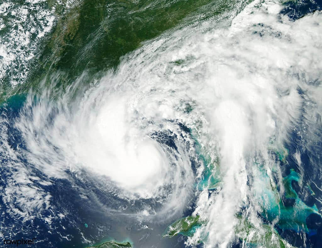
The remnants of Tropical Storm Arthur, the first named storm of the 2026 Atlantic hurricane season, have soaked the central Gulf Coast and pushed a rare high flood risk into the western Florida Panhandle. Forecasters warned of life-threatening flash flooding as the weakening system dumped torrential rain across a swath of the Deep South stretching from Texas to Florida.
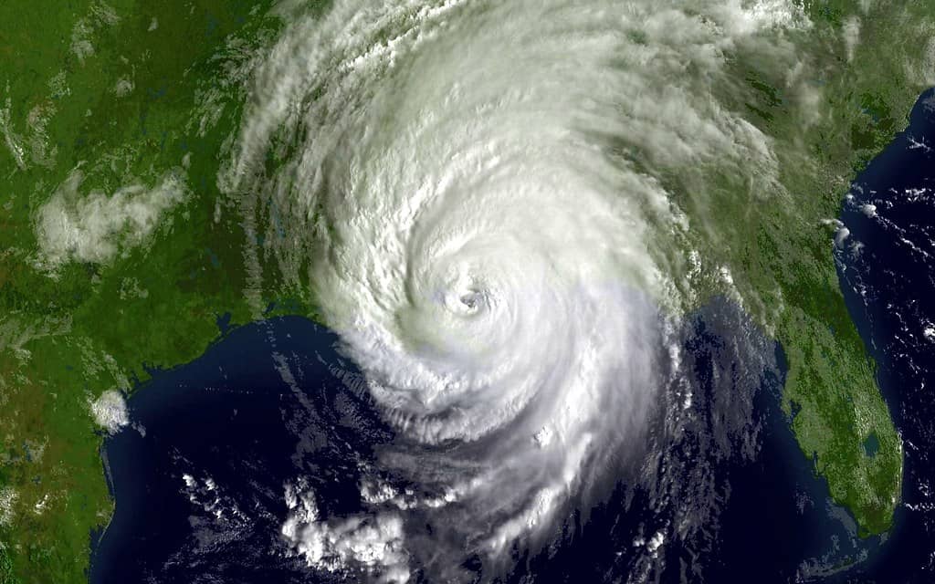
Arthur formed in the Gulf and made landfall along the Texas coast before weakening to a remnant low and crawling inland, spreading heavy rain across Louisiana, Mississippi, Alabama, Georgia, and the Florida Panhandle. Rainfall totals across the region reached 5 to 10 inches, with isolated higher amounts, overwhelming drainage and triggering flood emergencies in the hardest-hit areas. The slow forward motion of the remnant low was central to the danger, because a system that lingers over the same ground can stack rainfall hour after hour rather than spreading it out, allowing totals to climb well beyond what local drainage can absorb.
For the Florida Panhandle, the storm served as an early-season reminder of the threat posed by tropical systems, even those that never reach hurricane strength. The flooding danger underscored how slow-moving tropical remnants can deliver dangerous rainfall far from where a storm makes landfall. It also arrived at the very front of the season, when residents who weathered prior years of storms are only beginning to refresh their plans, sharpening the lesson that the calendar offers no grace period once the tropics turn active.
A rare high flood risk
Forecasters issued a rare high risk for excessive rainfall, the top level on the scale, covering portions of southern Mississippi, southern Alabama, and the western Florida Panhandle. A high risk is reserved for the most dangerous flooding situations and is issued only on a small fraction of days each year. Because the designation is used so sparingly, its appearance is meant to command attention, signaling that the threat goes well beyond a routine soaking and warrants immediate caution from residents and officials alike.
The designation reflected the potential for life-threatening flash flooding as Arthur's moisture stalled over the region. Such warnings signal that rainfall could overwhelm rivers, creeks, and urban drainage systems, posing a serious threat to anyone caught in low-lying or flood-prone areas. Saturated ground compounds the problem, because soil that has already absorbed days of rain cannot take in more, sending additional rainfall straight into streets, ditches, and waterways where it can rise with alarming speed.
In the broader region, multiple flash flood emergencies were declared and water rescues were underway as the storm's rains piled up. The Panhandle's inclusion in the high-risk zone placed western Florida communities on alert for the kind of rapid, dangerous flooding that can develop with little warning. A flash flood emergency is itself an uncommon and urgent step, reserved for situations where flooding is already causing a severe threat to life, and its use across the region underscored how serious conditions had become as Arthur's rains accumulated.
The Florida impact
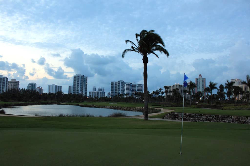
While Arthur's heaviest effects concentrated to the west, the Florida Panhandle faced significant flooding potential from the storm's lingering moisture. Communities across the region's western counties were warned to watch for rising water on roads and in low-lying neighborhoods as bands of heavy rain moved through. The intermittent nature of those bands can be deceptive, lulling residents during dry stretches before a fresh round of downpours quickly refills streets and underpasses that had only begun to drain.
The Panhandle is no stranger to tropical weather, having absorbed major hurricanes in recent years, and residents are generally attuned to the dangers of flooding. Even so, flash flooding remains one of the deadliest weather hazards, often catching drivers and residents off guard when water rises quickly across roadways. Many flood deaths occur in vehicles, when motorists misjudge the depth or force of water across a familiar road, a danger that persists even in communities well versed in storm season.
Beyond the immediate flood threat, Arthur generated dangerous surf and rip current conditions along Gulf beaches, posing a hazard to swimmers. Officials urged caution at the coast as the system churned the water and created life-threatening conditions for those venturing into the surf. Rip currents are a persistent and frequently underestimated danger along Florida's coastlines, and a passing tropical system can energize them well beyond the immediate footprint of its heaviest rain, putting beachgoers at risk even under partly sunny skies.
The Florida context
Arthur's arrival marked the official start of the 2026 hurricane season's named-storm activity, a reminder that Florida sits squarely in the path of Atlantic and Gulf systems each year from June through November. The season's first storm focusing attention on the western part of the state, rather than the peninsula, illustrated the broad geographic reach of the threat. No single stretch of Florida coastline is immune, and the Panhandle's exposure to the Gulf means systems can form close to home and arrive with little of the lead time that storms tracking across the open Atlantic sometimes provide.
Florida's emergency-management infrastructure is built around the recurring danger of tropical weather, and early-season storms test that readiness. The state's experience with destructive hurricanes in recent years has reinforced the importance of preparation, evacuation planning, and heeding official warnings. Local emergency operations centers, county alert systems, and coordination with state and federal agencies form a layered response that activates quickly when a threat emerges, and early-season events serve as a real-world rehearsal for the more intense storms that often follow.
Importantly, a storm does not need to be a powerful hurricane to be dangerous. Arthur's flooding threat, delivered by a weakening tropical system, demonstrated that water, not wind, is frequently the deadliest aspect of tropical weather, a lesson that shapes how officials communicate risk to the public. Historically, inland flooding and storm surge have accounted for a large share of fatalities in tropical systems, a pattern that has pushed forecasters to broaden their messaging well beyond a storm's headline category.
What it means for residents
For Panhandle residents, the immediate guidance during such events is to avoid driving through flooded roads, where even shallow moving water can sweep away vehicles. The longstanding safety message to turn around rather than drive into flooded areas is repeated precisely because flash floods claim lives every year. Just a foot or two of moving water can carry away a car, and floodwaters can hide washed-out pavement, downed power lines, and other hazards that are impossible to judge from behind the wheel.
Residents in flood-prone areas are advised to monitor official forecasts and heed any warnings or instructions from local emergency officials. Flood watches and warnings convey different levels of urgency, and understanding the distinction helps residents respond appropriately as conditions evolve. A watch indicates that flooding is possible and a time to prepare, while a warning means flooding is imminent or already occurring and a time to act, and the rare emergency designation marks the most dire conditions of all.
The storm also serves as a prompt for residents statewide to review their hurricane preparations early in the season. Having supplies, an evacuation plan, and a way to receive emergency alerts is essential before the peak months of August through October arrive. Reliable means of receiving warnings matter especially during overnight hours, when flash flooding can develop while families sleep, and multiple alert methods help ensure that critical messages get through even if power or cell service falters.
Beyond the wind: the flooding threat
Arthur reinforced a central truth of tropical weather: inland flooding can be just as dangerous as coastal wind and surge. Slow-moving systems and remnants can park over an area and unload prolonged heavy rain, producing catastrophic flooding far from any coastline. Communities dozens or even hundreds of miles inland, which may not think of themselves as vulnerable to tropical weather, can find themselves facing the worst of a storm's impact when its rains settle overhead.
This dynamic has prompted forecasters to emphasize rainfall and flood risk in their messaging, not just a storm's wind category. The National Hurricane Center has updated its products in recent years to better convey inland threats, including displaying inland watches and warnings within the forecast cone. That shift reflects a recognition that the traditional focus on wind speed can understate the danger of a wet, slow-moving system, and that clearer communication of the water threat can save lives.
For Florida, where development continues in flood-prone areas and where intense rainfall events have caused serious flooding, the inland threat is a growing concern. Arthur's high flood risk in the Panhandle highlighted the importance of taking rainfall threats seriously regardless of a storm's strength. As more pavement and rooftops replace land that once absorbed rainfall, water runs off faster and pools more readily, raising the stakes of heavy-rain events across the state's growing communities.
Preparing for what the season may bring
Early-season storms like Arthur offer a window to assess preparedness before the most active weeks arrive. Emergency officials often encourage residents to use such episodes as a checkpoint, confirming that emergency kits are stocked, important documents are secured, and household members know where to go and how to communicate if conditions worsen. Flood insurance, which typically requires a waiting period before taking effect, is another consideration that rewards early action rather than last-minute scrambling.
Knowing one's specific risk is part of that readiness. Residents who understand whether they live in a low-lying area, near a creek or river, or in a zone prone to street flooding can make better decisions when warnings are issued. Local resources, including county emergency-management offices, can help residents identify their vulnerabilities and the actions best suited to their circumstances, turning general advice into a concrete plan.
What's next
As Arthur's remnants move on and dissipate, the immediate flood threat to the Panhandle will ease, though communities may face cleanup and recovery from any flooding that occurred. Officials will assess damage and continue monitoring waterways that can remain elevated after heavy rain. Rivers and creeks sometimes crest in the days following a storm as water drains from upstream, meaning the danger can persist even after the skies clear.
Attention will then return to the broader hurricane season, which runs through November and typically peaks in late summer and early fall. Forecasters and emergency managers will watch the tropics closely for the next system that could threaten Florida. The early arrival of a named storm offers no certain signal about the months ahead, but it does ensure that preparedness is front of mind as the season builds toward its most active stretch.
For now, Arthur stands as the season's opening act and an early test of preparedness. Residents across Florida are encouraged to use the episode as motivation to finalize their hurricane plans well before the heart of the season delivers its most dangerous storms. The difference between a close call and a tragedy often comes down to decisions made in advance, and Arthur's rains were a timely reminder that the work of preparation is best done before the next system appears on the horizon.
Spotted an issue with this article?
Have something to say about this story?
Write a letter to the editor